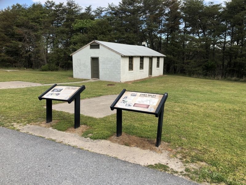
Near Dune Road 0.5 miles east of Campground Road, on the left when traveling east.
The troops stationed here during World War II were part of the nation's coastal defense system that protected the mouth of the Delaware Bay and industries located up the Delaware River. Later the U.S. Army used the area as a recreation center . . . — — Map (db m150103) HM
Near Dune Road 0.5 miles Campground Road, on the left when traveling east.
Just before World War II, the U.S. War Department began upgrades of the harbor defenses that protect the Delaware Bay. They built new fortifications here at Cape Henlopen that became known as Fort Miles. The fort grew as the members of the . . . — — Map (db m150101) HM
Herring Point is named for Battery Herring, which housed two 6-inch guns during World War II as part of the United States coastal defense. At the close of that war and during the Cold War, the site was used for top secret military tests and . . . — — Map (db m272539) HM
Noted painter Howard Schroeder (1910-1995) was assigned to Fort Miles in 1941. That first winter, soldiers lived in tents or a large warehouse because barracks were still under construction. Schroeder painted fellow soldiers as well as the . . . — — Map (db m272540) HM
Delaware State Senate President Pro Tempore David B. McBride served as chair of the Senate Natural Resources Committee for 25 years. Before, during and after his time as chair, the senator, a life-long Delawarean, has been a steadfast and unwavering . . . — — Map (db m272527) HM
Near Dune Road, on the right when traveling south.
Built from 1939 to 1942, the 11 concrete observation towers along Delaware's coast were built to protect the shores during World War II - and to last about 20 years. They are still standing after 60 years. The towers were the eyes for the guns of . . . — — Map (db m39595) HM
On Gordons Pond Trail 0.2 miles west of Ocean Drive (County Road 300), on the right when traveling north.
Built from 1939 to 1942, the 11 concrete observation towers along Delaware's coast were built to protect the shores during World War II - and to last about 20 years. They are still standing after 60 years. The towers were the eyes for the guns of . . . — — Map (db m232986) HM
Built from 1939 to 1942, the 11 concrete observation towers along Delaware's coast were built to protect the shores during World War II - and to last about 20 years. They are still standing after 60 years. The towers were the eyes for the guns of . . . — — Map (db m272521) HM
Cape: a piece of land jutting into a body of water beyond the rest of the coast line; a headland; a promontory. Delaware's coastline is constantly changing. The daily effects of wind, tidal currents, and wave action are reshaping and redesigning the . . . — — Map (db m39388) HM
The United States Navy's ties to Cape Henlopen spanned nearly 100 years. The Navy first came to the Cape in 1898 to build a signal tower during the Spanish American War. In the 20th century, the Navy kept a communications station he, beginning with . . . — — Map (db m79201) HM
On Bay Road 0.2 miles north of Post Lane, on the right when traveling north.
When Bill Hopkins came to Delaware in 1964 as the first superintendent for Cape Henlopen State Park, he brought with him a vision that would shape preservation in the state for years to come. For more than forty years he has been a driving force . . . — — Map (db m150116) HM
Near Wolfe Neck Road 0.4 miles east of Rusty Anchor Drive, on the right when traveling east.
When the Dutch first arrived in 1631 to build a whaling station near Lewes, they met a band of Lenape Indians known as the Sicconese. For at least 2,500 years, the Indians had been coming to Wolfe Neck in the spring to harvest clams, oysters and . . . — — Map (db m245056) HM
Near Island Trail 0.8 miles south of County Road 450, on the right when traveling east.
In 1879, Delaware illustrator an other Howard Pyle visited the shingles to watch them at work. The result was these drawings and a report of what he saw.
The workmen had just excavated a log, the butt or root . . . — — Map (db m198867) HM
114 entries matched your criteria. Entries 101 through 114 are listed above. ⊲ Previous 100