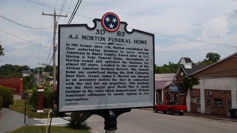
By Tom Bosse, July 3, 2016
A.J. Morton Funeral Home Marker
| On East 8th Street, on the left when traveling east. |
| On Mississippi Boulevard at Edith Avenue, on the right when traveling south on Mississippi Boulevard. |
| On North Cherry Street at U.S. 287, on the right when traveling north on North Cherry Street. |
| On West Center Street (Farm to Market Road 150) at South Main Street, on the left when traveling west on West Center Street. |
| On North Covington Street near Fancher Street, on the left when traveling north. |
| On British Flying School Boulevard at South Virginia Street (Texas Highway 34), on the left when traveling east on British Flying School Boulevard. |
| On South May Street (State Highway 75) at Bacon Street, on the right when traveling north on South May Street. |
| On Clarendon Boulevard just east of Washington Boulevard, on the right when traveling west. |
| On Wilson Bouleard west of North Hudson Street, on the left when traveling west. |
| On Marshall Drive west of North Meade Street, on the right when traveling west. |
| On North Marshall Drive west of North Meade Street, on the left when traveling east. Reported permanently removed. |
| On Marshall Drive near Richmond Highway. Reported permanently removed. |
| Near Campus Drive (County Route 378) near Chritanna Highway (Virginia Route 46). Reported permanently removed. |
| Near Campus Drive (County Road 378) 0.1 miles west of Christanna Highway (State Route 46), on the left when traveling west. |
| On Tech Lane at Lunenburg Highway (Virginia Route 40) on Tech Lane. Reported permanently removed. |
| On Daniel Road just north of Lunenburg Highway (Virginia Route 40), on the right when traveling north. |
| On Wine Street just south of Old Brandy Road, on the left when traveling south. |
| Near Air and Space Museum Parkway west of Localizer Road, in the median. |
| On Letcher Avenue, on the left when traveling east. |
| On East Market Street (Business State Highway 7) at Loudoun Street, on the right when traveling west on East Market Street. |
| On Monument Terrace just north of Court Street, on the right when traveling north. |
| On Pierce Street north of 14th Street, on the right when traveling north. |
| Near Skyline Drive (at milepost 57.5), on the right when traveling north. |
| On Wells Avenue Northeast east of North Jefferson Street, on the left when traveling east. |
| Near James Monroe Highway (Virginia Route 205) 0.2 miles south of Ferry Landing ( Route 638), on the left when traveling south. |
| Near Columbia Avenue (State Highway 155) south of Lincoln Avenue, on the left when traveling south. |
| On National Road (U.S. 40) east of Wheeling Park Drive, on the right when traveling west. |
| On East State Avenue (West Virginia Route 7) just west of East High Street, on the right when traveling east. |
| Near Ridge Road 0.4 miles west of Clark Avenue. |
| Near U.S. 61 at State Highway 171, on the right when traveling south. |
| On U. S. Highway 51 (Interstate 39 at milepost 117), on the right when traveling north. |
| On Williams Street west of North Grand Avenue, on the left when traveling west. |
| Near Bottomside Tour Route at Wainwright Park. |
235 entries matched your criteria. Entries 201 through 235 are listed above.
⊲ Previous 100
