Marker Logo
THE HISTORICAL
MARKER DATABASE
“Bite-Size Bits of Local, National, and Global History”


7 entries match your criteria.  


Related Historical Markers

To better understand the relationship, study each marker in the order shown.
 
By Dale K. Benington, July 27, 2011
The Battle of Queenston Heights Marker
SHOWN IN SOURCE-SPECIFIED ORDER
1 Ontario, Niagara Region, Niagara-on-the-Lake, Fonthill — The Battle of Queenston Heights / la Bataille de Queenston — The Battle of Queenston Heights Walking Tour / Sentier auto-guidι de la Bataille de Queenston
The Battle of Queenston Heights The village below you and the heights on which you are standing were the stage for the famous Battle of Queenston Heights. It took place during the Anglo-American conflict 1812-1815 known as . . . Map (db m282134) HM
2 Ontario, Niagara Region, Niagara-on-the-Lake, Fonthill — 1 — Attack / L'attaque — Battle of Queenston Heights Walking Tour / Sentier auto-guidι de la bataille de Queenston
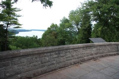
If you go to the lookout behind the Laura Secord monument you will see (across the river and slightly to your right) the area where a huge American force assembled for the invasion of Canada. In the early hours of October 13, . . . Map (db m282127) HM
3 Ontario, Niagara Region, Niagara-on-the-Lake, Fonthill — 2 — The Treacherous River Cliff / La falaise traξtresse — Battle of Queenston Heights Walking Tour / Sentier auto-guidι de la bataille de Queenston
An unguarded trail up this steep cliff was the only route which the Americans had to the heights of Queenston. The trail was to your right but does not exist any longer. Trapped on the river shore by unrelenting gunfire, the . . . Map (db m282129) HM
4 Ontario, Niagara Region, Niagara-on-the-Lake, Queenston — 3 — The Capture of the Redan and the Death of Brock — Battle of Queenston Heights Walking Tour / Sentier auto-guidι de la bataille de Queenston
On the river banks below here, the Americans were trapped. To the right the Americans scaled the river cliff and seized the Heights above. To the left the British held the Village of Queenston. A British 18-pounder cannon situated here within an . . . Map (db m282130) HM
5 Ontario, Niagara Region, Niagara Falls — Site of Redan Battery
Near this spot Lieut-Col. John MacDonnell Attorney General of Upper Canada was mortally wounded 13th October 1812.Map (db m75855) HM
6 Ontario, Niagara Region, Niagara-on-the-Lake, Queenston — 4 — The Counter-Offensive Takes Shape / La contre-offensive prend forme — Battle of Queenston Heights Walking Tour / Sentier auto-guidι de la bataille de Queenston — Reported missing
The Niagara escarpment rises above you. The British reinforcements arriving here from Fort George, in battle dress and exhausted from a "double quick march", struggled up this slope some distance to your right. While the . . . Map (db m282132) HM
7 Ontario, Niagara Region, Niagara-on-the-Lake, Fonthill — 5 — The Decisive Battle / La bataille dιcisive — Battle of Queenston Heights Walking Tour / Sentier auto-guidι de la bataille de Queenston
On the plateau before you, the British and Americans met for battle. The British formed a line to your right, the Americans were on your left. General Sheaffe formed a British counter offensive force of 900 men in a line shoulder . . . Map (db m282121) HM
 
 
CeraNet Cloud Computing sponsors the Historical Marker Database.
This website earns income from purchases you make after using our links to Amazon.com. We appreciate your support.
Paid Advertisement
Sep. 9, 2026