By William Fischer, Jr., July 27, 2017
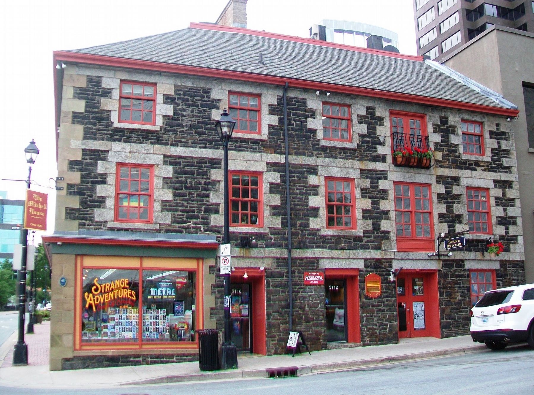
The Mitchell House and Marker
| On Prince Street at Lower Water Street, on the right when traveling east on Prince Street. |
| On Barrington Street close to Spring Garden Road, on the right when traveling south. |
| Near Morris Street close to Lower Water Street. |
| Near Sackville Street close to Brunswick Street. |
| On the Harbourwalk, on the left when traveling north. |
| Near Barrington Street close to Garden Spring Road. |
| On Barrington Street close to Spring Garden Road, on the right when traveling south. |
| On Spring Garden Road just east of Grafton Street, on the right when traveling east. |
| Near Castine Way at Lord Dalhousie Drive, on the right when traveling east. |
| Near Granville Street near Duke Street, in the median. |
| Near York Redoubt Access Road, 0.2 kilometers south of Ferguson's Cove Road. |
| On Marine Drive (Nova Scotia Trunk Highway 7) (Provincial Highway 7) 0.3 kilometers north of Baptist Loop, on the right when traveling north. |
| Near Prospect Road (Nova Scotia Route 333) 1.6 kilometers west of Peggys Point Road, on the left when traveling west. |
| On Peggy's Point Road, 0.4 kilometers south of Prospect Road (Nova Scotia Route 333), on the right when traveling south. |
| On Peggy's Point Road, 0.4 kilometers south of Prospect Road (Nova Scotia Route 333), on the right when traveling south. |
| On Peggy's Point Road, 0.4 kilometers south of Prospect Road (Nova Scotia Route 333), on the right when traveling south. |
| On Peggy's Point Road, 0.7 kilometers south of Prospect Road (Nova Scotia Route 333), on the right when traveling west. |
| On Peggy's Point Road, 0.4 kilometers south of Prospect Road (Nova Scotia Route 333), on the left when traveling south. |
| On Peggy's Point Road, on the right when traveling east. |
| On Peggy's Cove Road, on the left when traveling east. |
| On Peggy's Point Road, 0.4 kilometers south of Prospect Road (Nova Scotia Route 333), on the right when traveling south. |
| On Peggy's Point Road, 0.4 kilometers south of Prospect Road (Nova Scotia Route 333), on the left when traveling south. |
| On Peggy's Point Road, 0.4 kilometers south of Prospect Road (Nova Scotia Route 333), on the left when traveling south. |
| On Peggy's Pointe Road, 0.4 kilometers Prospect Road (Nova Scotia Route 333), on the left when traveling south. |
| On Marine Drive (Nova Scotia Trunk Highway 7), 0.1 kilometers west of Church Point Road, on the left when traveling west. |
| On Marine Drive (Nova Scotia Trunk Highway 7), 0.1 kilometers west of Church Point Road, on the left when traveling west. |
| Near Marine Drive (Nova Scotia Trunk Highway 7), 0.3 kilometers east of Highway 224, on the right when traveling east. |
| Near Marine Drive (Nova Scotia Trunk Highway 7), 0.3 kilometers east of Highway 224, on the right when traveling east. |
| Near Marine Drive (Nova Scotia Trunk Highway 7), 0.3 kilometers east of Highway 224, on the right when traveling east. |
| On Marine Drive (Nova Scotia Trunk Highway 7), 0.1 kilometers west of Church Point Road, on the left when traveling west. |
| Near Marine Drive (Nova Scotia Trunk Highway 7), 0.3 kilometers east of Highway 224, on the right when traveling east. |
| Near Marine Drive (Nova Scotia Trunk Highway 7), 0.3 kilometers east of Highway 224, on the right when traveling east. |
| On Jennings Settlement Road at James Mason Lane, on the left when traveling west on Jennings Settlement Road. |
139 entries matched your criteria. Entries 101 through 139 are listed above.
⊲ Previous 100