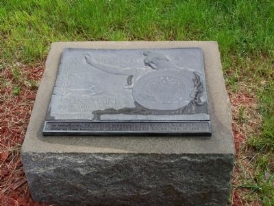
On Lincoln Way West near S. Main Street, on the left when traveling west.
Erected at center of Memorial Square to honor over 5,000 Franklin County soldiers who served in Civil War, 1861-65. Secured through gifts of Franklin County citizens and dedicated July 17, 1878. Entered in National Register of Historic Places, May . . . — — Map (db m8095) HM
On Oakville Road at Cumberland Valley Rail Trail, on the right when traveling east on Oakville Road.
Confederate Invasion: Union forces stopped the Confederate invasion of Maryland at the Battle of Antietam on September 17, 1862, still the bloodiest day in American history. With the initial news of the Confederate Army's movement, Pennsylvania . . . — — Map (db m242601) HM
Near Railroad Street at Humes Street, on the left when traveling west.
Visionary Pennsylvanians chose to act and were among the first great American conservationists. In fact, Pennsylvania is often considered to be the “cradle of conservation” in the United States. The great north central forests, stripped of their . . . — — Map (db m304465) HM
Like many pioneers of this district, the founder of Waterloo was a German Mennonite from Franklin County, Pennsylvania. In 1805 he purchased 900 acres of bush land on the site of this town. He settled here in 1806 and erected the first sawmill two . . . — — Map (db m244169) HM
On March 30, 1734, Benjamin Chambers, a Scots-Irish immigrant and millwright was granted a Blunston License by the Penn family to develop a 400-acre plantation and gristmill for the first Franklin County settlement, named the Falling Spring . . . — — Map (db m18630) HM
Recruited in this part of Cumberland (now Franklin) County, Chambers' Company was a unit of the first battalion in the colonies authorized by Congress, in June 1775. From here this company marched about 450 miles to join the siege of Boston. The . . . — — Map (db m8116) HM
On Lincoln Highway (U.S. 30) 0.1 miles east of Mercersburg Road, on the left when traveling east.
One of the forts for the defense of the frontier of Cumberland County from Fort Davis to Shippensburg stood near this marker on the plantation then owned by Thomas Waddell — — Map (db m8051) HM
Near Charmian Road near Buchanan Trail East/Waynesboro Road, on the right when traveling west.
The Underground Railroad was a network of secret routes used by African American slaves during the early to mid 1800’s, to escape to the free states and Canada. One of the routes used by African-American slaves was South Mountain, where they . . . — — Map (db m202068) HM
Near South Confederate Avenue, on the right when traveling north.
(Front):12th Pennsylvania Reserves 41st Infantry Mustered in May 30 - July 3, 1861 - Mustered out June 11, 1864 Recruited in Philadelphia, Wyoming, Bradford, Dauphin, Northampton, Westmoreland, York, Indiana, Huntingdon, and Franklin . . . — — Map (db m17838) HM WM
On North Main Street (U.S. 11) north of Lincoln Way East (U.S. 30), on the left when traveling south.
The Greatest Sacrifice
Chambersburg
The price of war is devastation. Franklin County paid the price when its county seat, Chambersburg, was burned to the ground in 1864. Invaded in 1862, 1863, and 1864 by Confederate forces, Franklin . . . — — Map (db m201757) HM
Founding Father
Born in Massachusetts, Benjamin Franklin (1706-1790) is
remembered as the elder statesman of the American cause
during the Revolutionary War. Beyond the political arena, he
pursued many interests, including higher . . . — — Map (db m309137) HM
Near South Bedford Street just north of East Willow Street, on the right when traveling north.
The U.S. Civil War played out part of its tumultuous history along the banks of the LeTort Spring Run during the summer of 1863. While many in the North initially expected a quick and decisive victory, by June of 1863 bloody battles had raged for . . . — — Map (db m259228) HM
On Avenue of the Republic at Lansdowne Drive, on the right when traveling west on Avenue of the Republic.
The South Arch
This memorial honors Pennsylvania's military heroes of the Civil War (1861-1865). A pair of arches topped by tall pillars, the project involved 12 noted sculptors over a 15-year period. It is considered one of most ambitious . . . — — Map (db m191697) HM
On Lookout Lane 0.3 kilometers south of Deer Ridge Drive, on the left when traveling south.
In the spring of 1800, Joseph
Schoerg and Samuel Betzner, Jr.,
brothers-in-law mennonites, from
Franklin County Pennsylvania
began the first two farms in
the County of Waterloo, Schoerg
on land adjoining this farm,
Betzner on the west bank . . . — — Map (db m259457) HM
On North Railroad Street at Georgia Route 53, on the right when traveling north on North Railroad Street.
John Tate, born in Ireland in 1758, came to America in 1763. He volunteered for the Pennsylvania Militia in December 1776 from Shippensburg, Cumberland County, PA. He served as a private with Captain Robert Culbertson and later, at the Battle of . . . — — Map (db m315011) HM
This memorial is in commemoration of the services of Revolutionary War Soldiers buried in Brown's Mill Graveyard, Antrim Township, Franklin County, Pennsylvania, and is dedicated in grateful recognition of their patriotism, valor and fidelity. . . . — — Map (db m227394) HM WM
On S. Main Street near Seminary Street, on the right when traveling south.
James Buchanan, a Representative and a Senator from Pennsylvania and the 15th President of the United States; born at Cove Gap, near Mercersburg, Franklin County, Pa., April 23, 1791; moved to Mercersburg, Pa. with his parents in 1796; was privately . . . — — Map (db m202788) HM
On Lincoln Way West (U.S. 30) at St. Thomas-Williamson Road, on the right when traveling east on Lincoln Way West.
1734. License July 31, to Charles Campbell, 200 acres. No survey. At the head of a spring which runs thro John MacFarlans tract. 1734. License July 31, to James Campbell, 200 acres. No survey. joining to his brother Charles Campbell. 1738. . . . — — Map (db m8056) HM
Near W Fort Mifflin Road, on the right when traveling east.
Report from the Fort 21 January 1802 • Major J. J. Ulrich Rivardi The bombproofs are six in number and well arched. No.1 - used as a guard house has two large bake ovens – its dimensions are 50 feet in length, 18 in width . . . — — Map (db m12759) HM
On West Broad Street (U.S. 40) at North Gift Street, on the right when traveling west on West Broad Street.
Thomas Jefferson was president when the original two-story Federal-style brick building was built in 1807. The house is located on the east half of in-lot 123, a part of Franklinton since its beginning. Surveyed by Nathanial Massie on October 28, . . . — — Map (db m170438) HM
On Lincoln Way East (U.S. 30) near Philadelphia Avenue (U.S. 11), on the left when traveling west.
Arches were a common site across the Lincoln Highway route. A Gateway Arch, now removed, spanned Lincoln Way East. The wooden arch greeted travelers as they passed through downtown. It was at this very intersection (Lincoln Highway and U. S. . . . — — Map (db m35181) HM
On Lincoln Way East near Route 30, on the left when traveling east.
Thus spoke on October 14, 1924
Francis L. Haley
a member of the Pennsylvania State Police force, as he fell at this spot mortally wounded by a bullet fired by the escaping robber of the Abbottstown State Bank, located 27 miles east of here, . . . — — Map (db m258565) HM
On Southwest Confederate Avenue south of Millerstown Road, on the right when traveling north.
The stone house across the field to your front was the home of the Warfields, an African American family that had moved here from Maryland less than a year before the battle. James Warfield, a blacksmith and farmer, had worked hard to purchase . . . — — Map (db m217056) HM
On Church Road 0.2 miles east of Seven Stars Road (County Road 1001), on the left when traveling east.
In the 18th century, thousands of French and German protestants migrated to Pennsylvania seeking religious freedom and rich farmland. George Beaver, a Huguenot from Alsace, arrived in 1741 and settled in Chester County.
A grandson, Peter . . . — — Map (db m311008) HM
On Jackson Street near Gold Street, on the right when traveling west.
Here on November 29, 1858, was held the celebration in honor of the completion of the Columbia and Stanislaus River Water Company's ditch, which brought water from the north fork of the Stanislaus River to Columbia. James Wood Coffroth, attorney, . . . — — Map (db m25649) HM
On Montgomery Alley west of North Main Street (U.S. 11), on the right when traveling west.
Memorial dedicated in memory of
service personnel Killed in Action
World War II
Franklin County, Pennsylvania
Armstrong, Clarence D. 1944 •
Arris, William O. 1942 •
Ashbaugh, John H. 1944 •
Baker, Crawford A. 1944 •
Baker, . . . — — Map (db m282629) HM
Frontier Nashville
European exploration of the Middle
Tennessee region began as early as the 16th
century with the expedition of Spaniard
Hernando de Soto. By the early 18th
century French traders were exchanging
furs with the area's . . . — — Map (db m207197) HM
Thin black lines indicate changes in relevance. Between each pair of lines entries are ordered geographically but all have the same relevance.
* Inflectional forms of words are their plurals, singulars, and possessives as well as gramatical tenses and similar variations.