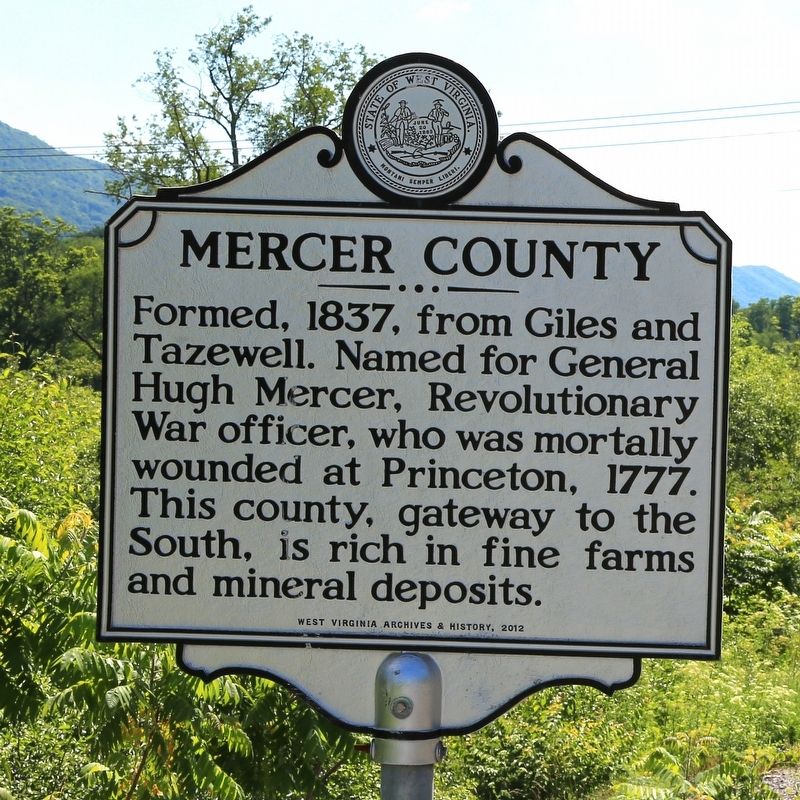
West Virginia. (Mercer County). "The Mountain State"—western part of the Commonwealth of Virginia until June 20, 1863. Settled by the Germans and Scotch-Irish. It became a line of defense between the English and French during . . . — — Map (db m105047) HM
West Virginia
(Mercer County)
"The Mountain State"—western
part of the Commonwealth of
Virginia until June 20, 1863.
Settled by the Germans and
Scotch-Irish. It became a line
of defense between the English
and French . . . — — Map (db m90595) HM
West Virginia. West Virginia was long a part of Virginia. Morgan Morgan began the settlement of the region in 1727. A great battle with the Indians took place at Point Pleasant in 1774. West Virginia became a separate state of the Union in . . . — — Map (db m34767) HM
Born in 1811, French represented Mercer County as delegate and later senator in the Virginia General Assembly. Although he voted against secession as a delegate to the 1861 Richmond Convention, he served in the Confederate Army. He led the 30th . . . — — Map (db m161236) HM
On April 6, 1846 The City of Princeton had its beginning when 22 Lots were sold. It was named for the battle in which General Mercer, the county's namesake, was killed. Samuel Speer owned the site and had a dwelling, a stable and a blacksmith shop. . . . — — Map (db m188198) HM
This is the site of a romance between Thompson L. Walker, a Confederate soldier, and Martilia Walker, the daughter of a staunch Unionist. Pvt. Thompson Walker enlisted in Company B, 23rd Virginia Infantry Battalion, on July 12, 1862, and fought . . . — — Map (db m138413) HM
Side A
Erected to the Honor & Memory of the Confederate Soldiers of Mercer County, Virginia (now West Virginia)
By the Members of Sons of Confederate Veterans
Camp No. 1694-'Flat Top Copperheads’ & Parshandatha Foley Chapter of the Order . . . — — Map (db m161238) WM
If you look closely, you can see the ruins of the vault of an old general store. This is the last large landmark remaining from the town of "Watoga.” In 1922, 51 African American coal miners and their families moved from Mercer County into an . . . — — Map (db m179270) HM
❶ Grant Street Bridge (replaced)
Grant Street over Norfolk Southern Railyard
The Grant Street Bridge was built in 1941 by the Virginia Bridge Company of Roanoke Virginia. It is a two-span, riveted-plate . . . — — Map (db m305234) HM
Mike Sizemore, a metal sculptor based in Mercer County, West Virginia, operates Mountain Artworks, a large welding studio he established in 1996. Sizemore founded the studio upon returning to West Virginia after his time in Santa Fe, New Mexico. . . . — — Map (db m281192) HM
Stretching across western Mercer County through McDowell and southern Wyoming counties is the Pocahontas coalfield, one of the most productive, coal-bearing areas in the world. In this area, 6 seams of high-quality coal can be found close to the . . . — — Map (db m179086) HM
The coalfields needed a steady supply of laborers, and the workers came from all parts of the world. In addition to native-born West virginians, African Americans poured into Bluefield from Virginia and the Deep South, and immigrants arrived from . . . — — Map (db m305243) HM
Bailey Building
has been placed on the
National Register
of Historic Places
by the United States
Department of the Interior
1923 — — Map (db m305259) HM
Explorations of West Blue Ridge
It is impossible to say when and where the first European settlers set foot on the soil of what is now West Virginia. In all probability no record was ever made of the first visit. It is well known that . . . — — Map (db m179016) HM
The Southwest Virginia Improvement Company
opened Pocahontas Mine No. 1, the first to
exploit the rich seams of the Pocahontas Coalfield,
in 1882. An extension of the Norfolk and Western
Railway soon followed, bringing industrial development to . . . — — Map (db m104975) HM
While the description of Bramwell as a town of millionaires can be
viewed as an exaggeration, it did have a significant number of wealthy
families. Their wealth was built largely upon the rapid growth of the
Pocahontas coalfield and Bramwell’s . . . — — Map (db m179168) HM
Pocahontas Fuel Company coal mining town, 1916,
named for Isaac T. Mann, President. Italian stonemasons built large Company store/office building, 1923-1925
on plans of Alex Mahood, a noted West Virginia architect. Placed on National Register in . . . — — Map (db m138396) HM
Thin black lines indicate changes in relevance. Between each pair of lines entries are ordered geographically but all have the same relevance.
* Inflectional forms of words are their plurals, singulars, and possessives as well as gramatical tenses and similar variations.