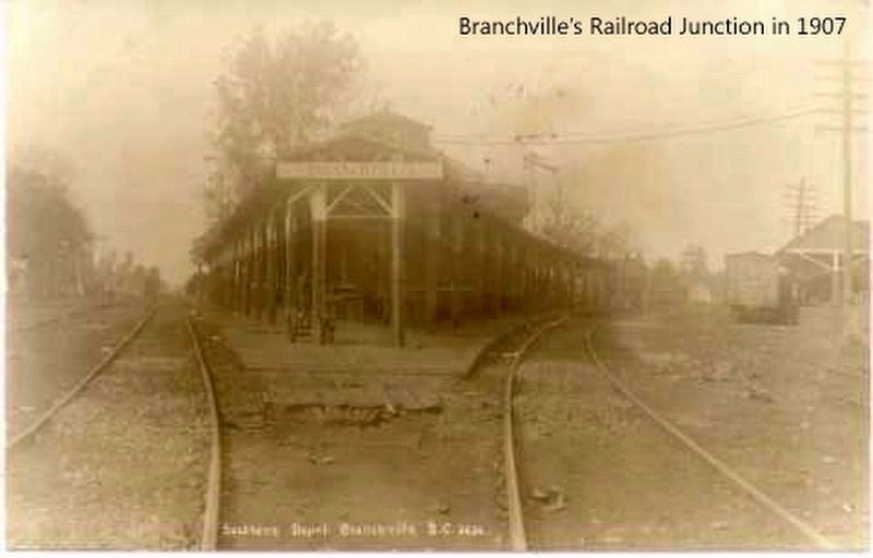
On Freedom Blvd. (US 21) at Freedom Rd. (US 21), on the right when traveling north on Freedom Blvd. (US 21).
The first settlement of the town of Branchville was 1735 about one mile southeast of the present town. Almost 100 years later, the present town grew from 170 acres of land purchased from the South Carolina Canal and Railroad Company. It was . . . — — Map (db m16536) HM
On Freedom Boulevard (U.S. 21) near East Railroad Avenue, on the right.
(Left text)
Parish House
Built in the 1830's it is thought to be the oldest of the plantation summer homes in the area. Acquired by the Church of the Epiphany across the street, it was used for various church activities. Now it . . . — — Map (db m16801) HM
On Belleville Road (State Highway 38-29), on the right when traveling west.
Here was the birthplace of Alexander Samuel Salley, who devoted fifty years to the collection, preservation, and publication of the historical records of the state as Secretary of the South Carolina Historical Society, Secretary of the
South . . . — — Map (db m33413) HM
On Waterspring Road (State Highway 38-142) near Lime Kiln Road, on the left when traveling east.
This cemetery was the burial site of the Miller family from the early 1800s. The remaining stones erected in 1836, are to John Miller (1750-1854), soldier of the Revolution; his wife, Margaret Ott Miller; and their son, John Miller Jr. Their . . . — — Map (db m25184) HM
On Laurens Street at College Street, on the right when traveling south on Laurens Street.
(side 1)
Alexander Samuel Salley 1871-1961), the historian described as a “walking encyclopedia” of S.C. history, lived here from 1910 until his death. Salley, born in Orangeburg County, was secretary of the S.C. Historical . . . — — Map (db m72734) HM
On Park Avenue near York St. SE (U.S. 1), on the right when traveling east.
Aiken County, created in 1871 from parts of Barnwell, Edgefield, Lexington, and Orangeburg counties, was named for William Aiken, first president of the South Carolina Canal and Railroad Company. Older industries in the county today are textiles, . . . — — Map (db m9707) HM
On Riverside Drive, on the left when traveling north.
Front
Orangeburg County
Parish House
Built in the 1830s it is thought to be one of the oldest of the plantation summer homes in the area. Acquired by the Church of the Epiphany across the street, it was used for various church . . . — — Map (db m52792) HM
This town, established in 1823, grew up around a store owned by Matthew Young (1803-1876), who was also postmaster 1831-43. It was first called Pressly's Station, for the post office opened in 1823 with David Pressly (1764-1834) as postmaster. The . . . — — Map (db m9397) HM
On West Forest Avenue at Carolina Avenue, on the right when traveling east on West Forest Avenue.
After the Civil War, the nearby Town of Hamburg, SC became a town where free blacks and freed slaves settled. Important local government positions were held by African-American leaders from the Town of Hamburg. The most notable were Prince . . . — — Map (db m274006) HM
On Charleston Highway (U.S. 178) near Park Street, on the right when traveling north.
James Edward Easterlin
Born Apr. 8, 1892
Lost on U.S.S. Cyclops, Mar. 4, 1918.
—–—
John Wesley Weathers
Born Apr. 17, 1895
Lost on U.S.S. Cyclops, Mar. 4, 1918.
—–—
John Moorer Livingston . . . — — Map (db m50537) HM
On State Street (U.S. 176) at Eutaw Road (State Highway 453), on the right when traveling south on State Street.
(Front text)
This community had come into existence by 1848 near the Camden fork of the Old State Road. It was chartered in 1887 in Berkeley County, following the coming of the railroad in 1886. The town was annexed to Orangeburg County in . . . — — Map (db m22917) HM
Near Stumphouse Tunnel Road near State Highway 28, on the right when traveling west.
[Listed from north to south]
Oconee Located on the edge of the Blue Ridge Mountains, Oconee County is known for nature-based activities such as boating, birding, backpacking, and camping
Pickens Pickens County has many beautiful . . . — — Map (db m185421) HM
On State Street (U.S. 176) at Depot Street, on the left when traveling east on State Street.
The rural 19th Century village began as a sparsely settled community in historic St. James, Goose Creek Parish of the Charleston District. Following the revolutionary War, increased numbers of settlers entered the parish's backcountry where it . . . — — Map (db m22505) HM
On Frontage Road, on the right when traveling west.
Randolph Cemetery, founded in 1871, was one of the first black cemeteries in Columbia. It was named for Benjamin Franklin Randolph (1837-1868), a black state senator assassinated in 1868 near Hodges, in Abbeville County. Randolph, a . . . — — Map (db m29315) HM
On State Highway 23 0.3 miles west of Main Street (State Highway 39), on the left when traveling west.
This site, approximately halfway between Augusta and Columbia, was the location of Jacob Odom's house, where George Washington spent the night of May 21, 1791, on his trip northward through South Carolina. His escort at this time consisted of . . . — — Map (db m7115) HM
On Norway Road (County Highway 332) 0.3 miles west of Trojan Street (County Highway 2218), on the right when traveling west.
(front)
This is the site of the Rocky Swamp Rosenwald School, a frame three-room school built here in 1920-21 for African-American students in Neeses and vicinity. An elementary school with two to three teachers in grades 1-9, it was one of . . . — — Map (db m103398) HM
[Front]:
This school, often called Retreat Colored School, was built in 1923 for the African-American students in and near Westminster. A two-room, two-teacher, elementary school, it was built by local builder William Walker Bearden of . . . — — Map (db m53235) HM
Thin black lines indicate changes in relevance. Between each pair of lines entries are ordered geographically but all have the same relevance.
* Inflectional forms of words are their plurals, singulars, and possessives as well as gramatical tenses and similar variations.