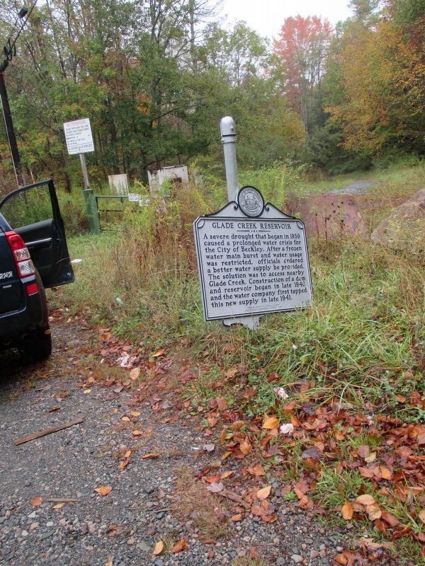
On Hinton Road (West Virginia Route 3) at Joes Ridge Road (County Road 3/25), on the right when traveling east on Hinton Road.
A severe drought that began in 1939 caused a prolonged water crisis for the City of Beckley. After a frozen water main burst and water usage was restricted, officials ordered a better water supply be provided. The solution was to access nearby Glade . . . — — Map (db m197782) HM
On Ritter Drive (West Virginia Route 19) at Blue Jay Drive, on the right when traveling south on Ritter Drive.
The ancient fortification in a bend of Beaver Creek was first surveyed by Alfred Beckley in 1837. Isaac Craig mapped it a year later and estimated then~fallen stone walls were 7 feet thick and 6 feet high. The walls of large enclosure, with design . . . — — Map (db m109188) HM
On Grandview Road (County Road 9) north of Heron Lane, on the left when traveling north.
James Beaty built sawmill at Crow in 1891 to mill timber on Grandview plateau and nearby areas. Mules pulled lumber in wagons on 8-mile tram from mill to point just east of here. Moved onto monitor, lumber lowered down steep incline to Mill Creek . . . — — Map (db m252087) HM
On Joel L. Smith Drive at Jersey Avenue, on the right when traveling north on Joel L. Smith Drive.
Alfred Beckley built a mill along
Piney Creek (1838-1840) to spur
economic growth on his wilderness
landholdings. Union Commander and future U.S. President Rutherford
B. Hayes visited site in 1862. It
was destroyed in the 1878 flood . . . — — Map (db m138152) HM
On South Fayette (West Virginia Route 3) near Mool Avenue, on the right when traveling south.
Born July 4, 1938, in Slab Fork, Withers grew up in Beckley. After nine years of service in the US Navy, he began a successful career in the music industry, recording hit songs “Ain’t No Sunshine” and “Lean on Me.” In his lifetime, he won three . . . — — Map (db m176833) HM
Built in 1927 as home of Raleigh Coal & Coke Co. general manager Ernest E. Chilson. One of the most prominent coal barons in the state, he also founded the Black Knight Country Club. His white-stuccoed mansion featured a copper roof and 18~inch . . . — — Map (db m250299) HM
On East Beckley Bypass (Bypass U.S. 19) 0.3 miles north of Pinecrest Industrial Road, on the right when traveling west.
Born February 11, 1904, in Beckley. Meadows, a lawyer, entered public service in 1930. He served as state delegate, county prosecutor and WV Attorney General before becoming a judge of the 10th Circuit in 1942. As governor (1945-49) he oversaw . . . — — Map (db m176834) HM
Five miles west at Eccles, on April 28, 1914, a gas explosion in No. 5 Mine in the Beckley seam killed 174 miners; another nine died in No. 6 Mine above from blackdamp. On March 8, 1926, 19 died in No. 5. In 1891, Royal Mine on New River was first . . . — — Map (db m60204) HM
Authorized by the Virginia General Assembly (1811) as a "salt road." Completed c. 1812, the primitive road connected the Kanawha salines with southwestern VA markets and also gave access to the county's interior. Though one account stated it . . . — — Map (db m250301) HM
The county's first mine opened at Royal on the New River in 1891. The Beckley Exhibition Mine, once an actual operating mine, and the dozens of others throughout Raleigh County produced 792,055,155 tons of bituminous coal in the first century of the . . . — — Map (db m161229) HM
On Bolt Road (West Virginia Route 99) 0.1 miles Rockhouse Fork (County Road 15/8), on the left when traveling west.
Construction of the Logan Turnpike was authorized by the VA General Assembly on March 17, 1849. The road was an important entryway into he relatively remote region of present-day southern West Virginia. Starting on the Big Sandy in Logan, it roughly . . . — — Map (db m176831) HM
On Stanaford Road (West Virginia Route 41) 0.1 miles east of Terry Road (County Road 41/8) when traveling east.
In 1950, the U.S. Army Corps of Engineers established a training and testing facility near McCreery. Chosen for its unique directional flows and proximity to Bluestone Dam, this section of the New River also allowed testing of floating bridge . . . — — Map (db m176827) HM
On Temple Street (West Virginia Route 20) south of Faith Lane (County Road 7), on the right when traveling south.
William Richmond Homeplace. Near here was homestead of William Richmond (1752-1850). A veteran of he Revolution, he came here in 1799 likely as the first permanent white settler. The prolific family operated a ferry across the New River for . . . — — Map (db m229268) HM
Near Ewart Avenue 0.5 miles west of Robert C. Byrd Drive ( Route 16), on the left when traveling west.
Company town, company school
Originally constructed as a two room school, it became a one room school when enrollment declined. Built in 1925 in Helen, West Virginia, it served black children that lived in the coal camp. A similar . . . — — Map (db m281649) HM
Shortly after European explorers arrived, permanent settlers began to use the "Indian Path" to enter southern West Virginia. The first permanent settlers arrived at Paint Creek in the early 19th century. Agriculture was the dominant way of life for . . . — — Map (db m75144) HM
On Neville Street west of Woodlawn Avenue, on the right when traveling west.
Founder of Raleigh County and the City of Beckley. Born in Washington, D.C., he was a West Point graduate, class of 1823, U.S. Artillery officer, and a brigadier general in the Virginia militia 1849-1861. He came to Fayette County (now Raleigh) in . . . — — Map (db m165062) HM
On Main Street at S Fayette Street on Main Street.
General Alfred Beckley, founder of the city of Beckley, shows this corner location as land lot 29 on his 1838 map. Reverend Matthew Ellison, founder of the First Baptist Church of Beckley, built his home here in 1850, and his heirs held title to the . . . — — Map (db m60262) HM
Near Foreman Bottom Road west of Tams Highway ( Route 16).
In the early 1920s baseball was becoming America's game, and the small towns of West Virginia were no exception. Little boys throughout the area dreamed of being the next Babe Ruth or Lou Gehrig while playing with baseballs made from paper and . . . — — Map (db m186955) HM
On Lester Highway (West Virginia Route 54/97) 0.1 miles west of 4th Avenue (County Road 54/4), on the right when traveling west.
In 1902, competing railroads raced to reach the coal fields of southern West Virginia. The Chesapeake and Ohio (C&O) and Deepwater-Tidewater Railway (known as the Virginian after 1907) both wanted to be the first to reach the rich coal deposits . . . — — Map (db m204806) HM
On South Fayette Street (West Virginia Route 3) at G Street, on the right when traveling west on South Fayette Street.
Gone are the days of the early 1800s in which African Americans were mainly provided education by missionaries and charitable organizations. The WV legislature passed a bill in 1866 that provided public schools for black students, but revised it in . . . — — Map (db m161232) HM
On May 12, 1962, Beckley Street Commissioner D. E. Warden, initially in charge of setting up the City's new Exhibition Coal Mine, announced the donation of a dinky locomotive to the project. Dinkies were small locomotives used on short line . . . — — Map (db m161230) HM
On Industrial Drive just west of Lewis Ritchie Drive, on the right when traveling west.
The airfield once located here was the first major aviation facility in southern West Virginia. Known variously as Skelton Field (for the town of Skelton), Scott Field (for S.A. Scott, President of the New River Coal Company) and most commonly as . . . — — Map (db m212839) HM
The Birdman of West Virginia
When thinking of the early aviation history of the United States, many times we think of Dayton or Kitty Hawk. However, the town of Ansted also holds a very special place in the story, as it was the birthplace of . . . — — Map (db m173335) HM
On Coal River Road (West Virginia Route 3) at Bridge Avenue, on the left when traveling east on Coal River Road.
The Coal River is a tributary of the Kanawha River in southern West Virginia. It is formed near the community of Alum Creek by the confluence of the Big and Little Coal Rivers. The Coal River flows generally northward through western Kanawha County, . . . — — Map (db m137542) HM
Eight panels mounted to the inside of the town gazebo depict some historical and notable features of the town.
Panel 1 - Town of Ansted
The town of Ansted, West Virginia chartered in 1891, was created because of coal. The town's . . . — — Map (db m173340) HM
Thin black lines indicate changes in relevance. Between each pair of lines entries are ordered geographically but all have the same relevance.
* Inflectional forms of words are their plurals, singulars, and possessives as well as gramatical tenses and similar variations.