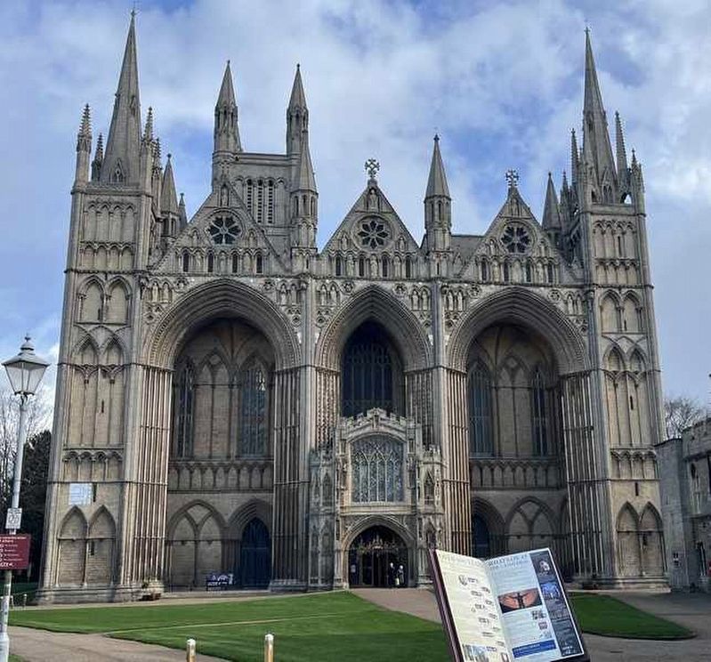
Ahead on your right is the gateway leading through to the church which has been Peterborough's Cathedral since 1541. The first church on this site was founded in 655AD as an abbey, but was then destroyed by the Vikings in 870AD. Its replacement was . . . — — Map (db m307432) HM
On Station Road, on the right when traveling north.
The first railway to come through Peterborough was built in 1845 on the line to Northampton with a station which stood south of the river. Peterborough North Station was built on the site in front of you in 1850, for the east coast line.
The . . . — — Map (db m306340) HM
On Cowgate at Queensgate Roundabout, on the left when traveling west on Cowgate.
The area across the road used to be the old Cowgate cemetery. Opened in 1803, this was the main graveyard for the city for much of the 19th century. It was notorious in the late 1820s as a haunt of body snatchers; criminals who dug up freshly buried . . . — — Map (db m306338) HM
On Bridge Street, on the right when traveling south.
In medieval times this street was called Hythegate, meaning 'wharf street', as for much of its history the River Nene was navigable. In the 1790s French prisoners of war were landed here to be taken to the world's first prisoner of war camp at . . . — — Map (db m306367) HM
The Quay Planter.
Designed by Stephen Broadbent this wonderful piece of street furniture represents the quay or landing stage Henry Penn used. It was on Bell Dyke near to his bellfoundry. Barges could be loaded with bells he cast and floated . . . — — Map (db m307433) HM
This building, known as The Guildhall, was erected in 1671 to celebrate the restoration of the monarchy in 1660. It became part of Peterborough's council chambers until they were replaced by the present Town Hall in 1933. — — Map (db m252584) HM
On Cowgate at Queensgate Roundabout, on the left when traveling west on Cowgate.
The Peterborough area has a rich heritage for you to discover and explore.
The area has been settled for centuries. 3,500 years ago, Bronze Age inhabitants built a causeway across the marshes at Flag Fen to the east of the city. The Romans . . . — — Map (db m306339) HM
Around 1150 Abbot Martin De Bec created a new market to bring more money into the town and help fund the building of his new abbey church. The result was the 'Marketstede', today Cathedral Square. The monks moved the settlement from Boongate to . . . — — Map (db m307431) HM
For most of its history, this was Narrow Bridge Street, stretching from here to Cathedral Square. It was a narrow medieval street - only 22 feet (6.7 metres) wide. The Town Hall was started in 1929 behind the right hand row of shops and houses, . . . — — Map (db m306363) HM
On Station Road, on the left when traveling north.
Peterborough grew rapidly from being a small market town during the second half of the 19th century, thanks to the coming of the railways. By 1861 there were four major rail companies operating in the city, employing 2,000 of the 12,000 population. . . . — — Map (db m307430) HM
In a house on this site lived Simon Gunton (1609-1676), Vicar of Peterborough during the Great Plague, historian and Prebendary of the Cathedral. His book 'The History of the Church of Peterburgh' was published in 1686. — — Map (db m252586) HM
Site of a chapel dedicated to St Thomas Becket murdered in 1170.
It was completed shortly afterwards for pilgrims venerating relics of Becket brought here from Canterbury. — — Map (db m248970) HM
Cowgate gets its name from livestock being driven to market along here in medieval times, particularly as nearby Queen Street was then called 'Butcher's Row'.
The grassed area across the road was covered by the Corn Exchange, built in 1846, . . . — — Map (db m306365) HM
The Minster Precincts
The Cathedral Church of St Peter, St Paul and St Andrew gives its name to Peterborough and is the ancient heart of the city. The Minster Precincts cover the site of a great medieval abbey, the remains of which can still . . . — — Map (db m252583) HM