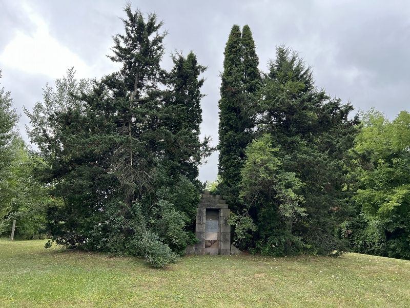
On Third Line 0.1 kilometers north of 5 Side Road, on the left when traveling north.
Erected on this site 1835 The Associate Presbyterian Church, united with Associate Reformed in 1858 forming the United Church of America. The brick church built in 1866 was used until 1935. — — Map (db m282043) HM
On Third Line 0.5 kilometers north of Fifth Line, on the right when traveling north.
The Boston Cemetery Association was incorporated on 15 November 1911
for the purpose of assisting in the permanent care of the burial ground and graves.
This plaque pays tribute to the pioneers & their descendants from the
first service of . . . — — Map (db m282045) HM
On Third Line 0.5 kilometers north of Fifth Side Road (County Road 9).
This Gothic Revival church was
designed by James Avon Smith RCA,
and constructed in 1868, by Charles
Blackwell, Thomas Henderson
& congregation volunteers
from Esquesing's Scotch Block — — Map (db m282050) HM
On Main Street East at Charles Street, on the right when traveling west on Main Street East.
This building served as the Town Hall from September 1867 to June 1985.
Built by Joseph Martin in 1865 for a cost of $5,000, it was known as Milton Town Hall and Market House. — — Map (db m196185) HM
On Brown Street at Mary Street, on the right when traveling north on Brown Street.
The Fred W. Armstrong Arena was Milton’s first indoor ice skating and hockey arena. It was also known by locals as the "Brown Street Arena" or "Brown Street Gardens." It was built on the north-east corner of Brown Street and Mary Street in 1921 at a . . . — — Map (db m282071) HM
On Mary Street at Brown Street, on the right when traveling east on Mary Street.
[north side]
In Flanders Fields
In memory of
those who gave
their lives in
the Great War
1914 • 1918
World War II
1939 • 1945
The Korean War
1950 • 1953
• Great • Britain • Norway •
• Ypres • Festubert • Givenchy • . . . — — Map (db m289657) WM
Milton Outlier - Halton's Legendary Promontory
You are standing atop of the largest detached section of the Niagara
Escarpment in Ontario. Known as the Milton Outlier, this 6 square
km island of bedrock was separated from the main . . . — — Map (db m285251) HM
On Mary Street at Brown Street, on the left when traveling west on Mary Street.
The Town of Milton's Cenotaph commemorates the people of
Milton and surrounding area who sacrificed their lives in World War I, World War II and the Korean War.
Canada, as a nation, owes an everlasting debt of gratitude to the young men and . . . — — Map (db m282182) HM WM
On Mary Street at Brown Street, on the right when traveling east on Mary Street.
Unbeknownst to many, the field gun situated here is not Canadian; it is a German gun. This field gun was a capture by the 3rd Canadian Infantry Battalion in World War I, during the famous period of "Canada's Hundred Days," from August 8th to . . . — — Map (db m282141) HM
On Old Britannia Road 0.2 kilometers west of Fourth Line, on the right when traveling east.
This monument is dedicated to the residents of
Omagh who attended the one-room schoolhouse that
stood in this hamlet from 1874 to 1957.
The Omagh Park was chosen as the location in
appreciation of William Devlin, who donated the land
for the . . . — — Map (db m288080) HM
On Bronte Street North 0.3 kilometers north of Victoria Street, on the right when traveling north.
The first firm in the world to produce socket-head screws, the P. L. Robertson Manufacturing Company was formed in Hamilton in 1907 and relocated here the following year. It was established by an Ontario inventor Peter Lymburner Robertson . . . — — Map (db m282053) HM
On Guelph Line near No. 10 Sideroad, on the right when traveling north.
This plaque was unveiled by the Primate of Canada,
Archbishop Michael Peers, on May 24, 1992, in the
presence of the congregation, and the rector, Rev. Charles
F. Masters. It commemorates the 150th anniversary of
the establishment in 1842 of an . . . — — Map (db m302406) HM
On Guelph Line 2.5 kilometers north of 25 Sideroad, on the right when traveling north.
Electric railway service on routes radiating from Toronto began
in 1889. Within 20 years, the Toronto and York Radial Railway
Company operated lines north on Yonge Street to Sutton, with
a branch to Schomberg; from the east end of Toronto to . . . — — Map (db m280886) HM
On Old Britannia Road 0.2 kilometers west of Fourth Line, on the right when traveling east.
Trafalgar Neighbourhood is named for the former Trafalgar Township, the municipality that once encompassed what is now Milton. Trafalgar Township was named for the 1805 Battle of Trafalgar, a celebrated naval conflict off Cape Trafalgar on the . . . — — Map (db m288078) HM
On Mary Street at Brown Street, on the right when traveling north on Mary Street.
Timeline
1853
Hugh Foster, a pioneer developer of this community, offered the Provisional Council of Halton a parcel of four acres of land to construct Halton’s new County Court House. This land is now home to Milton's Town Hall.
1854 . . . — — Map (db m282106) HM