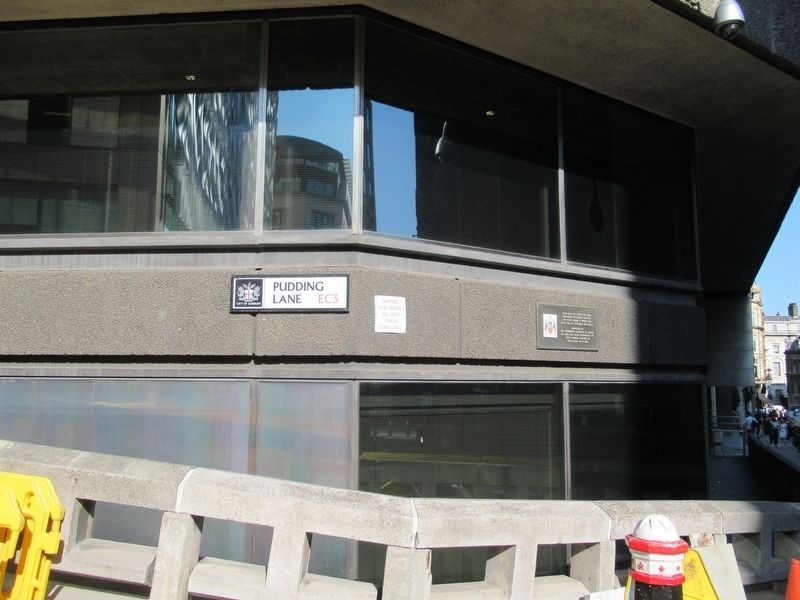
On Pudding Lane at Monument Street, on the right when traveling north on Pudding Lane.
Near this site stood the shop
belonging to Thomas Faryner,
the king’s baker, in which the
Great Fire of September 1666 began.
Presented by
The Worshipful Company of Bakers
to mark the 500th anniversary of
their charter granted by . . . — — Map (db m121550) HM
The London Wall Walk follows the line of the City Wall from the Tower of London to the Museum of London. The Walk is 1 3/4 miles (2.8km) long and is marked by twenty-one panels which can be followed in either direction. The City Wall was built by . . . — — Map (db m115970) HM
Near London Wall at Noble Street, on the right when traveling west.
The London Wall Walk follows the line of the City Wall from the Tower of London to the Museum of London. The Walk is 1¾ miles (2.8km) long and is marked by twenty-one panels which can be followed in either direction. The City Wall was built by the . . . — — Map (db m118133) HM
On London Wall at Noble Street, on the right when traveling west on London Wall.
The London Wall Walk follows the line of the City Wall from the Tower of London to the Museum of London. The Walk is 1¾ miles (2.8km) long and is marked by twenty-one panels which can be followed in either direction. The City Wall was built by the . . . — — Map (db m118131) HM
On Aldersgate Street just north of Gresham Street, on the right when traveling north.
The London Wall Walk follows the line of the City Wall from the Tower of London to the Museum of London. The Walk is 1¾ miles (2.8km) long and is marked by twenty-one panels which can be followed in either direction. The City Wall was built by the . . . — — Map (db m117213) HM
On Fish St Hill at Monument Street, on the right when traveling north on Fish St Hill.
This monument designed by Sir Christopher Wren was built to commemorate the Great Fire of London 1666 which burned for three days consuming more than 13,000 houses and devastating 436 acres of the City. The Monument is 202 ft in height, being equal . . . — — Map (db m104064) HM
On Fleet Street at Farringdon Street, on the right when traveling east on Fleet Street.
Nicholson’s
Est. 1873
The
Old Bell
The Old Bell Tavern was built in the 1670s for workmen and masons who were rebuilding St. Brides Church (designed by Christopher Wren) after The Great Fire of London in 1666 It has been a licensed tavern for . . . — — Map (db m118266) HM
On New Bridge Street just south of Bridewell Place, on the right when traveling south.
Here stood the Palace of Bridewell built by Henry VIII in 1523 and granted by Edward VI in 1553 to the City of London to house Bridewell Royal Hospital founded by Royal Charter in the same year. The present building was erected in 1802 and in 1862 . . . — — Map (db m117352) HM
In Memory
of those who gave their lives
while serving with
The 1st Battalion in the Korean War
July 1952 to August 1953
Fus G F Allen · Fus S J Anstead · Fus P G Austin · Sgt S W Burgess · Fus R G Cooper · Fus J C Crocker · Cpl E . . . — — Map (db m109467) WM
Welcome to The Salters' Garden.
The Salters' Company is one of the Great Twelve Livery Companies of the City of London and was first licensed in 1394.
The Company built their seventh Hall here in 1976 following the destruction of the previous . . . — — Map (db m120029) HM
On Cannon Street at Queen Street, on the right when traveling west on Cannon Street.
The Sugarloaf
The Sugarloaf is situated on Cannon Street which starts at St Paul's Cathedral and runs parallel with the River Thames for half a mile. Cannon Street was first known as ‘Candlewrich Street' named after the candle makers who used to . . . — — Map (db m121664) HM
On Fleet Street at Whitefriars Street, on the right when traveling west on Fleet Street.
The pub was built on the side of a monastery which dated to 1300 where, amongst other duties, the monks brewed ale. This site was an island between the River Thames and River Fleet which still runs under the pub that is now little more than a . . . — — Map (db m116403) HM
Trinity House is the general lighthouse authority for England Wales and the Channel Islands. A deep sea pilotage authority and also administers charitable funds mostly connected with seafarers.
The first Trinity House was at Deptford and then . . . — — Map (db m131964) HM
On West Smithfield, on the right when traveling north.
To The Immortal Memory Of SIR WILLIAM WALLACE
Scottish Patriot Born at Elderslie Renfrewshire Circa 1270 A.D.
Who From The Year 1296 Fought Dauntlessly In Defence Of His Country’s
Liberty And Independence In The Face Of Fearful Odds . . . — — Map (db m85736) HM
On Carter Lane at Peter's Hill, on the left when traveling west on Carter Lane.
Blitz
The Heroes With Grimy Gaces
Winston Churchill
In Honour and Memory
of Those Firefighters Who
Gave Their Lives in the
Defence of the Nation
1939-1945
This Monument was Commissioned
by the Founder Master of the
Guild . . . — — Map (db m117875) HM
On Blackfriars Roa close to Blackfriars Underpass, on the right when traveling south.
Victoria R.I.
1896
( back )
Presented
To the Citizens of London by
Sir Alfred Seale Haslam
In Token of
Friendship to Themselves
and Loyalty to
Her Majesty Queen Victoria
Rt Hon: Sir Walter Wilkin, Knt
Lord Mayor . . . — — Map (db m118267) HM
Near Upper Thames Street at Bell Wharf Lane, on the right when traveling east.
Roman London
Walbrook Wharf is the point where the now buried Walbrook River fed into the River Thames. The Walbrook is one of London’s ‘Lost Rivers’, a watercourse which has been lost to time and history.
The Walbrook was a feature of . . . — — Map (db m117900) HM
On Cornhill close to Threadneedle Street, on the right when traveling west.
Wellington
Erected
June 18
1844
( plaque behind the statue )
On 19th July 1838. the Court of Common Council of the City of London agreed to a contribution of £500 toward the cost of the above statue of the Duke of Wellington in . . . — — Map (db m121574) HM
On Upper Thames Street at Cousin Lane, on the right when traveling west on Upper Thames Street.
Welcome to Whittington Garden
This garden was named in honour of one of the City's best known Lord Mayors who was buried in 1423 in the nearby church of St Michael Paternoster Royal which he had rebuilt in 1409 at his own expense. The site, which . . . — — Map (db m121624) HM
On Cannon Street close to Queen Street, on the right when traveling west.
William Nicholson
( 1824 – 1909 )
Distiller, Politician,
Cricket Player, Benefactor
This alehouse is part of the Nicholson's heritage collection. They're all different, yet they all owe something to the man who founded them. William . . . — — Map (db m121666) HM
Near West Smithfield just north of Little Britain.
This plaque commemorates the funeral service
held in this church for
Sir William Wallace
on the 700th anniversary of his execution at Smithfield Elms
on 23rd August 1305.
David R. Ross, Convenor of The Society of . . . — — Map (db m117171) HM
On College Street close to Downgate Hill, on the right when traveling east.
29 & 30 College Street
Presented to the
Worshipful Company
of Innholders by
Walter Daniel Cronin
Master 1920 – 21
& John Wylde
Renter Warden 1920 – 21
This Building Was
Erected by the
Company in 1958
Bryan N. Gibbs . . . — — Map (db m121623) HM
On Fleet Street at Wine Office Court on Fleet Street.
Rebuilt 1667
in the reign of Charles II
and continued successively
in the Reigns of
James II 1685-1688
Interregnum Dec. 11, 1688 - Feb. 13, 1689
William III & Mary II 1609 - 1702
Anne 1702 - 1714
George I 1714 - 1727
George . . . — — Map (db m111396) HM
Near Ludgate Hill at Ave Maria Lane, on the left when traveling east.
Here in 1844 George Williams with eleven other young men employed in the City of London who shared his zeal and vision founded the Young Mens Christian Association in a drapery house on this site in which he worked and lived.
From its . . . — — Map (db m117866) HM
The Niblett Pegasus used to adorn the entrance to Niblett Hall. Constructed in 1932 behind 3 North King’s Bench Walk to house lecture halls and meeting rooms. On the Hall’s demolition in 1992 the Pegasus was resited here.
William Charles . . . — — Map (db m221626) HM
132 entries matched your criteria. Entries 101 through 132 are listed above. ⊲ Previous 100