On Palisades Road, 0 miles east of Peachtree Road NE (U.S. 19), in the median.
Lt. Gen. John B. Hood, on taking command of the Army of Tennessee [CS], July 18, 1864, began aggressive action against the Federal approach to Atlanta from
upper Chattahoochee crossings. July 20. Hood’s 1st move was to attack Thomas’ Army of the . . . — — Map (db m14415) HM
On Paces Ferry Road NW at Paces Place NW, on the right when traveling west on Paces Ferry Road NW.
July 18, 1864. The 14th A.C., which was posted on extreme rt. of the Cumberland Army, left camp at Mt. Paran Rd., crossed Nancy´s Creek & moved S. on Howell Mill Rd. to Peachtree Cr. Mitchell´s brigade of Davis´ div. covered the Ridgewood Rd. area . . . — — Map (db m14348) HM
On Briarcliff Road NE (Georgia Route 42) at Old Briarcliff Road NE, on the right when traveling north on Briarcliff Road NE.
July 19, 1864. In deployment of Federal forces approaching Atlanta, it became necessary to fill a gap between those on Peachtree Rd. at the creek & Schofield’s 23d A.C. on Pea Vine Cr. at the Paden plantation (Emory University). Sherman directed . . . — — Map (db m9764) HM
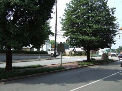
On Briarcliff Road (Georgia Route 42) 0.1 miles north of University Drive, on the right when traveling south.
July 20, 1864. A critical factor in the alignment of Federal troops moving on Atlanta, from Peachtree Creek valley, was a wide gap between Peachtree Rd. (the left of Thomas’ forces) & Schofield’s 23d A.C. posted at the intersection of N. Decatur & . . . — — Map (db m9500) HM
On Briarcliff Road (Georgia Route 42) 0.1 miles south of Old Briarcliff Road, on the right when traveling north.
This modern tv station, WAGA-TV stands in land lot 57 of the 18th District of the original Henry, now DeKalb County, near the south fork of Peachtree Creek, was erected in 1966.
In July, 1864 the present Briarcliff Road was the route of the . . . — — Map (db m9766) HM
On Hosea L WIlliams Dr SE at Clay St NE, on the left when traveling west on Hosea L WIlliams Dr SE.
McPherson's Army of the Tenn. (US) seized Decatur July 19, 1864 & on the 20th moved towards Atlanta in two columns - the 15th & 16th A.C. via the Ga. R.R., the 17th by roads S. of it where Wheeler's Cav.,(CS) guarding the right of Atlanta's outer . . . — — Map (db m8894) HM
On Clarimont Road (Georgia Route 155) 0.2 miles south of North Decatur Road, on the right when traveling south.
About 1826, Dr. Chapmon Powell erected a log cabin beside the Shallowford Trail near this site. His Indian patients called it the “Medicine House.” His cabin had been relocated onto this site by 1863 when Powell’s son-in-law, Washington Jackson . . . — — Map (db m9361) HM
On Briarcliff Road at Henderson Mill Road, on the right when traveling south on Briarcliff Road.
July 19, 1864. Logan's troops, in "light fighting order" left camp at Henderson's mill (0.8 mile N.E.), at 5 A.M. & marched to Decatur. They were joined at this point by Blair's corps which had camped at Blake's Mill, 2 miles west.
Both corps, . . . — — Map (db m8761) HM
On Walthall Drive, 0 miles south of Colland Drive NW, on the left when traveling south.
July 20, 1864. To this high ground, 500 yds. in front of Geary’s div. (20th A.C.) [US] on Collier Rd., the 33d N.J. regt., Jones’ brigade, was sent to establish & support a battery position. The regiment had scarcely reached this hill when, in a . . . — — Map (db m16407) HM
On Ardmore Road, 0.1 miles south of Collier Road, on the right when traveling south.
Four regiments ~ 33d & 85th Ind., 19th Mich. & 22d Wis. ~ Col. John Coburn’s brigade, Ward’s 3d div., 20th A.C., were posted in this sector ~ the 22d Wis. on the ridge as skirmishers, the other three in the ravine N. of the road. The left of . . . — — Map (db m16382) HM
On Ardmore Road, 0.1 miles south of Collier Road, on the right when traveling south.
Gen. W.S. Featherston’s Mississippi brigade of Loring’s div., Stewart’s A.C., [CS] together with Scott’s brigade (on his left), advanced from trenches at & near Loring’s Hill, .9 miles S.W. Traversing a broken area of tangled forest, the brigade . . . — — Map (db m16380) HM
On Peachtree Battle Avenue, 0.1 miles east of Bohler Road NW, on the left when traveling east. Reported missing.
A small tributary of Peachtree Creek, which rises near Pace’s Ferry Road & drains the valley between Arden, Dover, Howell Mill rds. & Moore’s Mill Road; a landmark of military operations in the Summer of 1864. July 19. Federal 14th A.C. troops . . . — — Map (db m50501) HM
On Northside Drive (U.S. 41), on the right when traveling north on Northside Drive.
July 20, 1864. Williams' div., 20th A. C., having crossed Peachtree Cr. 750 yds. N., deployed his 3 brigades - Robinson's, Knipe's & Ruger's in the order named, on this ridge from this point W. This was part of a general move on Atlanta by Fed. . . . — — Map (db m16408) HM
On Ardmore Road, 0.1 miles south of Collier Road, on the right when traveling south.
Col. James Wood's brigade, Ward’s div., [US] was the left of the 20th A.C. line. It was posted in the ravine N. of Collier Rd. where its left joined Kimball’s brigade. Newton’s div. 4th A.C. Featherston’s [CS] attack was delayed by skirmishers . . . — — Map (db m16381) HM
On Brighton Road at Peachtree Road NE (U.S. 19), in the median on Brighton Road.
Troops of Gen. W.J. Hardee’s A.C. [CS] were posted in this sector, July 18, 1864, to guard the creek crossings when it was learned that Federal forces were moving toward Atlanta from Pace’s & Power’s Fys., Chattahoochee River. Wheeler’s Cav. . . . — — Map (db m16426) HM
On Old Marietta Road NW, 0.2 miles Marietta Road NW, on the left when traveling south.
Johnston’s army [CS] moved to this side of the river July 9-10, 1864. French’s div., Stewarts A.C. was posted astride the R.R. to guard the left bank pending Federal crossings up river. July 18. With the Federal advance S. to Peachtree Cr. Valley, . . . — — Map (db m16583) HM
On Collier Road NW at Redland Road NW, on the right when traveling west on Collier Road NW.
150 ft. down stream, on the right bank of Tanyard Branch, stood an ante-bellum grist mill built & operated by Andrew J. Collier, pioneer resident of this area. (1827-1887). A notable landmark at the time of the Battle of Peachtree Creek - July 20, . . . — — Map (db m16497) HM
On Wesley Drive NW at Northside Drive NW (U.S. 41), on the right when traveling west on Wesley Drive NW.
July 19, 1864. Covered by the fire of Geary’s 12 guns [US] on the ridge N. of the cr., together with the musketry of a heavy skirmish line, the division pioneers hastily built a foot bridge with timbers previously prepared. Ireland’s Brigade . . . — — Map (db m16516) HM
On Palisades Road NE, 0 miles Peachtree Road NE (U.S. 19), in the median.
July 20, 1864. At 3:30 P.M., 3 divisions of Hardee’s A.C., [CS] Bate’s, Walker’s, & Maney’s, moved to the attack of Newton’s 4th A.C. div. [US] posted on the ridge 200 yards north of Collier Road. Bate, on the right of the corps, was just west of . . . — — Map (db m16506) HM
On Collier Road at Redland Road NW, on the right when traveling west on Collier Road.
The 5 regts. of Col. Benjamin Harrison’s brigade of Ward’s div. (20th A.C.) [US] were N. of this ridge when the Confederate attack in this sector was made. The brigade was moved forward in support of Geary’s line & deployed astride Tanyard Branch . . . — — Map (db m16498) HM
On West Peachtree Street NE near Inwood Circle NE, on the right when traveling north.
The area E. (L. L. 104, 17th Dist.), long known as Collier’s Woods, was part of the ante-bellum plantation of George W. Collier (1813-1903). Clear Creek P.O. (1831-1839), probably in this land lot, was named for the stream flowing across it; old . . . — — Map (db m16545) HM
On Howell Mill Road NW, 0 miles north of Collier Road NW, on the right when traveling south.
Commanding Artillery Battalion attached to Alexander P. Stewart’s Corps [CS] - killed in action while supervising placement of two sections of Selden’s Ala. Battery, Lt. Chas. W. Lovelace, commanding, near the Embry House, July 20th, 1864, during . . . — — Map (db m16505) HM
On 28th Street NW at Wycliff Road NW, on the left when traveling east on 28th Street NW.
A section of the old Montgomery Ferry Road ran N.W. from Geo. W. Collier’s house (Land Lot 104) & crossed Peachtree Road (below Palisades). This point, on the old rd. is S.W. of the site of the war-time house of Andrew J. Collier which stood until . . . — — Map (db m16517) HM
On Collier Road NW at Walthall Drive NW, on the right when traveling east on Collier Road NW.
In 1864, Collier Rd. topped the ridge N. Descending the slope E. it crossed the branch below the dam at Collier’s Mill. Geary’s left – Candy’s brigade & Aleshire’s batteries [US] - were aligned along the old road facing south. The 33d N.J. . . . — — Map (db m16532) HM
On Springlake Drive NW at Collier Road NW, on the right when traveling north on Springlake Drive NW.
July 20, 1864. Four regiments of Reynolds’ Arkansas brigade, Walthall’s div., Stewart’s A.C., [CS] having deployed abreast at old Mt. Zion Ch., moved in a right oblique across Howell Mill & Collier rds. into the wooded ravine. The assault fell upon . . . — — Map (db m16515) HM
On North Colonial Homes Circle NW, 0.1 miles Colonial Homes Drive NW, on the left when traveling north.
July 20, 1864. Gen. W. T. Ward’s 3rd div., 20th A.C., having crossed the creek at Peachtree Road, moved to the low ground at stream-side, its three brigands aligned westward, facing S. From East to West were Wood’s, Coburn’s and Harrison’s . . . — — Map (db m16501) HM
On Johnson Ferry Road NE, 0.1 miles west of Hollis Cobb Circle, on the right when traveling west.
July 17, 1864. Gen. J. D. Cox’s 23d A.C. [US], enroute from Isom's Ferry via Mt. Vernon Rd., turned S.E. at Sandy Springs & followed a rural trail (now Johnson’s Ferry and Chamblee roads) to & beyond Nancy’s Creek in DeKalb Co. Cox’s div. was . . . — — Map (db m16424) HM