By Felch Dumas, August 14, 2008
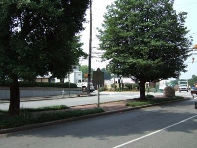
Battlefield of Peachtree Creek Marker facing Peachtree Street from Palisades Road
SHOWN IN SOURCE-SPECIFIED ORDER
| On Palisades Road, 0 miles east of Peachtree Road NE (U.S. 19), in the median. |
| On Paces Ferry Road NW at Paces Place NW, on the right when traveling west on Paces Ferry Road NW. |
| On Briarcliff Road NE (Georgia Route 42) at Old Briarcliff Road NE, on the right when traveling north on Briarcliff Road NE. |
| On Briarcliff Road (Georgia Route 42) 0.1 miles north of University Drive, on the right when traveling south. |
| On Briarcliff Road (Georgia Route 42) 0.1 miles south of Old Briarcliff Road, on the right when traveling north. |
| On Hosea L WIlliams Dr SE at Clay St NE, on the left when traveling west on Hosea L WIlliams Dr SE. |
| On Clarimont Road (Georgia Route 155) 0.2 miles south of North Decatur Road, on the right when traveling south. |
| On Briarcliff Road at Henderson Mill Road, on the right when traveling south on Briarcliff Road. |
| On Walthall Drive, 0 miles south of Colland Drive NW, on the left when traveling south. |
| On Ardmore Road, 0.1 miles south of Collier Road, on the right when traveling south. |
| On Ardmore Road, 0.1 miles south of Collier Road, on the right when traveling south. |
| On Peachtree Battle Avenue, 0.1 miles east of Bohler Road NW, on the left when traveling east. Reported missing. |
| On Northside Drive (U.S. 41), on the right when traveling north on Northside Drive. |
| On Ardmore Road, 0.1 miles south of Collier Road, on the right when traveling south. |
| On Brighton Road at Peachtree Road NE (U.S. 19), in the median on Brighton Road. |
| On Old Marietta Road NW, 0.2 miles Marietta Road NW, on the left when traveling south. |
| On Collier Road NW at Redland Road NW, on the right when traveling west on Collier Road NW. |
| On Wesley Drive NW at Northside Drive NW (U.S. 41), on the right when traveling west on Wesley Drive NW. |
| On Palisades Road NE, 0 miles Peachtree Road NE (U.S. 19), in the median. |
| On Collier Road at Redland Road NW, on the right when traveling west on Collier Road. |
| On West Peachtree Street NE near Inwood Circle NE, on the right when traveling north. |
| On Howell Mill Road NW, 0 miles north of Collier Road NW, on the right when traveling south. |
| On 28th Street NW at Wycliff Road NW, on the left when traveling east on 28th Street NW. |
| On Collier Road NW at Walthall Drive NW, on the right when traveling east on Collier Road NW. |
| On Springlake Drive NW at Collier Road NW, on the right when traveling north on Springlake Drive NW. |
| On North Colonial Homes Circle NW, 0.1 miles Colonial Homes Drive NW, on the left when traveling north. |
| On Johnson Ferry Road NE, 0.1 miles west of Hollis Cobb Circle, on the right when traveling west. |