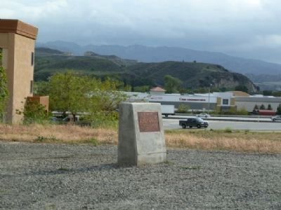
On Newhall Ranch Road (State Highway 126) at Golden State Freeway (Interstate 5), on the right when traveling east on Newhall Ranch Road.
The super highway of its day when opened in 1915, The Ridge Route, California’s first mountain highway, has been credited by some (for better or worse) as saving the state from being divided into two separate states. Constructed, graded, and paved . . . — — Map (db m121867) HM
On Ridge Route Road, 2.7 miles north of Templin Highway, on the right when traveling north. Reported unreadable.
Traveling north for the next 17.6 miles, you will see rock and concrete monuments on the roadside. These monuments tell a story of a bygone era. Each one represents a place or business establishment that was on the site. When this twenty foot . . . — — Map (db m151528) HM
On Ridge Route Road, 11 miles south of Highway 138, on the left when traveling south. Reported unreadable.
As a road-weary traveler, you could find whatever you needed during your passage over these steep mountains. Not only was this the location of a restaurant, gas station, garage, store, and water trough for overheated cars, but above the . . . — — Map (db m152074) HM
On Ridge Route Road, 9 miles south of Highway 138, on the left when traveling south. Reported unreadable.
Congratulations!!! At this stop you were halfway to wherever you were going. Bakersfield is 64 miles to the north and Los Angeles is 62 miles to the south. Weary travelers and truckers took advantage of the garage service and restaurant . . . — — Map (db m152072) HM
On Ridge Route Road, 7.7 miles north of Templin Highway, on the left when traveling north. Reported unreadable.
This remarkable 110-foot deep cut was excavated by large steam-powered shovels, which were hauled up the ridge by teams of mules. Though not maintained for over 60 years, these cut slopes remain secure today, a testimony to the engineering . . . — — Map (db m151495) HM
In front of you in the hills, high above freeway Interstate 5, is a portion of the historic 1915 two-lane “Ridge Route”. The power lines follow it.
The original Ridge Route was constructed in 1914-1915 by pick, shovel and mule drawn Fresno . . . — — Map (db m152085) HM
On Ridge Route Road, 6.6 miles south of Highway 138, on the left when traveling south. Reported unreadable.
Because of its distinctive rock work and spectacular views, the Tumble Inn was known as one of the loveliest locations on the ridge. From here travelers had breathtaking views of the Liebre Mountains to the east and coastal ranges to the . . . — — Map (db m152077) HM
On Ridge Route Road, 4.8 miles north of Templin Highway, on the right when traveling north. Reported unreadable.
The National Forest Inn consisted of neat, white clapboard buildings, one of which was built on stilts to compensate for the steepness of the landscape (note building on left).
The U.S. Forest Service also had a Station here for the . . . — — Map (db m151496) HM
On Ridge Route Road, 5.5 miles south of Highway 138, on the right when traveling south. Reported unreadable.
Primary surveying for the Ridge Route began in 1912, and grading by hand crews and mule-drawn scrapers was completed in 1915. A total of one million cubic yards of earth was removed to complete the Route.
This camp was one of the . . . — — Map (db m152076) HM
On Ridge Route Road, 3.7 miles south of Highway 138, on the right when traveling south. Reported unreadable.
This point is the highest point (4,213 feet) on the Old Ridge Route. From the origin of the Route in Castaic to the south, travelers climb 3,100 feet in 26 miles to reach this point, many times wearing out their tires or overheating their . . . — — Map (db m152073) HM
On Ridge Route Road, 2.7 miles south of Highway 138, on the right when traveling south. Reported unreadable.
This resort was established around 1915 and was constructed with rough-hewn logs and rugged stone, reflective of the “Western Alpine” style popularized by the National Parks in the early 1900s. It differed from the other stops along the . . . — — Map (db m152075) HM
On Ridge Route Road at Pine Canyon Road, on the right when traveling south on Ridge Route Road.
The old Ridge Route thru the Angeles National Forest was opened in 1915 and hailed as a miracle of modern engineering providing safety with a maximum speed of 15 MPH and a saving of 44 miles over the former road. — — Map (db m152079) HM