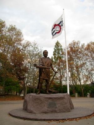
The legendary Roman is seen here after he had defeated the Aequians and rescued the trapped Roman army. With one hand he returns the fasces, symbol of power as appointed dictator of Rome. His other hand holds the plow, as he resumes the life of a . . . — — Map (db m25596) HM
On Broadway at Arch Street, on the left when traveling south on Broadway.
Beneath this building lies the powder magazine of Fort Washington, the major military outpost of the United States in the Northwest Territory, 1789-1808. The magazine was uncovered in October, 1952 when footers were being excavated. It is the only . . . — — Map (db m24948) HM
Southwest of Lytle was Fort Washington, built in 1789 and 1790 and named for President George Washington. The fort protected settlers in the new Ohio country from Indian attacks. It became the base headquarters for the Indian campaigns of Generals . . . — — Map (db m24891) HM
Near Weavers-Fort Jefferson Road, 0.1 miles west of Ohio Route 121, on the left when traveling west.
Built by the Army of
General Arthur St. Clair
in October 1791
and used as a military post
during the campaigns against
the North-Western Indian tribes
MCMVII — — Map (db m19885) HM
On Weavers-Fort Jefferson Road, 0.1 miles west of Ohio Route 121, on the left when traveling west.
Fort Jefferson. During the Indian Wars of 1790-1795, the United States built a chain of forts in the contested area of what is today western Ohio. These forts were built as a result of various tribes of the region attacking the encroaching . . . — — Map (db m20254) HM
On Weavers-Fort Jefferson Road, 0.1 miles west of Ohio Route 121, on the left when traveling west. Reported damaged.
Fort Jefferson was just a link in a chain of forts stretching north from Fort Washington (Cincinnati) to Fort Deposit (Waterville).
During the Indian War of 1790-1795, the United States felt it necessary to build forts in contested . . . — — Map (db m165698) HM
On Ohio Route 49, 0.7 miles south of Ohio Route 47, on the right when traveling south.
The army of
Maj. General Arthur St. Clair
camped on the ridge to the east
from Sunday evening, October 30th,
until the morning of November 2nd 1791,
awaiting the forwarding of flour,
tents and heavy baggage. The troops
had advanced . . . — — Map (db m20250) HM
On Fort Site Street at West Boundary Street, on the left when traveling north on Fort Site Street.
St. Clair's Defeat
When American pioneers attempted to settle the Northwest Territory following the Ordinance of 1787, the Indians, aided by the British fought fiercely for their homes. The first United States army sent to break the Indian . . . — — Map (db m168413) HM
Gen. Richard Butler
was Killed by Indians
beneath a tree which stood
on the site of this building
- - - in - - -
St. Clair's Defeat
November 4, 1791 — — Map (db m20271) HM
On Fort Site Street south of West Boundary Street, on the left when traveling south.
St. Clair’s Defeat, 1791. Native Americans inhabited and used much of the land in the Ohio valley as hunting grounds. As American settlers pushed west, conflicts resulted and attempts at peaceful settlement failed. Under political pressure, . . . — — Map (db m20333) HM
On Butler Street (Ohio Route 119) at North Elm Street (Ohio Route 49), on the right when traveling east on Butler Street.
Dr. Victor Grasson, a hero of the Indian Wars was killed while caring for the wounded during General Arthur St. Clair's defeat here, November 4, 1791. — — Map (db m22688) HM
On Butler Street (Ohio Route 119) at North Elm Street (Ohio Route 49), on the right when traveling east on Butler Street.
[West side of Monument]
This monument was erected by the Congress to commemorate the valor and perpetuate the memory of the heroic soldiers who were slain in those two memorable conflicts of the North West Territory the defeat of Arthur . . . — — Map (db m20355) HM