14 entries match your criteria.
Related Historical Markers
To better understand the relationship, study each marker in the order shown.
By William Fischer, Jr., October 31, 2009
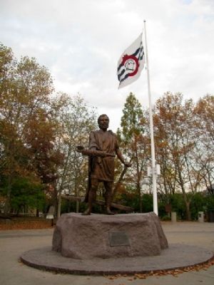
Lucius Quinctius Cincinnatus Statue and Marker
SHOWN IN SOURCE-SPECIFIED ORDER
| On Ludlow Street at 4th Street, on the left when traveling north on Ludlow Street. |
| On Broadway at Arch Street, on the left when traveling south on Broadway. |
| Near Weavers-Fort Jefferson Road, 0.1 miles west of Ohio Route 121, on the left when traveling west. |
| On Weavers-Fort Jefferson Road, 0.1 miles west of Ohio Route 121, on the left when traveling west. |
| On Weavers-Fort Jefferson Road, 0.1 miles west of Ohio Route 121, on the left when traveling west. Reported damaged. |
| On Ohio Route 49, 0.7 miles south of Ohio Route 47, on the right when traveling south. |
| On North Elm Street (Ohio Route 49) north of Butler Street (Ohio Route 119), on the right when traveling south. |
| On Fort Site Street at West Boundary Street, on the left when traveling north on Fort Site Street. |
| On Wayne Street at Butler Street on Wayne Street. |
| On Fort Site Street south of West Boundary Street, on the left when traveling south. |
| On Butler Street (Ohio Route 119) at North Elm Street (Ohio Route 49), on the right when traveling east on Butler Street. |
| On Butler Street (Ohio Route 119) at North Elm Street (Ohio Route 49), on the right when traveling east on Butler Street. |
May. 18, 2024