By Mike Wintermantel, February 12, 2011
Logstown/Legionville Historic Park & Center
SHOWN IN SOURCE-SPECIFIED ORDER
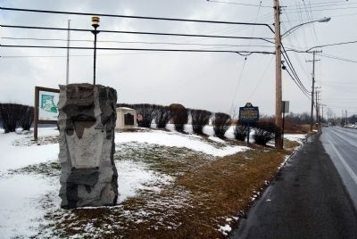
| On Duss Avenue at Anthony Wayne Drive, on the left when traveling north on Duss Avenue. |
| On Duss Avenue at Anthony Wayne Drive, on the left when traveling north on Duss Avenue. |
| On Duss Avenue, on the right when traveling south. |
| On Ohio River Boulevard (Pennsylvania Route 65) at Logan Lane, on the right when traveling east on Ohio River Boulevard. |
| On Ludlow Street at 4th Street, on the left when traveling north on Ludlow Street. |
| On Broadway at Arch Street, on the left when traveling south on Broadway. |
| Near Camden Road (Ohio Route 355). |
| On Weavers-Fort Jefferson Road, 0.1 miles west of Ohio Route 121, on the left when traveling west. |
| Near Weavers-Fort Jefferson Road, 0.1 miles west of Ohio Route 121, on the left when traveling west. |
| On Weavers-Fort Jefferson Road, 0.1 miles west of Ohio Route 121, on the left when traveling west. Reported damaged. |
| On South Broadway Street (Ohio Route 49) at West Main Street, on the right when traveling south on South Broadway Street. |
| On Ohio Route 49, 2.2 miles north of Ohio Route 47, on the left when traveling north. |
| On North Elm Street (Ohio Route 49) north of Butler Street (Ohio Route 119), on the right when traveling south. |
| On County Route 171, 0.2 miles south of County Route 177, on the left when traveling north. |
| On South Clinton Street (Ohio Route 111) 0.1 miles south of Sunday Street, on the right when traveling south. |
| On Fort Street at Washington Avenue, on the right when traveling west on Fort Street. |
| On Fort Street at Washington Avenue, on the right when traveling west on Fort Street. |
| On Fort Street at Washington Avenue, on the right when traveling north on Fort Street. |
| On South River Road (U.S. 24) at Waterville Monclova Road, on the left when traveling west on South River Road. |
| On Fallen Timbers Lane, 0.5 miles north of U.S. 24, on the left when traveling west. |
| Near State Park Road, 0.1 miles south of Fallen Timbers Lane. |
| Near Fallen Timbers Lane, 0.5 miles north of U.S. 24, on the left when traveling west. |
| Near Fallen Timbers Lane, 0.5 miles north of U.S. 24, on the left when traveling west. |
| Near North River Road, 0 miles south of Jerome Road, on the right when traveling south. Reported missing. |
| On River Road at Michigan Avenue, on the left when traveling south on River Road. Reported permanently removed. |