16 entries match your criteria.
Mojave Road (Old Government Road) Historical Markers
The historic trail stretching 138 miles across the Mojave Desert. It was used by Native Americans, the Juan Baustista de Anza Expedition of 1776, pioneers, US Army and gold seekers.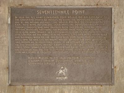
By Barry Swackhamer
Seventeenmile Point Marker
1 ► California, San Bernardino County, Baker — 74 — Marl Springs / Seventeenmile Point —  |
| 2 ► California, San Bernardino County, Baker — 34 — Soda Springs - Zzyzx Mineral Springs — |
| 3 ► California, San Bernardino County, Baker — The Desert Studies Center — Zzyzx — |
| 4 ► California, San Bernardino County, Chase — 40 — The Mojave Road — |
| 5 ► California, San Bernardino County, Daggett — 98 — Forks of the Road — |
| 6 ► California, San Bernardino County, Devore — 573 — Sycamore Grove — |
| 7 ► California, San Bernardino County, Goffs — 65 — Goffs Schoolhouse — 1914 — |
| 8 ► California, San Bernardino County, Goffs — 61 — Pah-Ute Creek — Fort Pah-Ute — Mojave Road — |
| 9 ► California, San Bernardino County, Hesperia — Las Flores Ranch / Guapiabit / This Fenced Lane / Mojave Trail — |
| 10 ► California, San Bernardino County, Lanfair — 19 — Camp Rock Spring — |
| 11 ► California, San Bernardino County, Lanfair — Fort Pah-Ute — 1867-68 — |
| 12 ► California, San Bernardino County, Lanfair Valley — 135 — Nevada Southern Railway — Reported missing |
| 13 ► California, San Bernardino County, Midway — 963 — Mojave Road — |
| 14 ► California, San Bernardino County, Needles — 781 — National Old Trails — |
| 15 ► California, San Bernardino County, Newberry Springs — 963-1 — Camp Cady — 1860-1871 — |
| 16 ► California, San Bernardino County, Rainbow Wells — Pozos de San Juan de Dios — Reported missing |