By Syd Whittle, May 11, 2008
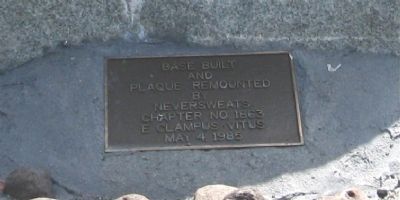
Plaque on Base of Marker
GEOGRAPHIC SORT Title Sort Marker Number Sort Marker Number Sort N Marker Number Sort T Publication Order Sort Publication Order Sort A Erected Year Sort Most Viewed Sort Most Recent-Interest Sort Most Recently Changed Sort SEE FAQ #33 FOR DESCRIPTIONS
On State Highway 395, on the left when traveling south.
On U.S. 395, on the right when traveling north.
On Forest Road 32N21, 0.5 miles south of California Route 44, on the left when traveling south.
Near California Route 44, 8.4 miles north of Mooney Road, on the left when traveling north.
Near North Street, on the right when traveling north.
Near California Route 44, 4.9 miles north of California Route 36 when traveling north.
Near Bridge Creek Springs Road, 1 mile north of Merrill Flat Road.
On Bridge Creek Springs Road, 2 miles north of California Route 44, on the right when traveling north.
On Eagle Lake Road, 0.2 miles north of California Route 36, on the right when traveling north.
On North Weatherlow Street near Nevada Street, on the right when traveling north.
On Dersch Road, 0.3 miles west of Hyrax Road, on the right when traveling west.
On Forest Road 32N21, 4.7 miles south of California Route 44, on the right when traveling south.
Near Volcanic Legacy Scenic Byway (California Route 44), on the left when traveling west.
Near Volcanic Legacy Scenic Byway (California Route 44) 1.3 miles north of Forest Route 32N32, on the right when traveling west.
Near California Route 44/89, on the left when traveling north.
Paid Advertisement
On California Route 44, 0.1 miles east of McElroy Road, on the left when traveling east.
Near Volcanic Legacy Scenic Byway (California Route 44), on the right when traveling east.
Near Forest Service Road 32N12 at McElroy Road.
On California Route 44 at Pittville Road, on the left when traveling west on State Route 44.
Near Volcanic Legacy Scenic Byway (California Route 44) 1.2 miles north of Forest Route 32N56, on the right when traveling north.
On California Route 44/89, on the left when traveling north.
On Highway 299 at Mackley Alley, on the left when traveling west on Highway 299.
On 15432 Eureka Way (California Route 299) at 2nd Street, on the right when traveling west on 15432 Eureka Way.
On Lassen Peak Highway (California Route 89), on the right when traveling south.
On Alpine Meadows Road just east of Emigrant Trail Road, on the right when traveling south.
On Lassen Peak Highway (California Route 89), on the right when traveling south.
Near California Highway 44 south of Ogburn Road, on the left when traveling west.
Near Dersch Road, 2.6 miles south of California Route 44, on the right when traveling south.
On Ritts Mill Road north of California Highway 44, on the right when traveling north.
Near California Route 44 west of Emigrant Trail/Wilson Hill Road, on the right when traveling west.
Paid Advertisement
On Forest Route 17, 0.1 miles south of California Route 44, on the left when traveling south.
On Forest Service Road 32N13F, on the right when traveling south.
Near Deer Flat Road, 0.1 miles west of Manzanita Creek Drive, on the right when traveling west.
On Deer Flat Road, 0.9 miles north of California Route 44, on the right when traveling north.
Near California Route 44, 3.3 miles west of Mineral Road (County Route 17), on the left when traveling west.
On Main Street (Nevada Route 447) 0 miles north of Beechnut Court, on the left when traveling north.