Arizona Pioneer Johnny Ward established a ranch here in 1858. In 1861 Indians kidnapped his Mexican stepson Felix Ward. Army officers assumed that local eastern Chiracahua Apaches were responsible, leading to the infamous conflict between Lt. . . . — — Map (db m24436) HM
Poston, known as the father of Arizona, came to Tubac in 1854 after the Gadsden Purchase and established the headquarters of a mining company, with mines near Arivaca and in the Santa Rita Mountains. Mining activities were discontinued during the . . . — — Map (db m27149) HM
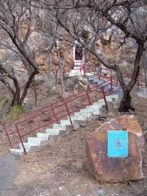
Beginning and History
In January of 1691, at the request of the O'odham (Pima) Indians of the Santa Cruz River Valley, Jesuit Father Eusebio Francisco Kino established the mission of Tumacácori, dedicated to Saint Cajetan (San Cayetano). . . . — — Map (db m68149) HM
The Mythology of a Western Fort
Fort Verde is typical of western forts built in the 1870's and 1880's but our vision of forts comes from movies. Log stockades with towers and John Wayne fearlessly firing his rifle at attacking Indians. The . . . — — Map (db m40815) HM
Could This Stone Be The Opening to a Macaw Pen?
Where Did This Stone Come From?
Who Used It?
Why Is This Stone at Montezuma Castle?
Did the Ancient Sinaguans Possibly
Raise Macaws Here?
In the 15th century, near modern-day Casa . . . — — Map (db m40895) HM
A farming community of perhaps 200 people prospered here for more than three centuries. The Castle was home to 35 or so of these people. Archeologists suggest they may have fled what is today the Flagstaff area due to overpopulation around A.D. . . . — — Map (db m40840) HM
The Neighborhood
You can see Montezuma Castle and Castle A from here. If you look closely at the Cliffside, you might spot other ledges and caves used by the Sinagua.
The Sinagua people who made their homes here may have been a . . . — — Map (db m40869) HM
The Way Up
How in the world do you build a structure large enough to house 35 people high up on a steep canyon wall? Sound impossible? Here’s how Montezuma Castle’s ingenious Sinagua farmers managed it.
Pause a few moments to enjoy this view of Montezuma Castle. Don't you suppose it must have stopped the settlers and soldiers who first saw the cliff-dwelling over a century ago?
The odd name came from a mistaken belief that the cliff-dwelling . . . — — Map (db m40819) HM
There was a time when progress in Yavapai County was spelled S-P-A-R-K-E-S. Grace M. Sparkes came to Prescott, Arizona Territory, at the age of 14 in 1906. By 1911, she was working for the Yavapai County Chamber of Commerce as Secretary, a job she . . . — — Map (db m33137) HM
Stone Marker:
14 Inf. N.Y.
John Towhey
Wounded
Here
1861
Plaque Attached to Stone:
-- January 1970 --
This stone with inscription of incident was originally located on the Yavapai Indian Reservation . . . — — Map (db m21966) HM
Pioneer • Prospector • Scout • Guide
Pauline Weaver
Truly a Great Man
Born in Tennessee in 1800
Died at Camp Verde
June 21, 1867
He was born, lived and died on the frontier of this country, always in the ever advancing westward . . . — — Map (db m33051) HM
Known as Prescott's first citizen, Weaver was a trapper, miner, Army Scout and friend of the Indians.
He was camped near this spot in 1863 and 1864 when gold miners and government officials first entered the area. — — Map (db m33052) HM
Across the Colorado River is "Indian Hill," the site of La Purisima Concepcion mission. Built in 1780 by Spanish explorers, it was destroyed in 1781 when native Quechans revolted, killing all European males. Nothing is left of that structure. Today . . . — — Map (db m158369) HM
Eager to expand it's New World empire, Spain
authorized a 1775-1776 expedition to settle the port of San Francisco. The expedition, lead by Juan Bautista de Anza, commander of the Royal Presidio of Tubac, traversed 1000 miles on foot, horseback, . . . — — Map (db m191836) HM
Below the junction of the Gila and the Colorado rivers was the only natural ford on the southern trail to the Pacific. Though often menacing, Indians helped early travelers across on crude rafts. Several ferries operated from 1850 on. Best known . . . — — Map (db m158300) HM
During his 1774 exploratory trip, Anza made friends with Chief Olleyquotequiebe (Anza called him “Palma”) of the Quechan Indians, who controlled the river crossing. The Quechans welcomed the 1775 colonizing expedition and supplied . . . — — Map (db m158365) HM
The Natural Setting The river supported pristine cottonwood / willow gallery forests, mesquite bosques, wetlands, inter-tidal salt flats, and lakes dependent on annual floods for existence. The area yielded a rich harvest of seasonal wild . . . — — Map (db m158377) HM
218 entries matched your criteria. Entries 201 through 218 are listed above. ⊲ Previous 100