On North Las Vegas Boulevard at Cashman Center, on the right when traveling south on North Las Vegas Boulevard. Reported missing.
This WWII neighborhood was named for the Nevada Biltmore Hotel which opened nearby in 1942. A WWII housing shortage called for the construction of several hundred homes for military personnel and their families. The federal government approved the . . . — — Map (db m51057) HM
On Twin Lakes Drive, 0.1 miles south of West Washington Avenue, on the left when traveling south.
Lorenzi Lake, the dream of pioneer David G. Lorenzi, opened as a private resort in 1926, became the Twin Lakes Lodge in the 1940s, and a public park in 1966.
Arriving in southern Nevada in 1911, Lorenzi began building his park on 80 acres . . . — — Map (db m51044) HM
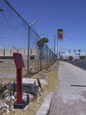
On Foothill Road (Nevada Route 206) near Canyon Creek Court, on the left.
In 1861, a blacksmith shop, a store, a boarding house, and two saloons comprised the village of Sheridan. The village had grown up around Moses Job’s General Store, established prior to 1855.
The Surveyor General, in his 1889-90 biennial . . . — — Map (db m21309) HM
On Jacks Valley Road/Main Street (Nevada Route 206), on the right when traveling south.
[Front of Marker:]
Genoa
Original Home Station
April 3, 1860 – Aug. 30, 1860
Relay Station
Sep. 1, 1860 – Nov. 20, 1861
By
Town of Genoa
Genoa Volunteer Fire Department
Carson Valley Historical Society . . . — — Map (db m20663) HM
Near Jacks Valley Road/Main Street (Nevada Route 206) at Genoa Lane.
In 1851 Col. John Reese, with a little band of eighteen men crossed the great deserts and built the first trading post in Nevada, “Mormon Station”. Later came more members of the Mormon Faith who settled and established the town of Genoa. Among . . . — — Map (db m20686) HM
On Genoa Lakes Drive near Jacks Valley Road (Nevada Route 206).
The principle emigrant trail to California’s gold fields in the 1850’s passed about 50 yards east of here. In June, 1850, Hampton S. Beatie and Abner Blackburn, two Mormons from Salt Lake City, established Nevada’s first trading post a few yards . . . — — Map (db m21218) HM
On Jacks Valley Road/Main Street (Nevada Route 206), on the right when traveling south.
These plaques are near the site
of the original Pony Express Station.
The Pony Express passed through
Genoa, the oldest city in Nevada, until
the completion of the telegraph.
Erected by the Nevada Pony
Express Centennial Committee. . . . — — Map (db m20711) HM
On Main Street (U.S. 395) near Esmeralda Avenue, on the right when traveling north.
Minden, the seat of Douglas County since 1916, was named for a town in Westphalia, Germany, where the founder of the D.F. Dangberg Land and Live Stock Company, was born in 1829. The company established Minden in 1905 to provide terminal facilities . . . — — Map (db m20877) HM
On Lamoille Highway (Nevada Route 227) east of Rosehip Court, on the left when traveling east.
Because heavy use denuded the grass from the main Fort Hall route of the California Emigrant Trail along the Humboldt River, many Emigrants left the river near Starr Valley. They skirted the East Humboldt Range and the Ruby Mountains along a . . . — — Map (db m89412) HM
On Nevada Route 226 just north of Nevada Route 18, on the right when traveling north.
This colorful historic camp originated with 1867 discovery of placer gold by John and Steve Beard. In 1871, W.O. Weed discovered the rich Mount Blitzen silver lodes, two miles northeast of the Beard Claims. The camp was named by C.M. Bensen, who had . . . — — Map (db m89411) HM
On Gold Street, 15 miles south of U.S. 95, on the left when traveling south.
Known originally as Lime Point, this area was first settled about 1880. The early camp was abandoned by 1882. In March 1908, a silver strike brought a new camp into existence. Called Hornsilver, it flourished for about a year, boasting about 800 . . . — — Map (db m34251) HM
On 6th Str at Ruby Way, on the right when traveling east on 6th Str.
Silver ore was discovered at Mount Tango in 1862 by a group of Mexican prospectors. They took the ore to Austin, Nevada. It was assayed. They were paid, and they were never heard from again.
In May of 1863 Simeon Wenban led a group to the Mount . . . — — Map (db m138451) HM
On Extraterrestrial Highway (U.S. 375) at Grants Street, on the right when traveling east on Extraterrestrial Highway.
D.C. Day started his Nevada Farms in the Sand Springs Valley in the mid 1960s, after moving here from Lubbock, Texas. Day subdivided a portion of his farm in 1973, eventually creating the town of Rachel in 1978. The town was named for Rachel Jones, . . . — — Map (db m106979) HM
On Cemetery Road/Main Street at Shady Lane on Cemetery Road/Main Street.
In July 1849, Abner Blackburn, a former member of the Mormon Battalion, made the first gold discovery in what is now Nevada near this site (see the canyon to the right). William Prouse, a member of a passing emigrant party, made a second discovery . . . — — Map (db m143642) HM
On Main Street (Nevada Route 342), on the left when traveling north.
It gives… “a forcible impression of the unhallowed character of the place” J. Ross Brown – 1860
This rugged reef of metamorphic rock was once one of the famous landmarks of the Nevada Territory. In June of 1850, John Orr and . . . — — Map (db m21561) HM
On Cheyenne Drrive at Lincoln Highway (U.S. 50), on the right when traveling south on Cheyenne Drrive.
Located approximately one mile south are the remains of a typical stage station of the period 1843 to 1869. An era of transition between the arrival of the first emigrant wagon trains and the completion of the Trans-Continental Railroad.
Desert . . . — — Map (db m89512) HM
Beatty was the center of three short-lived, so-called "gold" railroads that were spawned by the strikes of the early 1900's in Tonopah, Goldfield and Rhyolite.
During 1906-'07 three railroads were built in this area. The Las Vegas and . . . — — Map (db m31924) HM
Tonopah's remote location created an expensive obstacle. Digging the mineral out of the ground was one thing. Transporting it to the mill and eventually the marketplace was another.
Giant Wagons
Large wagons hitched in tandem were used to . . . — — Map (db m188160) HM
On Burro Avenue, on the right when traveling east.
It didn't matter how long or small a mine was. Miners tools and dynamite had to be hauled in, and ore, tools and miners had to be hoisted out.
The Whim
The simplest hoist - a pully with a rope leading down into the shaft.
The Whip . . . — — Map (db m188137) HM
On Main Street (Nevada Route 342), on the left when traveling north.
[Main Marker:]
This building is the original stone and brick edifice erected on the site of the first recorded claim on what became the Comstock Lode May 1, 1859. One of the earliest hotels it housed miners and notables offering lodging, . . . — — Map (db m21946) HM
On Nevada Route 341, on the left when traveling west.
Gold Hill's first fire company was organized as Silver Hook & Ladd on Novemeber 18, 1863. It disbanded and re-organized as Liberty Hose Co. No.1 on August 19 1864, purchasing its first hose carriage from Folsom & Hiller of San Francisco in October . . . — — Map (db m77695) HM
On Main Street (Nevada Route 342), on the right when traveling north.
Founded 1863
As Silver Bar Hook & Ladder Company No.1
Of Gold Hill, Nevada Territory
Reorganized 1864
As Liberty Engine Company No.1
Active in fighting fires for 90 years
The company motto was
“Faithful and . . . — — Map (db m21951) HM
On South D Street, on the right when traveling north.
Founded by William “Billy” Chollar (pronounced collar) in 1859, the original Chollar claim was 1,400 feet in length and 400 feet in width. In 1861, the nearby Potosi mine discovered an ore body that dipped into Chollar . . . — — Map (db m22054) HM
On B Street near Union Street, on the right when traveling south.
Constructed the year following the great 1875 conflagration, the building had deteriorated in latter-days until all that remained was the front brick façade in 1969. During this year the site was purchased by the Virginia City Chapter of E Clampus . . . — — Map (db m21986) HM
On South D Street, on the right when traveling north.
Once the residence of John Mackay, this elegant mansion also served as the office for the Gould & Curry Mining Company. Mackay, an Irish-born immigrant, was the richest man the Comstock ever produced. Built in the 1860s, this building survived the . . . — — Map (db m21596) HM
On B Street near Union Street, on the left when traveling north.
The Miners Union was organized in 1867. The Union fought for recognition, safety, family welfare, and a living wage $4.00 per day. This building, owned and maintained since 1913 by Aerie 532 F. O. E., was built in 1876. The original hall was . . . — — Map (db m21955) HM
Piper’s Opera House began as Maguire’s Opera House in 1863 when San Francisco theater impresario Thomas Maguire built the establishment, two blocks east of this site on “D” Street between Union and & Taylor Streets. Maguire fell on hard . . . — — Map (db m22005) HM
On B Street near Union Street, on the right when traveling south.
This building, the most magnificent vintage theater in the West, was erected by John Piper in 1885. Third in a succession of theatres, which he operated on the Comstock, Piper’s Opera House, with its original scenery, raked stage, and elegant . . . — — Map (db m37242) HM
On B Street near Union Street, on the right when traveling south.
Storey County was organized in 1860 and is named after Captain Edward Storey who was killed during the Pyramid Lake Indian wars in Nevada. The prior courthouse erected on this site was destroyed in the Great Fire of October 26, 1875, that also . . . — — Map (db m22007) HM
The “Big Bonanza” was the greatest mining strike in the history of the American West. In 1872, John Mackay, James Fair, James Flood & William O’Brien formed an alliance and took control of the “Consolidate Virginia” and . . . — — Map (db m50103) HM
On C Street (Nevada Route 341), on the right when traveling north.
Near this spot was the heart of the Comstock Lode, the fabulous 2 ½ mile deposit of high-grade ore that produced nearly $400,000,000 in silver and gold. After the discovery in 1859, Virginia City boomed for 20 years, helped bring Nevada into . . . — — Map (db m22630) HM
On South C Street (Nevada Route 341) near Union Street, on the left when traveling north.
Symbolized by the Greek Symbol was opened by Orindorff & McGee, Louisiana Patriots. The first Saloon rebuilt after the big fire of 1875.
The Delta Front is solid Comstock Cedar, hand made by McIntosh, Architect, wood craftsman and builder of the . . . — — Map (db m21863) HM
After Washoe Engine Co. No.4 organized in August 1863, it purchased a new Button hand-pumped fire engine with 9 1/4 inch cylinders, and 600 feet of hose for $4,288. The company housed their fire engine at the Virginia Stables on C Street, then . . . — — Map (db m77702) HM
On State Highway 341, on the right when traveling east.
Young America Engine Co. No. 2 was organized in 1862, housing its Rodgers double end stroke hand engine in the Metropolitan Stables building just South of here, across from the Presbyterian Church. In 1867, the company built a masonry fire hall just . . . — — Map (db m78129) HM
On East Aultman Street (Lincoln Highway) (U.S. 50) at 4th Street, on the right when traveling east on East Aultman Street (Lincoln Highway).
Digging began on the Liberty Pit in 1908, the same time that the Nevada Northern Railway tracks reached Copper Flat from Ely.
When work started, the pit was not a pit at all, but two small hills instead. The old map below shows the original . . . — — Map (db m126499) HM
The ghost town of Ward, in the foothills of the Egan Range, lies some eight miles west of here. Booming from 1876 until 1882, with a peak population of 1,500, Ward was somewhat of a lawless mining camp. Early killings did occur, but justice was . . . — — Map (db m27291) HM