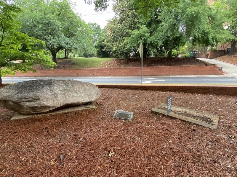
Near South Jackson Street north of Baldwin Street, on the right when traveling north.
These two engraved 'petroglyphic' boulders were carved by prehistoric Native Americans of Georgia. Their exact ages are unknown but the symbols are somewhat similar to Georgia pottery designs from ca. 800 years ago. The meaning of the symbols is . . . — — Map (db m198832) HM
On West Maple Street (Georgia Route 20) at Veterans Memorial Boulevard ( Route 9), on the left when traveling east on West Maple Street.
Lynching in America
Thousands of Black people were the victims of racial terror lynchings
in the United States between 1877 and 1950. After the Civil War,
violent resistance to the equal rights for African Americans and an
ideology of . . . — — Map (db m171844) HM
Near Old Poole's Mill Road 0.2 miles north of Heardsville Circle, on the right when traveling south.
Cherokee Chief George Welch constructed a grist mill here on his extensive homeplace c. 1820. An uncovered bridge was later added. With the 1838 removal of the Cherokees, the land was sold to Jacob Scudder. Dr. M. L. Pool purchased it from Scudder's . . . — — Map (db m14944) HM
On Georgia Route 225 at Route 52, on the right when traveling north on Georgia Route 225.
The earliest vehicular and postal route from northwest Georgia was the Federal Road, which led from the southeast Cherokee boundary, in the direction of Athens, Georgia to Tennessee; a Y-shaped thoroughfare, it forked at Ramhurst toward Knoxville . . . — — Map (db m18603) HM
Near Mill Street 0.3 miles east of Atlanta Street, on the right when traveling south.
Vickery Creek (also known as Big Creek) is a 26.5 mile-long stream in Forsyth and Fulton Counties. It is named after Charlotte Vickery, a Cherokee, who owned extensive property near its headwaters in Forsyth County in the nineteenth century. The . . . — — Map (db m228113) HM
On Veterans Memorial Boulevard (Georgia Route 9) south of Main Street ( Route 20), on the right when traveling south.
Forsyth County was created by Act of Dec. 3, 1832 from Cherokee County. It was named for Gov. John Forsyth (1780-1841), a native of Frederick Co., Va., a graduate of Princeton, and gifted Georgia lawyer. He was Attorney-General of Ga., Congressman, . . . — — Map (db m33575) HM
The Great Wagon Road passed 120 feet north of this marker.The Great Wagon Road from Philadelphia to Augusta was the premier 18th century backcountry road from Pennsylvania to Georgia. From about two miles north of Bethabara it was cut to . . . — — Map (db m52921) HM
On State Highway 119 at Jim Minor Road, on the right when traveling south on State Highway 119. Reported missing.
(Preface): The Carolinas Campaign began on February 1, 1865, when Union Gen. William T. Sherman led his army north from Savannah, Georgia, after the March to the Sea. Sherman’s objective was to join Gen. Ulysses S. Grant in Virginia to crush . . . — — Map (db m211213) HM
Near Mill Street 0.3 miles east of Atlanta Street, on the right when traveling south.
Now named Big Creek, this waterway was historically known as Vickery Creek. The creek was named for Charlotte Vickery, a Cherokee woman, who owned a farm along the creek’s headwaters in Forsyth County during the 1830s.
For over 140 years, the . . . — — Map (db m227973) HM
Thin black lines indicate changes in relevance. Between each pair of lines entries are ordered geographically but all have the same relevance.
* Inflectional forms of words are their plurals, singulars, and possessives as well as gramatical tenses and similar variations.