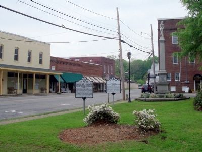
On Church Street (Virginia Route 611) at Court Street ( Route 1002), on the right when traveling east on Church Street.
Mathews County was formed in 1790 from Gloucester County and named for Thomas Mathews, of Norfolk, a soldier of the Revolution who was then Speaker of the Virginia House of Delegates. A local builder, Richard Billups, constructed the courthouse . . . — — Map (db m30124) HM
On Court Street (Virginia Route 1002) at Church Street ( Route 611), on the right when traveling south on Court Street.
Several Confederate companies were organized here during the war. The Mathews Light Artillery (formerly Co. H, 61st Virginia Militia) was organized in July 1861. On May 14, 1862, it was accepted into Confederate States service as Capt Andrew D. . . . — — Map (db m74694) HM
Near Windsor Road (Virginia Route 3) 0.2 miles north of John Clayton Memorial Highway ( Route 14), on the right when traveling north.
Fort Nonsense is a conspicuous reminder of Mathews County's Civil War history. When war broke out, men between the ages of 21 and 45 were mustered for service in the 61st Virginia Militia Regiment. Company H became known as the Mathews Light . . . — — Map (db m74692) HM
Near Windsor Road (Virginia Route 3) 0.2 miles north of John Clayton Memorial Highway ( Route 14), on the right when traveling north.
These earthworks are the remains of Fort Nonsense, first called the Smart's Mill or North End Mill fortification. Enslaved black laborers under the supervision of 2nd Lt. William Henry Clarke, an engineer who graduated from Virginia . . . — — Map (db m74687) HM
On John Clayton Memorail Highway (Virginia Route 3) at Main Street ( Route 14), on the right when traveling north on John Clayton Memorail Highway.
Two miles east is Toddsbury, home of the Todd family, built in 1722. Farther east, in Mathews County, are the old homes, Green Plains, Auburn, and Midlothian. Some miles beyond them is Gwynn's Island, where General Andrew Lewis drove the last royal . . . — — Map (db m30111) HM
Near Windsor Road (Virginia Route 3) 0.2 miles north of John Clayton Memorial Highway ( Route 14), on the right when traveling north.
Mathews County has numerous historic sites that reflect a rich history dating to the first English settlement early in the 1640s. Formed in 1791 from the Kingston Parish section of Gloucester County, Mathews County is named for Gen. . . . — — Map (db m74686) HM
On Main Street (Business U.S. 17) just west of John Lemon Lane, on the right when traveling west.
Native to parts of Europe and Northern Africa, daffodils were introduced to Britain by the Romans after they invaded and captured the country in AD 43. Daffodils (also known as "Lent Lilies") spread naturally and eventually became the favorite . . . — — Map (db m175990) HM
Near Windsor Road (Virginia Route 3) 0.2 miles north of John Clayton Memorial Highway ( Route 14), on the right when traveling north.
Although no major battles were fought in Mathews County, Union forces made several incursions during the war. One occurred in November 1862 to disrupt salt production and “contraband [military supplies] trade” with Maryland Confederates. . . . — — Map (db m74688) HM
On Williams Wharf Road (Virginia Route 614) 0.4 miles west of Bertschy Lane, on the left when traveling west.
Williams Wharf Landing and the Making of America: 1600's
Mathews County maritime history began in the 1600's, when the early colonists discovered deep water in the East River and plenty of natural resources along its shores.
The rapidly . . . — — Map (db m315303) HM
On Depot Avenue West at Whirlpool Street, on the left when traveling west on Depot Avenue West.
On Dec. 16, 1864, local police officer D.H. Thomas arrested two Confederate spies nearby after their attempt to derail passenger train south of here. — — Map (db m223987) HM
On Oyster Road east of Virginia Street ( Route 602), on the right when traveling east.
From 1850s to the 1950s, the town's fall and winter economy was driven by oysters. Urbanna's strategic location to fertile Rappahannock River oyster beds encouraged oyster hand-tongers to come to town from September to March. Oystermen from . . . — — Map (db m186726) HM
On Brickbat Road (Virginia Route 1001) at Court Street, on the left when traveling west on Brickbat Road.
The Tompkins Cottage, a weatherboard-clad structure, is one of the oldest standing buildings in the Mathews Downtown Historic District. Architectural historians surmise it was erected in two building campaigns. The oldest portion, which has been . . . — — Map (db m251484) HM
On Main Street (Business U.S. 17) at John Clayton Memorial Highway ( Route 3/14), on the right when traveling west on Main Street.
The land on which the Edge Hill Service Station now stands was onced in the early 1900s by Thomas Calhoun Walker, a prominent African American in the community. He was the first African-American lawyer in Gloucester County and in 1888 founded the . . . — — Map (db m176009) HM
Near Windsor Road (Virginia Route 3) 0.2 miles north of John Clayton Memorial Highway ( Route 14), on the right when traveling north.
The U.S. Navy’s longstanding tradition of recruiting black sailors enabled several runaways from Mathews County to enlist aboard Potomac Flotilla and North Atlantic Blockading Squadron warships. On January 30, 1862, the logbook of USS Young . . . — — Map (db m74691) HM
On Oyster Road (Virginia Route 1002) 0.2 miles north of Virginia Street ( Route 602), on the left when traveling north.
(panel 1)
Smith's Snapshot
The semi-permanent nature of their towns reflected the highly sustainable lifestyle of Virginia’s Indians. They located towns next to waterways, in places with the best soils. As farming depleted . . . — — Map (db m97249) HM
Thin black lines indicate changes in relevance. Between each pair of lines entries are ordered geographically but all have the same relevance.
* Inflectional forms of words are their plurals, singulars, and possessives as well as gramatical tenses and similar variations.