On Kamehameha Avenue near Lihiwai Street, on the right when traveling west.
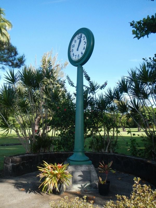
The Waiakea Social Settlement clock was refurbished and re-erected on this original concrete stand by the Waiakea Pirates Athletic Club in May, 1984. It is one of the few landmarks that withstood the destruction on Waiakea Town by the tsunami of May . . . — — Map (db m110924) HM
On Kamehameha Avenue near Lihiwai Street, on the right when traveling west.
Waiakea Town, or Yashijima, was a close-knit, vibrant community which occupied what is known today as Banyan Drive. The golf course and park that you see today was once filled with homes, businesses and Waiakea Kai School, all of which provided . . . — — Map (db m110928) HM
This ancient Hawaii Sanctuary (Puuhonua) was preserved through the foresight of Charles R. Bishop who added it to the Bishop Estate. With the cooperation of the State of Hawaii, the trustees of the Bernice Pauahi Bishop Estate have dedicated it to . . . — — Map (db m2981) HM
Near Kaupulehu Drive near Aina Kaha Place, on the right when traveling north.
You are walking along a segment of the ala loa (long path), a Hawaiian foot trail that linked settlement areas along the coast from Kealakekua to Kawaihae. This segment of the trail was also identified as a traditional route for the huaka'i pō, . . . — — Map (db m110501) HM
Near Kaupulehu Drive near Aina Kaha Place, on the right when traveling north.
This archaeological site contains several residential and food storage features, and was first occupied on a temporary basis during the early 1800s. Fishing and collecting marine resources was the primary economic activity for residents of this . . . — — Map (db m110504) HM
Near Kaupulehu Drive near Aina Kaha Place, on the right when traveling north.
This is a portion of an ala loa (long path) or ala kahakai (a more recent term meaning trail by the sea) that follows the coastline. The Hawaiians of old used it to connect communities for socializing and exchanging goods, as well as to arrive at . . . — — Map (db m110506) HM
On Kealakehe Parkway, on the right when traveling west.
Honokohau Settlement has been designated a Registered National Historic Landmark under the provisions of the Historic Sites Act of August 21, 1935. This site possesses exceptional value in commemorating and illustrating the history of the United . . . — — Map (db m4248) HM
Near Kaupulehu Drive near Aina Kaha Place, on the left when traveling north.
In the shallow water flat of Ka'ūpūlehu Beach a special fishing technique was used by Hawaiians during rough water conditions. Stone piles (imu) were constructed as shelters to attract fish. These piles were then dismantled as nets were . . . — — Map (db m110582) HM
On Kaahumanu Place near Palani Road, on the left when traveling north.
Kamakahonu
After uniting the Hawaiian kingdom, Kamehameha I returned to rule from his compound at Kamakahonu (lit. eye of the turtle) from 1812 until his death in 1819. 'Ahu'ena Heiau, the religious temple that served Kamehameha was rebuilt . . . — — Map (db m110665) HM
A prime habitat for kupe'e (Nerita polita) is located in a wave washed area of sand and basalt boulders along Ka'ūpūlehu Beach. This area is traditionally recognized for its dense concentration of kupe'e. These shellfish were collected . . . — — Map (db m110583) HM
Near Ali'i Drive, 0.1 miles south of Hualalai Road, on the left when traveling north.
When the first Polynesians landed in Hawai‘i, most of the life they found here was unique to this place. Organisms found only in one place are called endemic — and Hawai‘i has one of the highest rates of endemism on the planet.
The first . . . — — Map (db m123294) HM
Approximately 500 feet (150 meters) offshore of this location is a ko'a moi. Moi is Hawaiian for Treadfin (Polydactlus sexfilis), and ko'a is a fishing ground. This fishing spot was prized for its abundance of moi, which traditionally was a highly . . . — — Map (db m110585) HM
On Alii Drive at Sarona Road, on the right when traveling north on Alii Drive.
The first Hawaiian Christian,
Henry Opukahaia,
died at Cornwall, Conn. 1818
The first Christian
missionaries to Hawaii,
Bingham, Thurston, Whitney,
landed at Kailua, April 12, 1820
with their Hawaiian comrades
Hopu, . . . — — Map (db m39440) HM
Near Kupipi Street, 0.4 miles north of Keahole Airport Road, on the right when traveling south.
In Hawai'i, the lei, a garland of flowers, coveys respect, love, friendship, and continuity of life. It may be created from a wide variety of local flora and is offered on many occasions calling for a special token. The giving of leis as a floral . . . — — Map (db m190121) HM
On Kaupulehu Drive near Aina Kaha Place, on the left when traveling north.
By virtue of being a named place, Waiulu was clearly known by the people of old. It is a place of note recounted by elders in the area. A hālau wa'a (canoe house) was located here, indicating a good landing. One of the important factors that . . . — — Map (db m110502) HM
Near Kaupulehu Drive near Aina Kaha Place, on the left when traveling north.
Despite the naturally arid conditions of the surrounding landscape, there a few sources of drinkable water within this part of coastal Kekaha. One of these is located a short distance inland from this location. It is known as Waiulu, which is . . . — — Map (db m110503) HM
On Alii Drive at King Kamehameha III Road, on the left when traveling north on Alii Drive.
Moku (island districts) were traditionally subdivided into smaller land wedges called ahupua'a. Generally, these ahupua'a extend from the mountain to the sea and contain all the resources needed for sustainable living. . . . — — Map (db m39438) HM
On Kaleiopapa Street near Ehukai Street, on the right when traveling north.
In the time of the ruler 'Umi-a-Liloa, 22 generations before the time of King Kamehameha I, the Royal Center moved away from Waipi'o in the island's northern region. As a result of this move, Royal Centers developed along Kona's leeward coast, By . . . — — Map (db m110308) HM
On Kaleiopapa Street near Ehukai Street, on the right when traveling north.
The Kamehameha Dynasty
As a young man, Kamehameha was a proven warrior and political strategist who rose to power with the support of the chiefs of Kona and unified the island of Hawai'i under his leadership in the late 1700a. He embraced . . . — — Map (db m110302) HM
First Church in the Islands
this building erected in 1836
model of brig "Thaddeus"
on exhibit. Open Daily from
dawn to dusk. Komo mai — — Map (db m190118) HM
On Highway 19 (Hawaii Route 19), on the right when traveling north.
The Laupahoehoe we see now is very different from the Laupahoehoe of old. Laupahoehoe Point was a peaceful, Hawaian fishing village, untouched by missionaries and plantation life; the valley and the sea provided bountiful life. In the late 1800's . . . — — Map (db m94338) HM
Near Old Mamalahoa Highway near Old Onomea Road, on the right when traveling north.
Long ago, Onomea Bay was a fishing village, became a rough-water seaport in the 1800's, and later was inhabited by Portuguese, Chinese, Japanese and Filipinos who came here to work in the sugar cane fields and to help build the Onemea Sugar Mill. In . . . — — Map (db m110863) HM
Near Akoni Pule Highway (Hawaii Route 270), on the left when traveling north.
The ahupua'a is a traditional land division that runs mauka from the mountains to makai (seaward). The ahupua'a of Lapakahi encompasses more than 2,000 acres along the leeward slopes of the Kohala Mountains. The distance from the upland forests . . . — — Map (db m110324) HM
On Daniel K. Inouye Highway (Saddle Road) (Route 200 at milepost 27) near Mauna Kea Access Road, on the left when traveling east.
Traditional native uses of the Humu'ula area included bird catching and, at much higher elevations, adze quarrying. They were replaced by sandalwood harvesting and hunting wild cattle, and ultimately ranching and astronomy. Over time, travelers . . . — — Map (db m110792) HM
Near Kawaihae Road (Route 270), on the left when traveling north.
Who would suspect that the area at the base of this hill is one of the most significant cultural sites in Hawai'i? This plain-looking patch of earth was the site of Pelekane, one of several known royal compounds traditionally used by Hawaiian kings. . . . — — Map (db m110369) HM
On this site stood the villa of Chun Afong, Hawai‘i’s first Chinese millionaire, who arrived
in Honolulu in 1849. By 1855, he had made his fortune in retailing, real estate, sugar and rice, and for a long time held the government monopoly opium . . . — — Map (db m49676) HM
On Ala Moana Boulevard (Hawaii Route 92) at Kalia Road, on the right on Ala Moana Boulevard.
Chief Ma‘likūkāhi, who reigned over the island of Oahu in the mid-1400s, resided in Waikīkī and used it as his seat of government. He was greatly loved by his subjects who enjoyed unprecedented peace and prosperity. Ali‘i . . . — — Map (db m13200) HM
On Kalakalua Avenue at Kukio Avenue and Kuamoo Street, on the left when traveling south on Kalakalua Avenue.
(tablet on back of base)
David Kalākaua was born on November 16, 1836. He succeeded to the throne on February 12, 1874, and ruled with his queen, Kapi‘olani. King Kalākaua was the catalyst for the revival and flowering of . . . — — Map (db m13586) HM
On State Highway 56, on the right when traveling north.
The 15-foot cast concrete lantern was constructed in 1915 by Kaua‘i’s first generation Japanese immigrants. As a tribute to their homeland, the lantern commemorates the 1912 coronation of Emperor Taisho. An inscription reads: “Great Japan . . . — — Map (db m9786) HM
Near Ka Haka Road, 2.2 miles north of Hawaii Route 56.
You are now standing at what was – for a few months in 1816 and 1817 – the site of a Russian fort named for the Emperor Alexander. How a fort came to be built here, what became of it, and how this part of Kaua'i later got the name . . . — — Map (db m65811) HM
On Hawaii Route 50 at Panako Road, on the right when traveling west on State Route 50.
In January, 1778, two ships under the command of British navigator Captain James Cook sighted the northwest coast of O'ahu. The next day they cruised from Maha'ulepu to Waimea Bay on Kaua'i where they set anchor. Acquainted with the Tahitian . . . — — Map (db m65777) HM
On Honoapiilani Highwary (Route 30), on the right when traveling east.
This monument commemorates the arrival of the Norwegian barque Beta which dropped anchor near this spot on February 18, 1881, and of her sister ship Musca, which arrived in Honolulu May 13, 1881. They brought more than six hundred . . . — — Map (db m73188) HM
In the distant future, when our descendants ask, tell them here lies the first altar made by Korean American Christians.
Today, when more than three thousand Korean churches in America, along with their members ask, tell them you all are . . . — — Map (db m73191) HM