Battle Formation
Early on the autumn morning of Saturday 14 October 1066 two great armies are preparing to fight for the throne of England.
On the top of this hill are arrayed the English forces of Harold Godwinson, who was crowned king just . . . — — Map (db m128720) HM
Battle town and the abbey’s estates
Much of the land you can see was owned by Battle Abbey. William the Conqueror granted the monastery all the land within a radius of 1.5 miles of the abbey's high altar. The abbot of Battle had power over both . . . — — Map (db m128711) HM
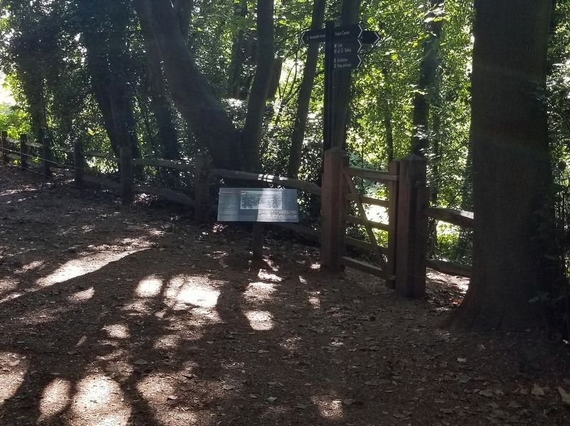
Battlefield to Vegetable Garden
The garden behind this wall was part of the 19th century country estate, but was perhaps a garden or orchard in earlier times.
The land here is part of the original battlefield, part of the slope defended by . . . — — Map (db m128796) HM
Beehives in the Walled Garden
The hives in the garden are based on an 1890s design by William Broughton Carr. The wooden hives help the bees stay cool in summer and warm in winter. They are built in sections using frames, so the bees are less . . . — — Map (db m128800) HM
Dairy and Icehouse
The dairy and icehouse were part of the abbey's later life as a country estate. They were probably constructed by Sir Godfrey Webster around 1818 for his new wife.
The octagonal dairy (left), in the fashionable Gothick . . . — — Map (db m129334) HM
Dusk. William Victorious
The Normans finally break through the shield wall and the English army is routed.
During the final Norman assault the English shield wall breaks. The Normans begin to slaughter any who stand against them.
Those . . . — — Map (db m128795) HM
East Range of Cloister
This was extensively rebuilt in the
13th century. The first floor was
the monk’s dormitory. The doorway
above led to a day-stair to the
cloister. — — Map (db m129379) HM
‘On the very spot’
Sources written within living memory of the Battle of Hastings in 1066 state that Battle Abbey was founded by William the Conqueror ‘on the very spot' where he had secured his great victory over King Harold and the English. . . . — — Map (db m128710) HM
Parlour
This was one of very few rooms where
the monks were allowed conversation.
It was rebuilt in the 13th century.
The doorway in its eastern wall led
to the infirmary. — — Map (db m129346) HM
Rebuilding the Abbey Church
The most important part of an abbey church was its eastern end — here were the altars and the choir where the monks worshipped.
The most ambitious part of the 13th-century modernisation of the abbey was the . . . — — Map (db m129336) HM
Stalemate
The successful Norman counter-attack brings the first phase of the battle to an end.
It is probably early afternoon before the first phase of the battle has come to a close. Neither side has yet won a clear advantage. By now the men . . . — — Map (db m128789) HM
The 11th-century Church
When William the Conqueror founded Battle Abbey he ordered that the church's high altar should be placed on the spot where Harold had fallen.
The stone slab marks the site of the death of King Harold towards the evening . . . — — Map (db m129338) HM
The Abbey and its History
William the Conqueror founded Battle Abbey in 1070 as a memorial to the Battle of Hastings and as an act of atonememt for the bloodshed.
It was carefully laid out on this hillside with the church on the ridge. The . . . — — Map (db m128792) HM
The Afternoon Assaults: Norman Trick Tactics
During the afternoon the Normans weaken the English line by adopting a new tactic.
It is now clear that the English are not going to be easily defeated. To create gaps in the shield wall, groups of . . . — — Map (db m128790) HM
The Afternoon Assaults: Norman Trick Tactics
During the afternoon the Normans weaken the English line by adopting a new tactic.
It is now clear that the English are not going to be easily defeated. To create gaps in the shield wall, groups of . . . — — Map (db m129380) HM
The Battle of Hastings and Battle Abbey
The Battle of Hastings was fought here on 14 October 1066. It is the most famous battle on English soil and its outcome had a profound impact on the history of England.
William the Conqueror's . . . — — Map (db m128713) HM
The Chapter House
The chapter house was second only to the church as the focal point of monastic life.
Monks assembled here each morning to hear readings, including a chapter of the Rule of St Benedict, hence the room's name. Business matters . . . — — Map (db m129345) HM
The Cloister
The main abbey buildings were arranged round a cloister on the south side of the church.
Sheltered from cold north winds they would catch the sun. The cloister walks or alleys, marked out by the gravel paths, enclosed a garden and . . . — — Map (db m129341) HM
The Dormitory
This huge room was the dormitory, or dorter, where the monks slept. It dates to the 13th century and was originally a single open space without any heating. Monks slept communally and their single beds were arranged in rows along the . . . — — Map (db m129365) HM
The Duchess of Cleveland’s Walled Garden
The walled garden is planted today with fruit trees, recreating the work of the Duchess of Cleveland.
The Duke and Duchess, who bought Battle Abbey in the mid 19th century, were keen gardeners. The . . . — — Map (db m128799) HM
The East Range
These buildings contained the dormitory and the monastic latrines.
The first floor of the east range in front of you was a single large dormitory or dorter where originally the abbot and all the monks slept. To the left of it, . . . — — Map (db m128797) HM
The First Norman Attack
The battle opens to the terrible sound of trumpets on both sides.
William's men advance up the hill to attack the English shield wall. They are led by lightly armed foot soldiers and archers. Behind them are ranks of . . . — — Map (db m128718) HM
The First Norman Attack
The battle opens to the terrible sound of trumpets on both sides.
William's men advance up the hill to attack the English shield wall. They are led by lightly armed foot soldiers and archers. Behind them are ranks of . . . — — Map (db m128723) HM
The Great Gatehouse
The imposing size and elaborate decoration of the great gatehouse reflected the power and importance of Battle Abbey.
This was the main entrance for visitors, as well as for merchants, traders and abbey staff bringing . . . — — Map (db m128716) HM
The Traditional Site of
The High Altar of Battle Abbey
Founded to Commemorate
The Victory of Duke William
On 11 October 1066
The High Altar Was Placed to Mark
The Spot Where King Harold Died — — Map (db m129337) HM
The Norman Counter-Attack
After rallying his forces, William counter-attacks the English.
Encouraged by Duke William, the Normans turn and attack the English who have pursued them down the hill. Those who have been separated from the safety of . . . — — Map (db m128788) HM
The Norman Retreat
After ferocious fighting the first Norman attack falters and breaks.
The left wing of Duke William's army, including a group of knights from Brittany, is driven back by the English. At the same time rumour spreads that Duke . . . — — Map (db m128724) HM
The Outer Court
You are standing in what was the outer court of the abbey, where its agricultural and industrial building were located. These would have included workshops, forges, barns, stables and storerooms. Many of the inhabitants of Battle . . . — — Map (db m128717) HM
The Refectory
The monastic refectory or dining hall occupied the south range of the cloister.
The main meal was eaten in the middle of the day. Monks entered the dining hall after washing their hands in a lavatorium or wash-basin just by the . . . — — Map (db m129364) HM
The Weakened Shield Wall
Duke William brings forward archers in preparation for a final Norman assault on the English line.
By late afternoon the feigned Norman retreats have thinned the ranks of Harold's shield-wall. Duke William's bowmen are . . . — — Map (db m128791) HM
William rallies his Forces
Duke William shows his face in battle to prevent the Norman army fleeing from the field.
As the Normans retreat in confusion from the English line, Duke William rides out to confront them. Lifting his helmet to show . . . — — Map (db m128725) HM
William the Conqueror Trail
William,7th Duke of Normandy (1027-1087), set his stamp on the history of the Duchy of Normandy and of the Kingdom of England, their destinies becoming closely entwined for more than a century. The symbolic date 1066 . . . — — Map (db m128709) HM
In Grateful Memory Of
The Men of the Parish
Of Ewhurst
Who Gave Their Lives In
The Great War
1914 — 1918
C. Adams · S.T. Batehup · E. Crouch · P.J. Curtis · J. Dennis · A. Eldridge · B. Eldridge · J. Fellows · E.J. Ford · A. Foster . . . — — Map (db m128673) WM
Albion Russell (1821 – 1888)
opened a boot and shoe shop
here in 1861.
In 1873 he was joined by
George Bromley which led to
the founding of
today’s
Russell and Bromley. — — Map (db m129653) HM
Anchor
This iron anchor was caught in the net of a Newhaven trawler that was fishing about two miles offshore in October 1932.
It is probably about 300 years old. — — Map (db m129662) HM
Battle of Lewes 1264
On 14th May 1264 Simon de Montfort’s army of 5000 barons and Londeners defeated royalist forces of twice that size under Henry III on the downs northwest of Lewes. The Mise of Lewes, signed next day led to the first English . . . — — Map (db m129644) HM
Battle of Lewes 14th May 1264
Led by Simon de Montfort, Earl of Leicester, and Gilbert de Clare, Earl of Gloucester, the rebel army, with Londoners on the left flank, occupied the high ground. Henry III and his brother Richard, King of the Romans, . . . — — Map (db m129646) HM WM
Brack Mount
Brack Mount is the oldest part of Lewes Castle. William de Warenne built a motte and bailey castle here in the late 11th century.
He started with a mound overlooking the River Ouse and made it higher, using chalk blocks. When the . . . — — Map (db m129688) HM
Bull House Westgate
In ancient times the Bull Inn within the Westgate was held of the Barony of Lewes at the yearly rent of a race of ginger. It was sold in 1583 by Thomas Matthew to Sir Henry Goring who built the house which is now the Westgate . . . — — Map (db m129783) HM
County Hall 1812
Built to replace the old Town Hall and Sessions House which stood in the middle of High Street. Demolished in 1810.
1981 — — Map (db m129823) HM
Dr. Gideon A. Mantell F.R.S.
Surgeon and Geologist
Born in Lewes 1790. Died in London 1852
Lived Here
He discovered the fossil bones of
the Prehistoric Iguanodon
in the Sussex Weald — — Map (db m129822) HM
Fireplace
From the Great Hall
Excavations suggest that the hall was rebuilt in the 13th century, up against the wall of the Shell Keep.
This large fireplace would have helped to heat the room. The fireplace is backed with re-used tiles . . . — — Map (db m129690) HM
Lewes Market Tower 1792
Erected to house the Old Town Clock and 16th century Bell Gabriel taken from St. Nicholas Church demolished 1761. From 1881 to 1893 it served as Town Hall.
1981 — — Map (db m129649) HM
A new, larger prison was needed in Lewes in the mid-19th century and opened in 1853. The Prison is now old but still houses over 500 prisoners.
Mick Jagger, of the pop group The Rolling Stones was one of its most famous residents. In 1967 he . . . — — Map (db m129708) HM
Lewes Racecourse was open by 1712. The first grandstand was built in the 1770s. Lewes races were very fashionable. In 1806 two horses, Pancho and Pavilion, raced for a prize of over £2000. The Prince Regent and 3000 people watched the race. The . . . — — Map (db m129714) HM
In Memory Of
The Men of Lewes
Who Died
For Their Country
And for Mankind
In the Great War
1914 — 1918
Likewise
Remember
Those Of
This Town
Who Gave
Their Lives
In The War
1939 — 1945
Names of the . . . — — Map (db m129651) WM
This Tablet
Is Erected to Record the Loyal Feeling
of
The Inhabitants of the Borough of Lewes
as expressed at the
Commemoration of the 50th Anniversary of the Reign
of
Her Majesty Queen Victoria
And their Gratitude for the Great . . . — — Map (db m129650) HM
There was an Iron Age hillfort on Mount Caburn about 1000 years before Lewes Castle was built. The hillfort dominated the valley of the River Ouse from the east. Lewes Castle was built to control the valley from the west. — — Map (db m129711) HM
In the 1550s, during the reign of the Catholic Queen, Mary, 17 Protestants were burned to death in Lewes. They died in front of the Star Inn, now the Town Hall, in the High Street. This Obelisk was built in 1889 as a memorial to the martyrs. It . . . — — Map (db m129712) HM
In the vaults beneath this building were imprisoned ten of the seventeen Protestant martyrs who were burned at the stake within a few yards of this site 1555 – 1557. Their names are recorded on the memorial to be seen on Cliffe Hill. — — Map (db m129652) HM
Russian Cannon
This cannon is a trophy from the Crimean War and was never used by soldiers in this castle.
Britain, France and Turkey fought against Russia in the Crimean War from 1854-6. After the Siege of Bomarsund in Finland (then part of . . . — — Map (db m129663) HM WM
Southover was one of the earliest suburbs of Lewes. The Priory was built here on low land between the River Ouse and the Winterbourne stream. King Henry VIII ordered the Priory to be destroyed in 1537-8. Some of the Caen Stone from the Priory . . . — — Map (db m129710) HM
St Michael’s Church is one of the oldest in Lewes. It was built just inside the West Gate of the town. The oldest surviving part of the church is the round tower, which may have been built in the 12th century. There are only three round church . . . — — Map (db m129709) HM
Stocks
Minor criminals used to be punished by being put in the stocks. They sat on the bench with their legs held straight in front of them by the wooden beam, which was locked in place. Sitting in this position soon became very uncomfortable. . . . — — Map (db m129664) HM
The Battle of Lewes, 1264
A violent clash between the barons and the King
Standing here on 14th May 1264 you would have witnessed one of the most important battles between rebel barons and King Henry III.
The King had a reputation for . . . — — Map (db m129689) HM
The Curtain Wall and Castle Moat
The Curtain Wall stretched out to either side of the Norman Gatehouse. To one side it went across to the second motte and up to the Shell Keep.
On the other side the wall and dry moat went along the line of . . . — — Map (db m129665) HM
The Norman Gatehouse and the Barbican
The Norman Gatehouse
The Norman Gatehouse was probably square, but only one wall is left. From the Gatehouse, part of the Curtain Wall, which enclosed the Castle, went up to the top of the motte.
The . . . — — Map (db m129687) HM
The Shell Keep and Angled Towers
The second motte towers 20 metres above the High Street. It was built around 1100 and topped with a shell keep. This was basically a wall around the top of the motte. The most secure and important buildings, where . . . — — Map (db m129666) HM
The Weald is an area surrounded by chalk hills called the North and South Downs. Lewes is on the South Downs. In the distance you can see the sandstone ridge of the High weald.
Closer to Lewes is the Low Weald. For many years the Weald was . . . — — Map (db m129713) HM
Here expounded his revolutionary politics. This inn is regarded as a cradle of American Independence which he helped to found with pen and sword. — — Map (db m199203) HM
1768 — 1774. In this house lived Thomas Paine, Writer and Revolutionary. ( the marker text is inscribed along the bottom of the upper storey ) — — Map (db m129782) HM
What Happened Where?
The de Warenne family lived inside the safest part of the Castle, the Shell Keep. Most of the Castle's occupants lived and worked in the Bailey.
This was a large, roughly oval area between the two mottes and inside the . . . — — Map (db m129694) HM
In Grateful Memory of the Men
of Westfield Whose Names Are
Recorded Below Who Gave Their
Lives in the Great War 1914 - 1918
Herbert Henry Baker · Albert Ball · Lewis Crampton Barden · William Barrow · Stephen Blackman · Owen Carrick · . . . — — Map (db m129381) WM