34 entries match your criteria.
Related Historical Markers
By Dawn Bowen, July 22, 2007
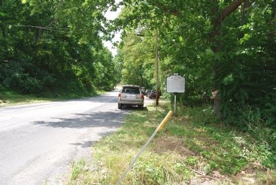
Marker on Iron Works Road
SHOWN IN SOURCE-SPECIFIED ORDER
| 1 ► Virginia, Augusta County, Mount Solon — D-40 — Mossy Creek — |
| On Iron Works Road (County Route 809) at Virginia Route 42, on the right on Iron Works Road. | |||
| 2 ► Virginia, Augusta County, New Hope — Piedmont Battlefield — |
| On Battlefield Road (Virginia Route 608) 0.4 miles north of Patterson Mill Road (Virginia Route 778), on the right when traveling north. | |||
| 3 ► Virginia, Augusta County, New Hope — Battle of Piedmont — Final Action at New Hope — |
| On Battlefield Road (County Route 608), on the left when traveling south. | |||
| 4 ► Virginia, Staunton — I-16 — The Virginia School for the Deaf and the Blind — Founded 1839 — |
| On Commerce Road (Bypass U.S. 11) south of Statler Boulevard. | |||
| 5 ► Virginia, Staunton — The Wesleyan Female Institute — |
| On West Beverly Street (Virginia Route 254) east of Church Street, on the left when traveling east. | |||
| 6 ► Virginia, Augusta County, Fort Defiance — A-100 — Augusta Military Academy — |
| On Lee Highway (U.S. 11) south of Fort Defiance Road (County Route 616), on the right when traveling south. | |||
| 7 ► Virginia, Staunton — I-17 — Mary Baldwin College — |
| On East Frederick Street at North New Street (Business Virginia Route 11), on the right on East Frederick Street. | |||
| 8 ► Virginia, Staunton — I-21 — Stuart Hall — |
| On West Frederick Street west of North Washington Street, on the right when traveling west. | |||
| 9 ► Virginia, Augusta County, Swoope — West View — Confederate Camps — 1862 Valley Campaign — |
| On Parkersburg Turnpike (Route 254), on the right when traveling west. | |||
| 10 ► Virginia, Augusta County, West Augusta — W-149 — Fort Edward Johnson — |
| On Shenandoah Mountain Drive (Route 250), on the right when traveling west. | |||
| 11 ► Virginia, Augusta County, Churchville — W-156 — James Edward Hanger — |
| On Churchville Avenue (U.S. 250) just west of Buffalo Gap Highway (State Route 42), on the left when traveling west. | |||
| 12 ► Virginia, Staunton — Staunton — Vital Link — 1864 Valley Campaigns — |
| On Middlebrook Avenue (State Highway 252), on the left when traveling west. | |||
| 13 ► Virginia, Augusta County, Fishersville — W-155 — Tinkling Spring Church — American Presbyterian and Reformed Historical Site — |
| On Tinkling Spring Road (County Route 805), on the right when traveling north. | |||
| 14 ► Virginia, Augusta County, Dooms — JD-14 — Jarman’s Gap — |
| On East Side Highway (U.S. 340), on the left when traveling north. | |||
| 15 ► Virginia, Staunton — The Barger House — The War's Lasting Effects — |
| On Avenue of Trees, on the left when traveling south. | |||
| 16 ► Virginia, Augusta County, West Augusta — Mountain House — Jackson's March — 1862 Valley Campaign — |
| On Shenandoah Mountain Drive (U.S. 250) at Ramsey's Draft North, on the right when traveling west on Shenandoah Mountain Drive. | |||
| 17 ► Virginia, Highland County, West Augusta — “The Shenandoah Mountain Pass is grand indeed…” — Confederate Breastworks Trail — |
| Near U.S. 250, on the right when traveling west. | |||
| 18 ► Virginia, Highland County, West Augusta — Confederate Breastworks Interpretive Trail — |
| Near Route 250, on the right when traveling west. | |||
| 19 ► Virginia, Highland County, West Augusta — Welcome to Fort Johnson — |
| Near U.S. 250, on the right when traveling west. | |||
| 20 ► Virginia, Highland County, West Augusta — Fort Edward Johnson — |
| Near U.S. 250, on the right when traveling west. | |||
| 21 ► Virginia, Augusta County, West Augusta — “It was cold business…” — |
| Near U.S. 250, on the right when traveling west. | |||
| 22 ► Virginia, Augusta County, West Augusta — “Wee are faring badly…” — |
| Near U.S. 250, on the right when traveling west. | |||
| 23 ► Virginia, Highland County, West Augusta — “… tolerable well fortified” — |
| Near U.S. 250. | |||
| 24 ► Virginia, Augusta County, West Augusta — “Wee are now looking out for a fight…” — |
| Near Route 250, on the right when traveling west. | |||
| 25 ► Virginia, Augusta County, West Augusta — “… to go wee did not know where” — |
| Near U.S. 250, on the right when traveling west. | |||
| 26 ► Virginia, Augusta County, West Augusta — “We had a hardscrabble up…” — |
| Near U.S. 250, on the right when traveling west. | |||
| 27 ► Virginia, Augusta County, West Augusta — Healing the Wounds — |
| Near U.S. 250, on the right when traveling west. | |||
| 28 ► Virginia, Staunton — United States National Military Cemetery - Staunton — |
| Near Richmond Avenue (U.S. 250). | |||
| 29 ► Virginia, Staunton — Confederate Dead Monument - Thornrose Cemetery — |
| Near West Beverly Street (State Highway 254), on the right when traveling west. | |||
| 30 ► Virginia, Staunton — Augusta County Confederates Plaque — |
| Near West Beverly Street (State Highway 254), on the right when traveling west. | |||
| 31 ► Virginia, Waynesboro — W-160 — Early’s Last Battle — |
| On Main Street (U.S. 250) at DuPont Circle, on the right when traveling east on Main Street. | |||
| 32 ► Virginia, Waynesboro — William H. Harman Monument — |
| On McElroy Avenue, on the left when traveling south. | |||
| 33 ► Virginia, Waynesboro — Plumb House — The Valley is Lost — 1864 Campaigns — |
| On West Main Street (U.S. 340), on the right when traveling east. | |||
| 34 ► Virginia, Waynesboro — Q-2-b — Waynesboro — |
| On West Main Street (U.S. 340) east of Arch Avenue, on the left when traveling east. | |||