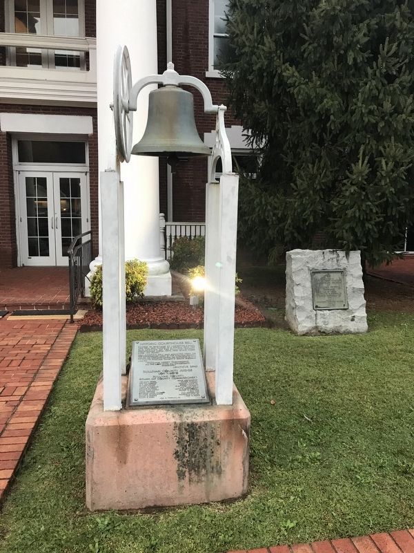
On Bristol Highway (State Highway 126), on the right when traveling west.
Forged in Maryland by J. Regester & Sons, this bell was placed in a cupola atop the old section of the Sullivan County courthouse circa 1870, and hung there nigh 100 years.
This historic bell was mounted here on the courthouse lawn by the . . . — — Map (db m158019) HM
On Musket Lane, on the right when traveling south.
David Crockett: 1786 – 1836 When David Crockett was born on this site on August 17, 1786 he entered a new world surrounded by extreme poverty, danger, and uncertainty – the birthright of almost every frontier family in the late . . . — — Map (db m58419) HM
Near Interstate 81 at milepost 320, at Gate City Highway (U.S. 58/421), on the right when traveling south.
Welcome to Sullivan County, Tennessee! Get ready to visit small towns with big stories. Tennessee Civil War Trails tells riveting stories of battles and leaders, and much more. You'll learn about some of the state's 275,000 enslaved men and women . . . — — Map (db m275056) HM
On Memorial Drive, on the left when traveling east.
John 15: 13 No greater love has a man than this, that a man lay down his life for his friends.
In John 15:13, Jesus proclaimed, "Greater love has no man than this, that a man lay down his life for his friends." An example of such a man lays in . . . — — Map (db m278202) HM
Sullivan County is named for Revolutionary Major General John Sullivan. Settled in 1785 by the first white pioneers from North Carolina, occupation of this Cherokee land provoked desperate fighting. Warrior’s Path State Park commemorates the trails . . . — — Map (db m201314) HM
Near Bristol Highway (Tennessee Route 126) at Anderson Road.
This little building originally stood across the street and served as the office of attorney John Fain in the late 1800s. Some Blountville residents remember it as the office of attorney Homer Smith in the second quarter of the 20th century. It was . . . — — Map (db m210240) HM
On Bristol Highway (Tennessee Route 126) west of Anderson Road, on the right when traveling west.
This is the Sullivan County Courthouse. Its interior was burned during the Union attack on Blountville on September 22, 1863, as Confederate and Federal forces vied for control of the Virginia and Tennessee Railroad, located a few miles east of . . . — — Map (db m69708) HM
On Bristol Highway (Tennessee Route 126) west of Anderson Road, on the right when traveling west.
In September 1863, Confederate Gen. Samuel Jones’s command and Union Gen. Ambrose E. Burnside’s forces contested control of the Virginia and Tennessee Railroad a few miles east. On September 22, Union Col. John W. Foster’s brigade engaged the forces . . . — — Map (db m69712) HM
Near James H Quillen Parkway (Interstate 26 at milepost 5).
Union and Confederate forces in Sullivan County
battled to control the East Tennessee & Virginia
Railroad and the Holston River, strategically vital
transportation routes for moving soldiers and
supplies. The county supported secession . . . — — Map (db m108222) HM
On Chestnut Ridge Road just west of Memorial Boulevard ( Highway 126), on the right when traveling west.
In 1779, James Hollis, Sr. erected this house on Island Road, Tennessee's first wagon road, built in 1761. The Sullivan County Court met here from 1780 to 1792. John Yancey purchased the home in 1782, using it for Yancey's Tavern. By the 1840s, it . . . — — Map (db m158066) HM
On East 3rd Street (State Highway E) at North Main Street, on the left when traveling east on East 3rd Street.
The first settlement in the county was made by Dr. Jacob Holland in 1836 (about eight miles southwest of this site). When Missouri became a state in 1821, what is now Sullivan County became a part of Chariton County. In 1842, the legislature passed . . . — — Map (db m216899) HM
On Bristol Highway (Tennessee Route 126) west of Anderson Road, on the right when traveling west.
Sullivan County was established by the North Carolina Assembly’s October 1779 session; its north of the Holston River section formerly in Washington County, Virginia; and its south of the river section formerly in Washington County, North Carolina. . . . — — Map (db m69711) HM
On Stage Coach Trail at Dulaney Road on Stage Coach Trail.
Steel House
has been placed on the
National Register
of Historic Places
by the United States
Department of the Interior
1774
Sullivan County Historical Society
Sullivan County 1796
Historic . . . — — Map (db m210230) HM
On Bristol Highway (State Highway 126) west of Anderson Road, on the right when traveling west.
Dedicated to
the memory of the
Confederate soldiers
of
Sullivan County
Tennessee
War of 1861-65
Battle of Blountville
Sunday September 22,
1863 — — Map (db m158034) WM
On South Roan Street east of Highridge Bonita Drive, on the right when traveling east.
The failed State of Franklin was formed in August of 1784 and comprised the area of then western North Carolina, present-day Northeast Tennessee. John Sevier was elected governor of Franklin while Colonel John Tipton became a leading loyalist to . . . — — Map (db m295180) HM
Near Lt Billy Webb Avenue 0.1 miles north of Cook Street.
The first “Liberty Tree” was an American Elm Tree that stood on the Boston Commons in Boston, Massachusetts prior to the American Revolution. On 14 August 1765 a group of men calling themselves the “Sons of Liberty” gathered in Boston under the elm . . . — — Map (db m210064) HM
Thin black lines indicate changes in relevance. Between each pair of lines entries are ordered geographically but all have the same relevance.
* Inflectional forms of words are their plurals, singulars, and possessives as well as gramatical tenses and similar variations.