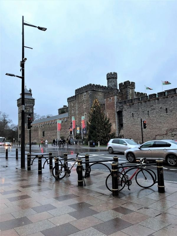
On Castle Street (Route A4161) just west of North Road, on the right when traveling west.
English: Cardiff Castle's history began with the first Roman fortress built in the 1st C. The Norman Conquest in the 11th C. brought impressive fortifications. In the 19th C. the apartments were extended for the 3rd Marquess of . . . — — Map (db m127009) HM
On Gorsedd Gardens Road just west of Park Place, on the right when traveling west.
English Text David Lloyd George was one of the most
notable politicians of the 20th century
and the only Welsh person to become
Prime Minister of Britain.
Raised in Llanystumdwy in north Wales
and a Welsh speaker, Lloyd George . . . — — Map (db m199532) HM
English Side These gates were presented by the Councils
of Kidwelly Borough - Llanelli Borough -
Burry Port Urban District -
Llanelli
Rural
District,
to mark the centenary of the
Llanelli Rugby Club 1872-1972 Welsh Side
Cyflwynwyd y . . . — — Map (db m245221) HM
Near Portmeirion Entrance Road, 1 kilometer south of High Street (County Route A497).
Plaque 1 This colonnade built circa 1760 by the Quaker copper smelter William Reeve stood before his bath house at Arnos Court, Bristol. Damaged by bombs, it had fallen to decay and although scheduled as an Ancient Monument Her Majesty's Minister . . . — — Map (db m175908) HM
Admiral Sir Max Horton RN
Honoring British Commonality and Diversity
Commander-in-chief responsible for British participation in the Battle of the Atlantic, WWII.
Admiral Max Horton RN was of Jewish heritage born in Anglesey. . . . — — Map (db m174575) WM
On Upper Church Street, on the right when traveling north.
Chepstow Priory
In 1067 William Fitzosbern, William the Conqueror's cousin established Chepstow Castle, and before his death in 1071 a Benedictine Priory on this site. It was a "daughter-house" to the Abbey he had founded in Cormeilles, . . . — — Map (db m154958) HM
This splendid tower was built c.1288-93 by Roger Bigod, probably replacing an earlier tower here. It contained a suite of grand private rooms on three floors and a private chapel.
All three access doorways had a portcullis, allowing the tower to . . . — — Map (db m155214) HM
Erected by Robt S. Byass & Company To the glory of God and in memory of those men in their employ who gave their lives for their Country in the Great War 1914-1918. World War II 1939-1943. — — Map (db m106080) WM
Near High Street (National Road A4322) at Canon Street.
English Wales is famous for its many chapels and the important part they played in the
development of Welsh society from the late eighteenth century (1).From this point we
can see two mid nineteenth century chapels built to satisfy the . . . — — Map (db m172837) HM
On High Street at Rock Grounds Carpark, on the left when traveling north on High Street.
The Rock Brewery (1) opened here in 1850. It was one of several breweries that opened in and
around Aberdare during the nineteenth century to satisfy the demand for beer by an ever
increasing population By the time it was sold in 1921, forty . . . — — Map (db m189270) HM
On Victoria Square at Monk Street on Victoria Square.
The statue of Griffith Rhys Jones overlooks the square. A blacksmith at the
nearby Llwydcoed Ironworks he is more commonly known by his bardic
name of 'Caradog (1) He started conducting choirs aged only 19 and
famously led the 'Cor Mawr a 460 . . . — — Map (db m189265) HM
On High Street close to Green Street, on the left when traveling west.
English To Commemorate Abraham Matthews 1832-1899 minister of Horeb chapel, Llwydcoed, who led 57 people from Cynon Valley among the 164 aboard the Mimosa which sailed from Liverpool on 28 May 1865 to establish the Welsh Settlement . . . — — Map (db m154462) HM
On Cardiff Road (County Route B4275) south of Llanddewi Street, on the left when traveling south.
Arthur Linton 1868-1896 World Champion Cyclist lived here Welsh Arthur Linton 1868-1896 Bu Pencampwr Beicio'r Byd 1895 yn byw yma — — Map (db m151287) HM
On Cardiff Road (County Route B4275) just south of Llanddewi Street, on the left when traveling south.
Welsh Mae'r Plac Glas uwchben drws blaen y siop drws nesaf yn rhif 218 Cardiff Road yn dangos i Arthur Linton, Pencampwr Beicio, fyw yno. Tŷ oedd yr eiddo yma ar yr adeg honno. Enillodd Arthur nifer o rasys gan gynnwys y ras glasur . . . — — Map (db m151591) HM
On High Street (National Road A4233) just north of Victoria Square, on the left when traveling north.
Centre Disc They shall not grow old, as we that are left to grow old, Age shall not weary them, nor the years condemn, At the going down of the sun, and in the morning, We will remember them. 3rd November 2019 Bench 1 LEST WE FORGET . . . — — Map (db m146647) WM
On Heol-Y-Parc south of Abernant Road, on the left when traveling north.
English Dr. Edward "Teddy” Morgan (22 May 1880 – 1 September 1949) was born and lived his
early life here at Agent's Row, Abernant.
A medical doctor and a Welsh international rugby union player, he was a member of the
winning . . . — — Map (db m156758) HM
On Heol-Y-Parc just south of Abernant Road, on the left when traveling north.
English Welsh International Rugby Player. Scored the winning try against the All Blacks in 1905. Born & lived in Agents Row (Nos. 8 & 10). Welsh Chwaraewr Rygbi Rhyngwladol a sgoriodd y cais buddugol yn erbyn Y Crysau Duon ym 1905. . . . — — Map (db m156729) HM
On Cardiff Road south of Wind Street, on the left when traveling south.
English Edwin Greening 1910-2003 Served in the International Brigades in the Spanish Civil War. Lived here 1911-1946 Welsh Edwin Greening 1910-2003 A fu'n gwasanaethu gyda'r Brigadau Rhyngwladol yn Rhyfel Cartref Sbaen. Bu'n by w . . . — — Map (db m155758) HM
On Depot Road near County Road A4233, on the right when traveling west.
English Site of the ironworks that produced iron for the early coal industry, the tram and rail networksWelshSafle a gynhyrchodd haearn ar gyfer y diwydiant glo cynnar, tramiau a rhwydweithiau'r rheilffyrdd — — Map (db m151564) HM
On High Street (Wales Route A4233) at Church Street on High Street.
English In Memory of James James, Iago ap Ieuan, harpist, and composer of the National Anthem of Wales, who lived in the Cynon Valley from 1873 until his death in 1902. His remains are buried in Aberdare Cemetery.Welsh Er cof am James . . . — — Map (db m151956) HM
On Rock Grounds Street close to High Street (National Route A4233), on the left.
English First chair and leader of the Parliamentary Labour Party 1906. Unveiled to commemorate the cemtenary of the Parliamentary Labour Party 2006 By the current chair Ann Clwyd, MP.Welsh James Keir Hardie, AS . . . — — Map (db m151639) HM
On State Highway A4059 at Meirion/Wellington Street Circle, on the right when traveling north on State Highway A4059.
English This cast iron bridge across the river Cynon between Trecynon and Robertstown is one of the
oldest surviving tramroad or railway bridges in the world. It was built in 1811 by the Aberdare
Canal Company to carry the 4ft 2ins . . . — — Map (db m152245) HM
Near Park Lane near National Route B4275, on the right when traveling west.
Erected by the voluntary subscriptions of friends
and admirers of Lord Merthyr in Aberdare and district
to commemorate his elevation to the Peerace conferred
upon him by His Majesty King George V in recognition
of his invaluable services in the . . . — — Map (db m151228) HM
English William Thomas Lewis was born in Merthyr on August 5th 1837. He was the first
son of Thomas William Lewis, an engineer at the Plymouth Iron Works, Merthyr Tydfil.
Aged only 27 he became the Chief Mineral Engineer to the Marquis . . . — — Map (db m151252) HM
On Green Street close to High Street (National Route A4233), on the right when traveling west.
Market house and assembly rooms 1832-1853 Meeting place of the local board of health 1854-1894 Aberdare urban district council 1894-1974WelshTŷ'r farchnad ac ystafelloedd cynnull 1832-1853 Lle cwrdd y bwrdd iechyd lleol . . . — — Map (db m151339) HM
On Penrhiwceiber Road at Winifred Street, on the right when traveling north on Penrhiwceiber Road.
English 1st Viscount Hall of Cynon Valley From Penrikyber Colliery to the House of Lords.Welsh Yr Is-iarll Hall Cwm Cynon cyntaf O Bwll Glo Penrikyber i Dŷ'r Arglwyddi. — — Map (db m159937) HM
Near Penrhys Road (County Road B4512) at Heol Pendyrus.
English The area where Penrhys now stands has a long and rich history. As the site of a religious shrine dedicated to 'Our Lady Mary' (1) it was one of the most famous pilgrimage sites of the medieval period. The tradition of pilgrimages to . . . — — Map (db m172751) HM
On Brown Lenox Road, on the left when traveling north.
English Text Established as Samuel Brown and Co., but changing to reflect the financial support of Samuel Lenox, this is a multi stranded business story that covers the development of iron chain cables and suspension bridges. Brown Lenox figures . . . — — Map (db m161650) HM
On High Street close to Ivey Place, on the right when traveling south.
English Pete Ham Master of Melody Of the Swansea Band The Iveys 1962-1969 with Ron Griffiths, Mike Gibbins and David Jenkins and Badfinger 1969-1975 with Tom Evans 1967, Joey Molland (Liverpool) Mike Gibbins (Swansea) and Bob . . . — — Map (db m172748) HM
On Lynn Street south of Fern Street, on the left when traveling south.
Engineer and Inventor of
Bakery Machinery.
In 1947 in this building Ayres
invented and manufactured the Worlds
first Bread Moulder
Peiriannydd a Dyfeisiwr
Peiriannau Becws
Yn 1947 yn yr adeilad hwn bu i Ayres
ddyfeisio a chynhyrchu . . . — — Map (db m234407) HM
Jessie Ace &
Margaret Wright
heroines of the Mumbles Lifeboat disaster
in the storm of 27 January 1883
'Merched Pen y Mwmbwls'
Jessie Ace a
Margaret Wright
arwresau trychineb bad achub y Mwmbwls
yn storm 27 Ionawr 1883
Dinas a . . . — — Map (db m217892) HM
On Church Street north of The Butts, on the left when traveling north.
Originally one house.
Previously the Town House (1738).
Believed to be the House of
the Chaplain sanctioned by
Richard III 27 Feb 1484. — — Map (db m248189) HM
The old Town Hall and
Preaching Cross stood in
the street outside this fine
medieval building which
has been an inn since
the 17th century. — — Map (db m247935) HM