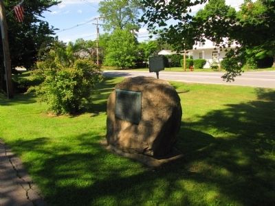
On Main Street (New Hampshire Route 12) north of Olcott Lane, on the left when traveling north.
This tablet commemorates the successful defense of the fort on this site by Captain Phineas Stevens and his company of rangers against a large war-party of French and Indians April 7-10 1747 — — Map (db m66278) HM
On Main Street (New Hampshire Route 12) at Depot Road, on the left when traveling north on Main Street.
South Panel 1861 In Memoriam 1865 Lists names Abbott to Kelly North Panel 1861 In Memoriam 1865 Lists names Keen to Way West Panel Honor Roll 1917-1919 Dedicated to the men of Charlestown New Hampshire who . . . — — Map (db m66283) WM
On Main Street (New Hampshire Route 12) at Olcott Lane on Main Street.
Carlton attended Charlestown schools, starring in basketball, soccer and baseball at Charlestown High School. He played professional baseball for the Boston Red Sox and the Chicago White Sox from 1969 to 1993, where he set several records including . . . — — Map (db m74583) HM
On Main Street (New Hampshire Route 12) north of Olcott Lane, on the left when traveling north.
In 1744 the settlers at No. 4 (now Charlestown) built a great log fort enclosing many of the town's dwelling. The fort, northernmost in the Connecticut Valley, was besieged in 1747 by a large force of French and Indians, who were beaten off by . . . — — Map (db m298330) HM WM
On Main Street (SR 12) at Elm Street on Main Street (SR 12).
To impede a British invasion from Canada into eastern New York, the New Hampshire legislature on July 19, 1777, commissioned John Stark of Derryfield to recruit and lead a force of 1500 New Hampshire militiamen. At Charlestown’s Fort No. 4, forces . . . — — Map (db m74585) HM
On Main Street (New Hampshire Route 12) north of Olcott Lane, on the left when traveling north.
Front Panel This American Liberty Elm was named after "The Liberty Tree: Our Country's first Symbol of Freedom." On the morning of August 14, 1765, the people of Boston awakened to discover two effigies suspended from an elm tree in protest . . . — — Map (db m66280) HM
This boulder from the hill-side is set here by citizens of Charlestown with the co-operation of the Union Historical Society of Charlestown N.H. and Springfield VT and of the Society of Colonial Wars, in the State of New Hampshire to mark the site . . . — — Map (db m65797) HM
On Broad Street at Barber Street, on the left when traveling north on Broad Street.
Erected in honor of the
Soldiers of Claremont
who died in the
Rebellion of 1861-1865
by their grateful fellow citizens
[Roll of Honored Dead]
Col. Alexander Gardiner • Capt. William H. Chaffin • Lieut. Ruel G. Austin
Lieut. . . . — — Map (db m230252) WM
On New Hampshire Route 12 at Plains Road on New Hampshire Route 12.
Southerly on Old Church Road is located the first Roman Catholic edifice in New Hampshire. It was erected in 1823 under the direction of the Reverend Virgil Horace Barber, S.J. The building serves St. Mary's parish and contained the first Roman . . . — — Map (db m109414) HM
On Maple Avenue 0.1 miles west of Buenavista Road, on the right when traveling west.
On June 11, 1995, President William Jefferson Clinton and Speaker of the U.S. House of Representatives Newt Gingrich met at the invitation of the Congress of Claremont Senior Citizens, Inc. to debate issues affecting senior citizens. During the . . . — — Map (db m109337) HM
On Opera House Square at Pleasant Street ( Route 11/12), in the median on Opera House Square.
On June 27, 1825, General Lafayette was greeted by crowds & 13 gun salute. He stayed at Stevens' Hotel, and left the next morning for VT. — — Map (db m230224) HM
On Water Street 0.1 miles east of Main Street, on the left when traveling east.
1830's
The Sugar River Manufacturing Co. constructs Mill No. 1 for the purposes of producing cotton and woolen products. Two overseer houses and a boarding house are also built.
1840's
In 1843, due to the recession, the buildings . . . — — Map (db m230227) HM
On Jarvis Hill Road (New Hampshire Route 12A) at Half Mile Road, on the right when traveling south on Jarvis Hill Road.
Located easterly on Old Church Road, this wood-frame structure, built 1771–1773, is the oldest standing Episcopal church in the State, serving the second oldest parish. The parish began in 1768 as a mission of the Society for the Propagation . . . — — Map (db m109370) HM
On Broad Street, on the left when traveling south.
In lasting tribute to the men of Claremont who
gave their lives in our country's service
World War I
Albert Audette ★ Charles H. Ayer ★ Arthur Baribeau
Burton Q. Benjamin ★ Charles L. Cady ★ Clifford J. . . . — — Map (db m230263) WM
Located in Rock Creek Cemetery, Washington, D.C., the Adams Memorial (1891) was commissioned by the historian, Henry Adams (1838-1918), for the grave of his wife, Marian "Clover" Hooper Adams (1843-1885). Adams stipulated that the figure . . . — — Map (db m230586) HM
Built about 1800 as an inn in the Federal style, Saint-Gaudens named the estate "Aspet" in honor of his father's birthplace in France. Many improvements were made to the house; and beautiful gardens added to the landscape. The majestic tree in . . . — — Map (db m230179) HM
On Chase Road (SR 12A) at Bridge Street on Chase Road (SR 12A).
Built in 1866 at a cost of $9,000, this is the longest wooden bridge in the United States and the longest two-span covered bridge in the world. The fourth bridge at this site, the 460-foot structure was built by Bela J. Fletcher (1811-1877) of . . . — — Map (db m74586) HM
On New Hampshire Route 12A south of the Cornish-Windsor Covered Bridge, on the left when traveling north.
In the second half of the 1980's it became clear that this
Bridge would need substantial repairs if it was to continue
in service for vehicular traffic.
Many in state government wanted to close the bridge, and
build something up river. . . . — — Map (db m230109) HM
When commissioned to create a memorial to honor Colonel Robert Gould
Shaw, Augustus Saint-Gaudens could not ignore the sacrifice of the individual
soldiers who served with Shaw. African American men from 24 states joined
the 54th . . . — — Map (db m230113) HM
On Chase Road (New Hampshire Route 12A) 0.1 miles south of McSwain Road, on the left when traveling south.
In this house was born Salmon P. Chase, U.S. Senator from Ohio (1849-55), Governor of Ohio (1855-59), a founder of the Republican Party and leader in the anti-slavery movement. After serving as Secretary of the Treasury in Lincoln’s Cabinet, he . . . — — Map (db m74587) HM
On Wilson Road (New Hampshire Route 12A) 0.1 miles north of St. Gaudens Road, on the right when traveling north.
The Cornish Colony (1885–1935) was a group of artists, sculptors, writers, journalists, poets, and musicians who joined the sculptor Augustus Saint-Gaudens in Cornish and found the area a delightful place to live and work. Some prominent . . . — — Map (db m109373) HM
The monument commemorating the Civil War naval hero Admiral David Glasgow Farragut was Saint-Gaudens’ first public commission. It was begun in 1879 and unveiled in Madison Square Park, New York City in 1881, where it still stands.
Here in front . . . — — Map (db m100671) HM
On the front façade of The Little Studio Saint-Gaudens placed casts from the Parthenon Frieze. The original frieze encircled the inner chamber of the Parthenon in Athens, Greece. The frieze was removed from the Parthenon over a period of more . . . — — Map (db m230197) HM
On Wilson Road (New Hampshire Route 12A) 0.3 miles south of Ferry Crossing Hill Road, on the right when traveling south.
American author of best-selling novels, such as "Coniston", written between 1898-1941 and partly based upon actual experience in New Hampshire politics. His nearby residence, "Harlakenden House", was built in 1898 and burned in 1923. It also . . . — — Map (db m109401) HM
On Mill Village Road North (New Hampshire Route 10) north of Brook Road, on the right when traveling north.
Born November 11, 1812, in Old Center Goshen, this rugged individualist attended Hopkinton (N.H.) Academy and taught school in a nearby log cabin before graduating from West Point in 1837. Following army service his talents as a surveyor and map . . . — — Map (db m304568) HM
On New Hampshire Route 10 at 2nd New Hampshire Turnpike/Lempster Mountain Road, on the right when traveling south on New Hampshire Route 10.
Born at Lempster, N.H., Aug. 17, 1814
Died at Boston, Mass., June 14, 1895
Minister in Boston 47 years
President of Tufts College 13 years
Overseer of Harvard College
Patron of Art • Leader in all reforms
This tablet is . . . — — Map (db m230359) HM
On Lempster Street at Pitkin Road, on the left when traveling south on Lempster Street.
On nearby Allen Road on December 4, 1939, the New Hampshire Electric Cooperative set its first utility pole, an important event in bringing electric service to the farms, mills, and homes of the New Hampshire countryside. A group of citizens . . . — — Map (db m230344) HM
On Lempster Street at Pitkin Road, on the right when traveling south on Lempster Street.
To the memory of
★Don Sylvester Hooper
who made the supreme sacrifice
and to
Lewis E Allen • Benjamin Aniralaijos • Arthur Armstrong
Flored Bagaty • William H George • Samuel D Hamlin • Willard Hamlin Jr
who served in the . . . — — Map (db m230355) WM
On Main Street south of Depot Street, on the left when traveling south.
Established 1985 Downtown National Historic District Newport, New Hampshire Newport's Downtown National Historic District contains a wide variety of historic buildings dating back to the early 1900s. Their diverse architectural styles include . . . — — Map (db m263661) HM
On New Hampshire Route 10 at Corbin Road, on the left when traveling north on New Hampshire Route 10.
Born in Endfield, Conn. in 1760, Joel McGregor
enlisted in 1777 and served five years.
prisoner by the British, he was confined eight
months in the famous Old Sugar House in
New York City. He settled in Newport in 1789
and was a resident for . . . — — Map (db m304564) HM
On Main Street just north of West Street, on the left when traveling north.
A transition from farming to manufacturing took
place in Newport during the mid-1800s with the
advent of water-powered mills on the Sugar River
and the construction of the Concord and Claremont
Railroad line. The first train arrived in town . . . — — Map (db m304563) HM
On New Hampshire Route 120 at Main Street on New Hampshire Route 120.
This school, known first as Union Academy, was chartered June 16, 1813 "to train young men for leadership in the ministry." The original building, located about 1,000 feet west of here and dedicated to January 9, 1815, was destroyed by fire in . . . — — Map (db m109402) HM
On 2nd New Hampshire Turnpike north of Center Road, on the left when traveling north.
We thank you for your service
[Armed Services Emblems]
————————————————
POW ☆ MIA ☆ KIA
You Are Not Forgotten
In memory of many
In honor of all
Thank You — — Map (db m230283) WM
On 2nd New Hampshire Turnpike north of Center Road, on the left when traveling north.
In memory of the men who served
in the World War.
John G. Blake • Ernest Filiauelt • Eugene A. Filiauelt • Richard C. Graves
Eddie B. LaClair • Guy LaClair • Arthur R. LeClair • Perley A. Newton
Everett Osgood • Perley C. Stone • Lyman . . . — — Map (db m230284) WM
On South Main Street (New Hampshire Route 31), on the right when traveling north.
In April 1842, a group of citizens in this town banded together to form "the first Christian Society." In the Adventist movement of 1842-43, they espoused the Advent hope. In January 1842, these Washington Sabbathkeepers, after meeting for many . . . — — Map (db m73224) HM
On Halfmoon Pond Road east of the Town Common, on the left when traveling east.
Sylvanus Thayer came to Washington in 1793 at the age of eight to live with his uncle Azariah Faxon in the house at the right. He attended school at the left, then a brick building, and worked in his uncle's store to earn money for an education . . . — — Map (db m230420) HM
Carved in ca.1894 by Carroll Farnsworth (1884-1986)
while a student at Ball-Farnsworth District 3 School,
at NW corner of Faxon Hill Rd. and King St.
Latter [sic] Carroll was an instructor. — — Map (db m230415) HM
On Main Street (New Hampshire Route 31) at Halfmoon Pond Road, in the median on Main Street.
N.H.
Washington The first town incorporated under the name of George Washington Our first president December 13, 1776
Erected Nov. 1932 — — Map (db m104566) HM
On S. Main Street (New Hampshire Route 31) at Halfmoon Pond Road, in the median on S. Main Street.
1861-1865
Erected in memory of those brave soldiers of Washington, who gave their lives in the defense of their country, during the great rebellion.
Side 1 Hamilton Wilkins, Æ. 19. • J. Langdon Miller, Æ. 21. • Gilman L. Beckwith, . . . — — Map (db m104561) WM
On Main Street (New Hampshire Route 31) at Halfmoon Pond Road, on the right when traveling north on Main Street.
The Washington Common
has been placed on the
National Register
of Historic Places
by the
United States Department of the Interior — — Map (db m104562) HM
On Main Street at Lempster Mountain Road, on the left when traveling north on Main Street.
In 1776 Washington, New Hampshire, became the first town in the nation to be incorporated under the name of General Washington.
In the early 19th century two major turnpikes joined near the site of this wayside park: Second New Hampshire . . . — — Map (db m230400) HM