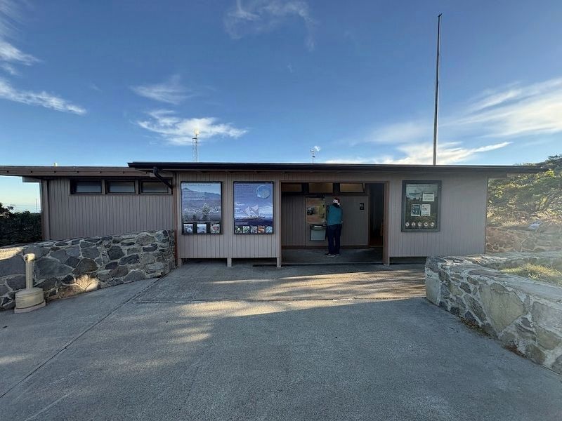
Near Haleakala Highway 11.3 miles west of Kekaulike Avenue (Hawaii Highway 377), on the left when traveling west.
For millennia, Polynesian navigators explored the Pacific in large double-hulled canoes using stars, tides, currents, the wind, and patterns of bird migration. They introduced the concept of kuleana to mālama 'aina (the . . . — — Map (db m290127) HM
The landscape of Haleakalā National Park rises from a lush valley beneath a waterfall at sea level to a red desert of cinder cones here at the volcanic summit of Haleakala. An astounding array of climates and life zones lies in between. Yet the . . . — — Map (db m71753) HM
The Nene is a native Hawaiian Goose that lives in the wild on the islands of Hawaii and Maui. This rare State bird is believed to have descended from the Canada Goose, and isolated on these islands for thousands of years, it has evolved into a . . . — — Map (db m71754) HM
Holy Ghost Catholic Church has been placed on the National Register of Historic Places by the United States Department of the Interior — — Map (db m71770) HM
The trail climbs to the top of a volcanic cinder cone for views of the Haleakala Wilderness Area and the highest peaks of the Big Island. At first glance the trail environment seems nothing but barren rock. Yet these rocks are living habitat for . . . — — Map (db m71765) HM
This ranch wall stacked stone by stone in the late 1800s, represents an investment in the land. Stretching for two miles, it guided cattle through the harsh landscape of Haleakala to pasture lands on the east and west sides of Maui. The ranching era . . . — — Map (db m71762) HM
He laid the foundation of the National Park Service, defining and establishing the policies under which its areas shall be developed and conserved unimpaired for future generations. There will never come an end to the good that he has done. — — Map (db m297420) HM
The Hawaiian Islands are very isolated. Colonizing species arrived, against overwhelming odds, by wind, waves, or wings as a small group or flock, or even just a single individual. A species survival depended upon ability to find suitable food and . . . — — Map (db m71756) HM
Near Baldwin Avenue north of Makawao Avenue, on the right when traveling north.
If you take this pathway, you will see
businesses utilizing 1920s-era buildings.
Three such areas along Baldwin Avenue
once included homes, structures to
protect furos (Japanese-style baths),
and businesses such as tofu shops
and blacksmiths. — — Map (db m293181) HM
On Baldwin Avenue north of Makawao Avenue, on the right when traveling north.
Portuguese Hawaiian William and
Annie Cooper lived here and ran
a taxi stand. In 1947, Takeshi and
Suteko Kitada opened Kitada's
Kau Kau Korner. Kitada's lasted
for decades so that locals could
enjoy its hekka and saimin. — — Map (db m293172) HM
On Makawao Avenue at Olinda Road, on the left when traveling north on Makawao Avenue.
Crossroads Service Station was built by Joseph Tam Sing in 1930 and run by Hajime (Jimmie) Karakawa for decades. Notice where two bays for repairing cars used to be along Makawao Avenue. — — Map (db m293025) HM
On Baldwin Avenue north of Makawao Avenue, on the right when traveling north.
This was originally a residence, as were most of the buildings that now exist in central Makawao, almost all built in the 1920s, 1930s and 1940s. Most of the buildings housed both people and the businesses they ran. — — Map (db m293032) HM
Near Baldwin Avenue 3.5 miles south of Hana Highway (Hawaii Route 36), on the left when traveling south.
Fred Baldwin Memorial Home, circa 1910, has been placed on the National Register of Historic Places by the United States Department of the Interior. — — Map (db m276610) HM
On Baldwin Avenue north of Makawao Avenue, on the right when traveling north.
The Yoza Ginsho family both worked
and slept next door. However their
living room and kitchen were located
here. Later this building served as
the home of pineapple worker
Koshiro Miyabara, his wife Ichi,
and their children. — — Map (db m293171) HM
On Baldwin Avenue north of Makawao Avenue, on the right when traveling north.
From 1926 to 1938 Chutaro Honda provided shaves, cuts and a porch to socialize. He followed a local tradition by training his daughters Evelyn and Violet in the skills needed to continue the business. — — Map (db m293029) HM
On Baldwin Avenue north of Makawao Avenue, on the left when traveling north.
This paddock is a reminder of
Makawao's love affair with horses.
Three blacksmiths kept busy at their
trade in town for many years. At one
time there was a sign asking riders to Please keep horses off the sidewalk — — Map (db m293180) HM
On Baldwin Avenue north of Makawao Avenue, on the right when traveling north.
Kakusuke Matsui built this building as a general store, selling just about anything the community needed, including groceries and dry goods, as well as providing a watch repair service and marriage licenses. — — Map (db m293028) HM
On Baldwin Avenue north of Makawao Avenue, on the right when traveling south.
Rikiichi Kawaguchi founded a fish and
vegetable store here and later added a
restaurant. Tetsujiro and Sono Iwaishi
took over his business in 1937, which
was then known as T. Iwaishi Store.
Their counter service flourished
for decades. — — Map (db m293173) HM
On Baldwin Avenue north of Makawao Avenue, on the left when traveling north.
Takezo and Shigeri Komoda started Komoda Store and Coffee Saloon as part of their home on Olinda Road in 1916. They constructed this building and opened as Komoda Store in 1932. They did not add bakery to their name until 1947. — — Map (db m293027) HM
On Baldwin Avenue north of Makawao Avenue, on the right when traveling north.
M. Ichiki Store opened here as part of a local chain. Daughter of the founder, Hitoe Ichiki Kajihara, and her husband, Sakae, operated the store for many years, providing a variety of merchandise and food. — — Map (db m293031) HM
On Baldwin Avenue north of Makawao Avenue, on the right when traveling south.
Makawao Theatre was built in 1926
by major property owner Rose Crook
shortly after electricity came to
Makawao. J.C. Marciel managed the
theater which offered daily movies,
including newsreels, for 10 cents. — — Map (db m293174) HM
On Baldwin Avenue north of Makawao Avenue, on the right when traveling north.
Built by the Matsui family at the same time as their store, this served as a gas station and repair shop for many decades. Look inside to see doors, now blocked, that are big enough for cars. — — Map (db m293026) HM
On Baldwin Avenue north of Makawao Avenue, on the left when traveling north.
Shinjo Nohara first operated a
clothes cleaning shop here. Later,
Kame Asato took over the site as
a tailor shop which boomed as
she repaired servicemen's
uniforms during WWII. — — Map (db m293178) HM
On Baldwin Avenue north of Makawao Avenue, on the right when traveling north.
This building illustrates the ethnic diversity of Makawao. Lee Pang, a female pineapple worker, first lived here with her six children, followed by Madrid Store which catered to the Filipino trade. — — Map (db m293030) HM
On Makawao Avenue west of Olinda Road, on the right when traveling north.
Tam Chow Store served the community until the Crossroads USO took over during WWII, providing recreation for servicemen. Salvador and Mary Molina later opened Club Rodeo as a restaurant, liquor store and night club. — — Map (db m293024) HM
On Baldwin Avenue north of Makawao Avenue, on the right when traveling north.
Yoshizu Fish Market began as part of
the Takeshi and Miki Yoshizu home.
It changed to a meat market during
WW II as fishing was restricted for
security reasons. Later it became
Yoshizu Market. — — Map (db m293182) HM
On Baldwin Avenue north of Makawao Avenue, on the right when traveling north.
The exterior contrasts with structures
around it, as it was designed for
business. In the late 1930s, it became
the Yoza Ginsho barber shop. The
front provided barber chairs and space
for games of Go (a popular Japanese
game) and the family . . . — — Map (db m293145) HM
Near Makena Road south of Makena Keonopio Road, on the left when traveling north.
Starting with a Volcanic Eruption
An eruption from a vent on the western flank of Haleakala volcano created Pu'u Ola'i, the 360 foot high cinder cone (pu'u) in the park, and Molokini Islet. The
pu'u continues to be shaped by waves, wind . . . — — Map (db m293184) HM
On Baldwin Avenue north of Hikina Place, on the right when traveling north.
Maui Dharma Center
A Tibetian Buddhist Church
Founded in 1974
by the Great Tibetian Spiritual Master Kalu Rinpoche
(1904-1989)
Resident Teacher - The Venerable Lama Gyaltsen
The Public is Welcome
6:30 AM 6:30 PM
The Great Paia Lha . . . — — Map (db m293023) HM
On Honoapiilani Highway (Hawaii Route 30) east of Maaleaea Road, on the right when traveling east.
Blessings of Leeward Life
The giant ocean nursery before you, Ma'alaea Bay, lies us the cradle of Maui's leeward coast, to your left.
This sheltered coast is often called South Maui. It boasts of rich seas, accessible beaches, and the . . . — — Map (db m293183) HM