THE HISTORICAL
MARKER DATABASE
“Bite-Size Bits of Local, National, and Global History”


16 entries match your criteria.  


Related Historical Markers

the relationship...markers shown in North Carolina
 
By Stanley and Terrie Howard, October 19, 2008
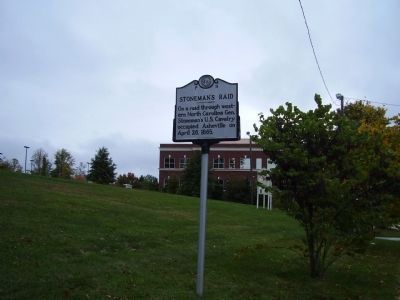
Stoneman's Raid Marker
SHOWN IN SOURCE-SPECIFIED ORDER
1 ► North Carolina, Buncombe County, Asheville — P-9 — Stoneman's Raid —
On Hendersonville Road (U.S. 25).
On a raid through western North Carolina Gen. Stoneman's U.S. Cavalry occupied Asheville on April 26, 1865. — — Map (db m12768) HM
2 ► North Carolina, Burke County, Morganton — N-13 — Stoneman's Raid —
On Lenoir Road (State Highway 16) 0.2 miles north of Sanford Drive (County Route 64), in the median.
On their raid through western North Carolina Gen. Stoneman's U.S. cavalry skirmished with Confederates near here on April 17, 1865. — — Map (db m20346) HM
3 ► North Carolina, Caldwell County, Lenoir — N-11 — Stoneman's Raid —
On Norwood Street Southwest at Pennton Avenue Southwest, on the right when traveling south on Norwood Street Southwest.
On a raid through western North Carolina Gen. Stoneman's U.S. Cavalry passed through Lenoir, Mar. 28, and there again, Apr. 15-17, 1865. — — Map (db m20388) HM
4 ► North Carolina, Davidson County, Linwood — K-15 — Stoneman’s Raid —
On U.S. 29 at Old Salisbury Road, on the right when traveling north on U.S. 29.
Southern troops turned back Stoneman's U. S. Cavalry, raiding through western North Carolina, at the Yadkin River Bridge, April 12, 1865. — — Map (db m33927) HM
5 ► North Carolina, Forsyth County, Lewisville — J-20 — Stoneman's Raid —
On Shallowford Road, on the left when traveling east.
On a raid through western North Carolina Gen. Stoneman's U.S. cavalry fought a skirmish with southern troops at Shallow Ford, April 11, 1865. — — Map (db m65414) HM
6 ► North Carolina, Iredell County, Statesville — M-11 — Stoneman's Raid —
On South Tradd Street (U.S. 21) at East Front Street, on the right when traveling north on South Tradd Street.
On a raid through western North Carolina Gen. Stoneman's U.S. Cavalry occupied Statesville, April 13, 1865. — — Map (db m51073) HM
7 ► North Carolina, Polk County, Tryon — O-11 — Stoneman's Raid —
On Lynn Road (State Highway 108) at Old Howard Gap Road and Story Road, on the right when traveling south on Lynn Road.
On a raid through western North Carolina Gen. Stoneman's U.S Cavalry fought Southern Troops at Howard's Gap. 4 Mi. North, April 22, 1865. — — Map (db m11210) HM
8 ► North Carolina, Rowan County, Salisbury — L-29 — Stoneman’s Raid —
On N Main Street, on the left when traveling north.
Stoneman’s U.S. Cavalry occupied the town of Salisbury, Apr. 12, 1865, and destroyed the Confederate warehouses, supplies, and prison. — — Map (db m33918) HM
Paid Advertisement
9 ► North Carolina, Rowan County, Salisbury — L-28 — Stoneman’s Raid
On West Innes Street, on the right when traveling north. Reported permanently removed.
On a raid through western North Carolina Gen. Stoneman’s U. S. Cavalry fought a skirmish with Southern troops near here, April 12, 1865. — — Map (db m33921) HM
10 ► North Carolina, Rutherford County, Rutherfordton — O-10 — Stoneman's Raid —
On North Washington Street north of West 2nd Street, on the right when traveling north.
On a raid through Western North Carolina Gen. Stoneman's U.S. Cavalry passed through Rutherfordton, April 21, 1865. — — Map (db m253440) HM
11 ► North Carolina, Stokes County, Danbury — J-18 — Stoneman’s Raid —
On Main Street (State Highway 89), on the left when traveling east.
On a raid through western North Carolina Gen. Stoneman’s U.S. cavalry passed through Danbury, April 9, 1865. — — Map (db m34105) HM
12 ► North Carolina, Surry County, Dobson — M-9 — Stoneman’s Raid —
On S Main Street (U.S. 601), on the right when traveling south.
On a raid through western North Carolina Gen. Stoneman’s U.S. cavalry passed through Dobson, April 2, 1865. — — Map (db m34102) HM
13 ► North Carolina, Surry County, Mt. Airy — M-8 — Stoneman’s Raid —
On Rockford Street, on the right when traveling north.
On a raid through western North Carolina Gen. Stoneman’s U.S. cavalry passed through Mount Airy, April 2-3, 1865. — — Map (db m54461) HM
14 ► North Carolina, Watauga County, Blowing Rock — N-10 — Stoneman's Raid
On U.S. 321 south of Norwood Circle, on the right when traveling south. Reported permanently removed.
On a Raid through Western North Carolina Gen. Stoneman's U.S. Cavalry passed through Blowing Rock March 28, 1865. — — Map (db m264028) HM
15 ► North Carolina, Watauga County, Boone — N-12 — Stoneman's Raid —
On East King Street (State Highway 321), on the right when traveling west.
On a raid through western North Carolina Gen. Stoneman's U.S. Cavalry Fought a skirmish with the Home Guard at Boone, March 28, 1865. — — Map (db m20352) HM
16 ► North Carolina, Wilkes County, Wilkesboro — M-10 — Stoneman's Raid —
On Main Street (Route 18) at Bridge Street, on the right when traveling west on Main Street.
On a raid through western North Carolina Gen. Stoneman's U.S. cavalry occupied Wilkesboro, March 29, 1865. — — Map (db m55297) HM
 
 
CeraNet Cloud Computing sponsors the Historical Marker Database.
This website earns income from purchases you make after using our links to Amazon.com. We appreciate your support.
Paid Advertisement
Nov. 10, 2026
