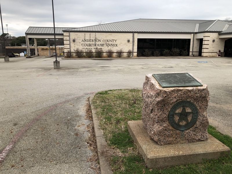
On North Mallard Street (State Highway 19) at East Poplar Street, on the right when traveling south on North Mallard Street.
Created March 24, 1846,
from Houston County
Organized July 13, 1846 with
Palestine as the county seat
Named in honor of
Kenneth Lewis Anderson
Vice-President of the
Republic of Texas
1844-45 — — Map (db m128942) HM
Member of Nacogdoches Volunteers 2nd Regiment, Texas Volunteers Battle of San Jacinto
Early Texas Ranger Commanding Officer, Fort Houston Houston County Rangers Battle of the Neches July 16 - 17, 1839
Texas Ranger. Mounted Rifleman . . . — — Map (db m212224) WM
On North Main Street (State Highway 71) at Greenville Street (State Highway 20) on North Main Street.
Burt-Stark House When Jefferson Davis, President of the Confederacy, left Richmond after its fall in April 1865, he traveled south, trying to reach and rally the remnants of his army. On May 2, he spent the night at the home of Col. Armistead . . . — — Map (db m10564) HM
On Main Street at Greenville Street, in the median on Main Street.
This tablet was placed here to commemorate the last meeting of the Confederate States Cabinet which was held in the Burt House near by directly in front of this stone.
The following cabinet members were present:
Jefferson Davis, President . . . — — Map (db m73949) HM
Near County Road 1680 north of Farm to Market Road 227.
A native of Illinois, Darius H. Edens moved to Texas in 1831. He served in a Texas Army infantry unit commanded by Thomas J. Rusk in 1836. A surveyor by trade, he worked in present Houston and Anderson counties. He and partner James E. Box platted . . . — — Map (db m245645) HM
A ranger in Republic of Texas, Greenwood left Illinois to avoid Indian Wars. Arrived in Texas (then part of Mexico) in 1833 with wagon train of Baptist Daniel Parker. In 1835 he helped found Fort Houston (in present Anderson County); set up a . . . — — Map (db m175372) HM
On East Palestine Avenue (State Highway 19) at North Laura Street, on the right when traveling east on East Palestine Avenue.
Native American photographer, artist and writer Osjetea Briggs was born on December 14, 1917, to Simeon Singleton Briggs (1877-1974) and Docia Augusta (Gant) Briggs (1894-1969) in Groesbeck, Limestone County, Texas. Following her high school . . . — — Map (db m186131) HM
On South Fant Street (State Highway 22) at East River Street (U.S. 76), on the right when traveling north on South Fant Street.
The location of the Anderson County Courthouse Annex on the corner of Fant and River Street has unique significance to Anderson's history. The site is the location of the 1865 federal encampment of the First Maine, 33rd Regiment, United States . . . — — Map (db m19838) HM
On Farm to Market Road 1364 at County Road 255, on the left when traveling south on Road 1364.
The beginning of Antioch Cemetery is very closely associated with the Turlington community, the Antioch and Mt. Zion churches, and the surrounding rural area. The area has ample springs and creeks which increased the number of people who settled . . . — — Map (db m272127) HM
On West Reagan Street at Knox Street, on the right when traveling east on West Reagan Street.
A stockade and blockhouse of the Republic of Texas. Built in 1835-1836 to protect settlers who founded Houston, a pioneer town, now in Anderson County.
Friendly Indians would come to trade at the site, but wary settlers often slept inside the . . . — — Map (db m258244) HM
On East Lacy Street, on the right when traveling east.
P.L. Chism’s devotion to education was unsurpassed. From the time of his youth, through his many years as a teacher, principal, superintendent and supervisor, he never stopped challenging himself and others for education. Purvey Lee Chism was born . . . — — Map (db m128938) HM
On West Spring Street at West Oak Street, on the right when traveling west on West Spring Street.
Established as Anderson County seat in 1846 by the Texas Legislature, Palestine grew steadily throughout the remaining 19th century, nearing 9,000 residents by 1900. The town first centered on trade facilitated by the Trinity River, with . . . — — Map (db m155447) HM
On North Jackson Street at West Oak Street, on the left when traveling north on North Jackson Street.
After the creation of Anderson County in 1846, most settlers came from southern states, shaping the county’s destiny in the Civil War. When Texas became the seventh state to secede from the Union on March 2, 1861, the county vote, 870 to 15, was . . . — — Map (db m182382) HM
As the longest river with its drainage basin entirely within Texas, the Trinity River's watershed covers 18,000 square miles flowing 715 river miles through 37 Texas counties. Native Americans referred to the Trinity as the Arkikosa or . . . — — Map (db m128336) HM
On East Market Street east of N Dechard St, on the right when traveling east.
In Memory of Captain William Kimbro; commanded a company at San Jacinto; came to Texas in 1831; born in Tennessee; died in Anderson County, September 14, 1856. — — Map (db m285717) HM
On North Perry Street (Loop State Highway 127), on the right when traveling south.
Little is known about this Anderson County pioneer until he married Elizabeth Van Winkle in Crawford County, Illinois, in 1820. The Mains lived in the Illinois township of Palestine until 1833, when, drawn by a favorable change in the Mexican . . . — — Map (db m128935) HM
On Saint Paul Road east of Cutter Crossing Place, on the left when traveling east.
A native of Maryland, Charles C. Stibbens came to Texas about 1835. He served in the Army during the Texas Revolution, participating in the Battle of San Jacinto. He settled in Anderson County soon after the war and worked as a farmer and . . . — — Map (db m246072) HM
Born near Elkhart in Anderson County, Alton W. Birdwell was reared in the Piney Woods of East Texas. His early education was provided through home schooling; he earned money for later study by hand-molding clay bricks and hewing railroad ties. . . . — — Map (db m221341) HM
On Farm to Market Road 861 0.2 miles north of County Road 103, on the left when traveling north.
A Soldier in the Army of Texas, 1836
Born in Indiana July 26, 1816 Died November 24, 1849
His Wife Laura Jordon Bennett
Born August 28, 1830 Died December 24, 1925 — — Map (db m245833) WM
On North Church Street (State Highway 19), on the right when traveling north.
Created by the Texas Legislature on March 24, 1846, Anderson County was named for former Republic of Texas Vice President Kenneth L. Anderson. The first court in the new county was held in a log house at nearby Fort Houston in 1846.
The first . . . — — Map (db m128934) HM
On Harcrow Road, on the right when traveling south.
In 1835, Joseph Jordan and William S. McDonald donated about 500 acres of land in this area for the town of Houston, later known as Fort Houston. An early map of the townsite shows a section designated as a "public burying ground." The infant . . . — — Map (db m181890) HM
On West Debard Street at North Queen Street, on the right when traveling north on West Debard Street.
Established on November 21, 1846, the Palestine Masonic Lodge is one of the oldest organizations in Anderson County. Established by 22 charter members meeting under a dispensation from the Grand Lodge of Texas. The group was officially chartered as . . . — — Map (db m246936) HM
On County Route 111 at County Route 113, on the right when traveling west on County Route 111.
D. R. Thornton from Mississippi married Mary Anna, daughter of frontier fighter Peter Garland in Anderson County, Texas, in 1853. The Thorntons settled here in 1857 as cattleraisers, and helped make this frontier safe for less hardy citizens. Mrs. . . . — — Map (db m83867) HM
On North Main Street, on the left when traveling south.
This store is the oldest business firm in Anderson. It has been owned and operated consistently by the same family for 175 years. Established by George W. Fant and originally named G.W. Fant & Son the store is an outgrowth of Dr. Edmund Webb's Drug . . . — — Map (db m21292) HM
On East Kolstad Street east of North Elm Street, on the left when traveling east.
Built in 1848 as the home of Judge John B. Mallard, first lawyer in Palestine. Became the home of Judge William Alexander in 1857. Alexander was Chief Justice of Anderson County 1860-1865, and a trustee of the first school in Palestine. . . . — — Map (db m185721) HM
On Park Road 70, on the left when traveling south.
Micam Main of Illinois was granted a league of land by the Mexican government in 1835. One of the area's first brickmakers, Samuel M. Warden, died while working on Main's estate on Christmas Eve in 1847. He was interred on this site. According to . . . — — Map (db m128982) HM
On Tennessee Colony Cemetery Road (Farm to Market Road 2230) near Farm to Market Road 321.
Settlers from the southern United States founded Tennessee Colony in 1838 years before the formation of Anderson County. One of their first community efforts was construction of a log church building on a hill near this site.
Located on the . . . — — Map (db m297403) HM
On County Road 454 0.5 miles north of County Road 453, on the right when traveling north.
Luther Thomas Martin Plummer and his wife Rachel (Parker) arrived in what is now Limestone County in 1834. They received a Mexican land grant for 3,321 acres in this area the next year. In 1836, Rachel, her son James, and her cousin Cynthia Ann . . . — — Map (db m293413) HM
Near Locust Street at Main Street (Business U.S. 82).
During the 4 years, 4 months after secession, Texas sent 18 lawmakers to the Confederate capitols. Her delegates to the Provisional Congress, Feb. 1861 to Feb. 1862, were John R. Gregg, Freestone County; John Hemphill, Travis County; Wm. B. . . . — — Map (db m96899) HM
On South McDuffie Street at East Reed Street, on the left when traveling south on South McDuffie Street.
Front
This Parish, organized in 1851 with the Rev. Benjamin Webb as its first vicar, grew out of occasional Episcopal services held in Anderson as early as 1844. The first church here, a frame Carpenter Gothic building, was completed in . . . — — Map (db m10417) HM
On West Parker Street (State Highway 294) 0.2 miles west of Hemby Street.
After the Civil War, the Cromwell family moved to Elkhart in Anderson County. Finding no organized Baptist church in the community, J.W. Cromwell decided to organize a Baptist church. In April of 1886, Cromwell and six other charter members founded . . . — — Map (db m207084) HM
On East Parker Street (State Highway 294) at Church Street, on the left when traveling west on East Parker Street.
The first Methodist service held in this area was in 1840. When a group of citizens formed a small congregation that met in private homes. In 1878 a Methodist mission was established in Elkhart. The Rev. J.F. Henderson, a circuit riding minister, . . . — — Map (db m207066) HM
On Country Club Road (Farm to Market Road 3309) at North Link Street, on the right when traveling east on Country Club Road.
Methodist missionary efforts in this area date to the late 1830s. Circuit-riding ministers served Methodists in Palestine from the time of its founding as the Anderson County seat in 1848. In 1850 church members built a frame sanctuary and in . . . — — Map (db m247007) HM
On East Lacy Street, on the right when traveling east.
Born the son of a runaway slave, Smith yearned for a better life. He attended Prairie View A&M College and received a degree in Vocational Agriculture. He became a teacher, educating the children of North Carolina and Texas for 42 years. He also . . . — — Map (db m128939) HM
Near County Road 1680 north of Farm to Market Road 227, on the right.
John and Lucinda (Nugent) Sheridan left North Carolina in the mid-1820s and became two of Houston County's first permanent settlers. John (Apr. 5, 1796 – May 10, 1837), a former Texas Ranger, was killed by Indians in what is now Anderson County. . . . — — Map (db m245643) HM
On County Highway 2602 at County Highway 2601, on the left when traveling north on County Highway 2602.
Originally part of a Mexican land grant awarded to Jose de Jesus Grande in 1828, land at this site was later granted to early area settler Henry Rampy. Rampy, who had come to this part of Texas in 1848, deeded 5 acres of his land in 1859 for a . . . — — Map (db m181660) HM
Near Moody Street east of Birch Street, on the right when traveling east.
William Freeman was born a slave in Anderson County on August 1, 1863, to Charlotte Freeman. His mother was a slave and the maid at the Jacob Hunter Plantation near Mound Prairie. After the slaves were freed in 1865, they moved to Palestine. . . . — — Map (db m186069) HM
On Farm to Market Road 2022 0.5 miles south of State Road 294, on the right when traveling south.
Racial tensions in America in the early 20th century were sometimes punctuated by violent outbursts. One such occasion began near Slocum and Denson Springs and spread across a wide area near the Anderson-Houston county line. Beginning on the morning . . . — — Map (db m286937) HM
On East Tyler Street at South Carrol Street, on the right when traveling east on East Tyler Street.
The Rev. Robert H. Hodge (1805-1866), a native of Tennessee, immigrated in 1850 to Anderson County, Texas. After two years he came to Henderson County. He began Science Hill Academy (15 mi. S). The only classical high school in the area during that . . . — — Map (db m247189) HM
On Farm to Market Road 2574 at Neches Street, on the left when traveling north on Road 2574.
Murdoch McDonald was born in North Carolina on February 15, 1810, the son of Scottish immigrants. About 1832 he went to Georgia, where he met Dr. George Lester. In 1839, McDonald, along with Lester and his family, came to Texas. Settling in the . . . — — Map (db m136105) HM
On South Magnolia Street at Bowers Street, on the right when traveling south on South Magnolia Street.
Originally house of merchant Henry Ash, built 1878; bought 1884 by Andrew L. and Nellie O'Connell Bowers, who had architect-builder W.W. Wainright add cupola, gazebo, circular galleries after 1886. Charles Dunbar was architect in 1897 for ornate . . . — — Map (db m245942) HM
On West Oak Highway (State Highway 24) at Townville School Road, on the right when traveling east on West Oak Highway.
[Front]
This church, founded as Nazareth on the Beaverdam Presbyterian Church, was established in 1803. It met in members’ homes until they paid $1.50 for a half-acre tract and built a small frame church 2.5 mi. E. The founders’ cemetery . . . — — Map (db m39349) HM
Thin black lines indicate changes in relevance. Between each pair of lines entries are ordered geographically but all have the same relevance.
* Inflectional forms of words are their plurals, singulars, and possessives as well as gramatical tenses and similar variations.