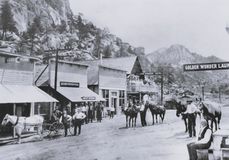
Near U.S. 285 just north of U.S. 50, on the right when traveling south.
"It is a town of only eight days' growth, but full of life.... There are now about 300 inhabitants, with fifty houses, tents, etc., and quite a number of buildings in process of construction, comprising one hotel, one boarding house, two . . . — — Map (db m281103) HM
On U.S. 285 5 miles north of U.S. 50, on the left when traveling north.
Following ancient paths The history of Chaffee County as part of the United States began in 1803, with the purchase of the Louisiana Territory from France. But human history was established here centuries earlier. Many of the hiking trails . . . — — Map (db m116085) HM
On East Main Street at North Court Street, on the right when traveling east on East Main Street.
DSP&P Historical Timeline: 1872: Governor John Evans, the 2nd territorial governor of Colorado, forms the Denver, South Park & Pacific Railway. 1873: Governor Evans forms a new company, the Denver, South Park & Pacific Railroad (DSP&P, . . . — — Map (db m293299) HM
On U.S. 24 at West Main Street, on the right when traveling south on U.S. 24.
The Ute People made this land home. Next came Spanish military expeditions and French fur trappers. The fledgling U.S. sent its own explorers west into the Rocky Mountains in the early 1800s. In 1806 the Zebulan Pike expedition explored the Buena . . . — — Map (db m293270) HM
On West Main Street just west of U.S. 24, on the right when traveling west.
In Memoriam William Joseph Walsh ————— 41 Replacement Unit No. 41 Medical Corps who died September 29, 1918, serving his country during The World’s War 1914 1918 — — Map (db m293296) HM WM
On County Road 152 0.2 miles west of County Road 150.
As early as 1880, when gold, silver, copper, and iron mines began producing ore in Chaffee County, a local smelter was needed. Several small concentrating plants and smelters were built close to ore sources, but most were inadequate. The arrival . . . — — Map (db m293381) HM
On U.S. 24 at West Main Street, on the right when traveling south on U.S. 24.
Farms and ranches dotted the upper Arkansas River valley as early as 1864. The Mahon, Loan, and Bard families established some of the first ranches, portions of which are now part of Buena Vista. The area's first farmer, Dr. Frank Mayol, raised . . . — — Map (db m293274) HM
On Crestone Avenue just west of Poncha Boulevard (TransAmerica Trail), on the right when traveling west.
Chaffee County Courthouse built by Ray Lines Post 64 American Legion Architect De Morduant Approximate cost $120,000 Completed 1932 — — Map (db m293500) HM
On County Road 152 0.2 miles west of County Road 150.
A legacy of hard work and dedicated workers When operating, the smelter ran 24 hours a day. Work was physically demanding and often tedious, but the men were proud of their accomplishments. Many smelter workers and their families lived near . . . — — Map (db m293384) HM
On West 1st Street (State Highway 291) just north of G Street, on the left when traveling north.
Salida sprouted within weeks of the arrival of the railroad. Homes and businesses couldn't be built fast enough, and many families spent time camped along the Arkansas River. In its first edition The Mountain Mail newspaper reported that . . . — — Map (db m293397) HM
On U.S. 24 at West Main Street, on the right when traveling south on U.S. 24.
The beauty and majesty of the landscape intrigued locals and visitors from Buena Vista's earliest days. Early newspapers touted everything from the scenery to the local hot springs, encouraging outdoor recreation and tourism via stagecoach, rail, . . . — — Map (db m293277) HM
Thin black lines indicate changes in relevance. Between each pair of lines entries are ordered geographically but all have the same relevance.
* Inflectional forms of words are their plurals, singulars, and possessives as well as gramatical tenses and similar variations.