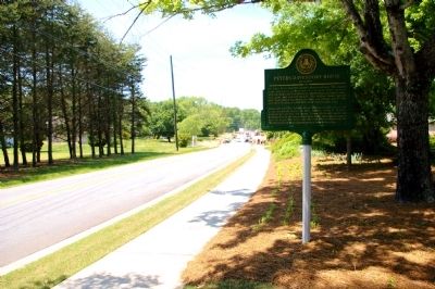
On Mars Hill Church Road at Rose Arbor Drive, on the right when traveling north on Mars Hill Church Road.
Dr. James Peters built his family’s homestead here. The original house was a very early version of a two-room frame structure with two doors and two chimneys. Outbuildings included a barn, well, privy, and summer kitchen. The original rooms had 10" . . . — — Map (db m30655) HM
On Lawrence Street NE west of Haynes Street, on the right when traveling west.
In 1808–1809, the Cherokee nation divided when some of its members decided to move west of the Mississippi River to pursue a hunter lifestyle where game was plentiful rather than live the more settled lifestyle prevalent in the east. A portion . . . — — Map (db m68042) HM
Near Mill Street 0.3 miles east of Atlanta Street when traveling south.
In 1832, the State of Georgia held a lottery to distribute land located north of the Chattahoochee River. This land was formerly part of the Cherokee Nation. The Cherokee Indians were removed to land west of the Mississippi over the route, which . . . — — Map (db m227728) HM
On Sandy Springs Circle at Sandy Springs Place, on the right when traveling north on Sandy Springs Circle.
Sandy Springs, Georgia, the unincorporated community just north of Atlanta, began a 30-year campaign for incorporation when the City of Atlanta tried to annex the area in the 1970s. The Committee for Sandy Springs formed in 1975 to incorporate Sandy . . . — — Map (db m53430) HM
Near West Atlanta Street SE 0.3 miles north of Cemetery Street, on the left when traveling west.
Front:
To our
Confederate Dead.
Erected and
dedicated by
Kennesaw Chapter
United Daughters
of the
Confederacy,
Marietta, Georgia.
1908.
Right:
To the
3000 soldiers in this
cemetery, from every . . . — — Map (db m87441) WM
Near North Marietta Parkway Northwest (Georgia Route 5) at Polk Street Northwest, on the right when traveling north.
Welcome to the William Root House, one of the oldest homes remaining in the Atlanta area! The home of the Root family from 1845 to 1886, the Root House is more typical of its time and place than the columned mansions popularized by Gone With the . . . — — Map (db m227648) HM
Near Richland Avenue east of Memorial Drive, on the left when traveling east.
Thomas W. Cobb was a United States
Representative and Senator from Georgia.
Born in Columbia County, Georgia, he pursued
preparatory studies, and studied law. He
was admitted to the bar and practiced in
Lexington, Georgia. He moved to . . . — — Map (db m267722) HM
On West Park Square south of North Park Square, on the left when traveling south.
Alexander Stephens Clay Citizen, lawyer, statesman, Born on a Cobb County farm Sept. 25, 1853; Died a member of the United States Senate Nov. 13, 1910. His life was largely given to the service of his people - as Councilman of his home city. . . . — — Map (db m120224) HM
On County Services Parkway 0.2 miles south of Powder Springs Road ( Route 360), on the right when traveling south.
In 1803, Georgia established a lottery as the fairest means of distributing land to common farmers. After gold was discovered in 1828 near Dahlonega, the state ignored federal treaties and asserted its claims on the Cherokee territory (including . . . — — Map (db m224740) HM
On Haynes Street at Washington Avenue, on the right when traveling north on Haynes Street.
Judge Debra Halpern Bernes was a loving and devoted wife and mother to her husband, Gary, and children, Lane and Matthew. She served her community as an Assistant District Attorney for Cobb County, a solo practitioner of law and as an elected judge . . . — — Map (db m54702) HM
On Oakdale Road south of Fort Drive, on the left when traveling south.
Within this park is the remnant of a unique fortification known as Johnston's River Line. In mid June 1864, the Confederate Army of Tennessee under General Joseph E. Johnston was fighting in central Cobb County and about to withdraw to the . . . — — Map (db m86946) HM
Near Floyd Road Southwest 0.1 miles north of Maran Lane Southwest, on the right when traveling north.
The Friends of the Mable House, a part of the South Cobb Arts Alliance, along with Cobb County P.A.R.K.S., welcomes you to explore the historic Mable House, its outbuildings and grounds. Use the map to locate the informative signs around the . . . — — Map (db m197609) HM
Sara Freeman Clarke established the first public library in Marietta and Cobb County in 1882 when she allowed residents to borrow books from her home without charge. She named it the “Franklin Lending Library”.
The next year, a group . . . — — Map (db m60577) HM
On Fairground Street 0 miles north of South Cobb Drive, on the right when traveling south.
This park is dedicated to thousands of men and women who built 665 B-29 bombers that played a major role in bringing the U.S. victory during World War II.
The steps remain as a reminder of the daily walk to work at the Bell Aircraft Plant by . . . — — Map (db m30044) HM
Near Streetman Road west of Ephesus Church Road, on the left when traveling west.
Family History
William Clinton (1754-1847) married Violet Perry (1760-1852) in South Carolina
Their known children are:
1. David - Born 1785. Moved to Campbell County (Douglas), then to Louisiana.
2. John P. - Born . . . — — Map (db m298430) HM
Thin black lines indicate changes in relevance. Between each pair of lines entries are ordered geographically but all have the same relevance.
* Inflectional forms of words are their plurals, singulars, and possessives as well as gramatical tenses and similar variations.