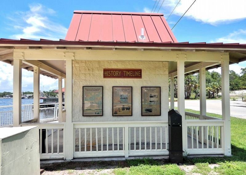
On Marine Street at Avenue F South, on the right when traveling south on Marine Street.
Where the River Meets the Gulf Native peoples were drawn to this natural port. They used dugout canoes for travel and fishing. Parties of men hunted and fished while women gardened and gathered herbs in the marshes. 200 A.D. — 800 A.D. . . . — — Map (db m299196) HM
On 9th Street at Avenue M, on the right when traveling west on 9th Street.
At the end of the Civil War, Emanuel Smith, a formerly enslaved man who became a member of the local school board in Apalachicola during Reconstruction, wrote to the American Missionary Association for help in establishing a school in Apalachicola . . . — — Map (db m276505) HM
On 7th Street 0.1 miles east of Avenue K, on the right when traveling west.
On February 5, 1920, a group of nuns from the missionary Congregation of the Sisters of the Holy Family (one of three orders of African American nuns in the U.S.) arrived from New Orleans to serve the new mission in Apalachicola. In 1922, the . . . — — Map (db m276531) HM
On 12th Street at 24th Avenue, on the right when traveling north on 12th Street.
Often, the entire community turned out for a funeral service to honor the deceased. Children were permitted to participate in the mourning rituals and local people provided succor for the bereaved family. The Usher Board members were present for . . . — — Map (db m276508) HM
On Avenue E (U.S. 98) at 8th Street, on the right when traveling north on Avenue E.
The First Baptist Church was established in Apalachicola in 1848 under the leadership of a White minister. According to the Tennessee Baptist - published October 24, 1857, Rev. E. H. Warren became the pastor of the Church in December 1855. . . . — — Map (db m276738) HM
On 6th Street near Avenue H, on the left when traveling east.
The Odd Fellows Hall in Apalachicola
FL at 143 Sixth Street was built between 1881 and 1883 as a meeting hall for the local Black Fraternal Order.
The period from the end of the Civil War to the First World War has been called the golden age . . . — — Map (db m276709) HM
On Avenue I 0.1 miles north of 7th Street, on the left when traveling north.
African American churches have stood on this spot for more than 150 years, playing a vital role in the spiritual, educational, and economic growth of the community.
On April 16, 1866, the Stewards of the Methodist Episcopal Church purchased . . . — — Map (db m276578) HM
On Market Street at Avenue F, on the left when traveling north on Market Street.
During the 1830's, when the cotton port of Apalachicola was rapidly expanding, David G. Raney built a rather plain, Federal style house at this site. Around 1850, A two - story portico and other features of the then popular Greek Revival . . . — — Map (db m26663) HM
On Bay Avenue at High Street, on the left when traveling north on Bay Avenue.
Apalachicola is one of the most historic cities in Florida. Located where the Apalachicola River meets Apalachicola Bay, the name "Apalachicola" is an Indian word interpreted as a ridge of earth produced by sweeping the ground in preparation for a . . . — — Map (db m276202) HM
Near Water Street at Bay AVenue, on the right when traveling east.
Apalachicola Bay is considered one of the least polluted, most undeveloped, resource rich systems in the U.S. The Apalachicola drainage basin includes upland, floodplain, riverine, estuarine, and barrier island environments all of which are . . . — — Map (db m276187) HM
On Avenue D at Market Street, on the right when traveling north on Avenue D.
Thomas Orman (1799-1880) was an ambitious entrepreneur and significant member of the Apalachicola mercantile community. In his lifetime, Orman held title to over 39,000 acres in Franklin County. Of the many cotton warehouses once located on Water . . . — — Map (db m275855) HM
Founding Father
Born in Massachusetts, Benjamin Franklin (1706-1790) is
remembered as the elder statesman of the American cause
during the Revolutionary War. Beyond the political arena, he
pursued many interests, including higher . . . — — Map (db m309137) HM
On 4th Street at Avenue D, on the right when traveling east on 4th Street.
The Franklin Guards, a company of Infantry organized in Apalachicola in 1884 by J. H. Coombs and Fred Betterfield, erected the first building in the city to be used solely as an armory in 1898. Made of simulated brick, it was located at the corner . . . — — Map (db m26120) HM
On Oak Street at Kansas Street, on the left when traveling west on Oak Street.
In June 1942 the U.S. War Department selected a 155,000 acre section of coastal Franklin County to be used as an amphibious warfare training center. Originally called Camp Carabelle, the base was renamed in January 1943 to honor the memory of . . . — — Map (db m101177) HM
On Water Street south of Avenue E, on the left when traveling south.
At one time, cotton was king in Apalachicola. Less than 10 years after the town was established in 1831, Apalachicola reveled a cotton boom that lasted nearly 20 years and catapulted the town to rank as third largest cotton shipping port on the Gulf . . . — — Map (db m276092) HM
Thin black lines indicate changes in relevance. Between each pair of lines entries are ordered geographically but all have the same relevance.
* Inflectional forms of words are their plurals, singulars, and possessives as well as gramatical tenses and similar variations.