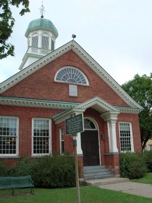
Sent to the Province of New York in 1737, by his uncle Sir Peter Warren for the purpose of supervising landed property in the Mohawk Valley, William Johnson engaged in trade with settlers and Indians.
Prospering in mercantile enterprises, he . . . — — Map (db m52124) HM
Hostilities of the Seven Years' War having commenced, Colonel William Johnson was commissioned a Major General of Provincial Forces and assigned to command the Crown Point Expedition against the French, in 1755. After the failure of the other . . . — — Map (db m52121) HM
In efforts to develop great land holdings, he surveyed and laid out the village of Johnstown, built the first public school, and after Tryon County was set off in 1772, ensured the location of the county seat here. Interested in learning, he was a . . . — — Map (db m52094) HM
Gaining considerable knowledge of Indian Affairs, his area of responsibility for administration reached from Hudson's Bay Canada to the Carolinas. From the Atlantic to as far west as any Indians were known.
Appointed to deal with Indians, and . . . — — Map (db m52120) HM
On North Franklin Street 0.1 miles north of West Montcalm Street, on the right when traveling north.
In 1844 John and Deborah Green and their children moved to Montcalm County from their native New York. He purchased land, which now encompasses more than half the town, and erected a dam and sawmill on this site. As the town grew, it became the . . . — — Map (db m55250) HM
On Broadway at Park Street, on the right when traveling north on Broadway.
Tryon County 1772-1784 Montgomery County 1784 *Tryon County set off from Albany County 1772 Name changed to Montgomery County in honor of Major General Richard Montgomery 1784 County Seat moved from Johnstown to Fonda, 1836, and Present court house . . . — — Map (db m59764) HM
On Buchanan Trail (Pennsylvania Route 16) north of Horton Drive, on the right when traveling north.
During the invasion of Pennsylvania by the Confederate Army, raiding parties crossed into Fulton County to steal horses, livestock, and supplies. On June 29, 1863, Union troops of the 1st New York Cavalry attacked the enemy soldiers, killing two, . . . — — Map (db m201701) HM
On Ohio Route 108 0.2 miles south of County Road J, on the left when traveling north. Reported permanently removed.
The Fulton County 9/11 Memorial is a tribute of remembrance and to honor the nearly 3,000 people killed in the terror attacks of September 11, 2001 at the World Trade Center site, near Shanksville, Pa., and at the Pentagon, as well as the six . . . — — Map (db m265703) HM WM
On Fulton County Fairgrounds, on the right when traveling north.
The Fulton County 9/11 Memorial is a tribute of remembrance and to honor the nearly 3,000 people killed in the terror attacks of September 11, 2001 at the World Trade Center site, near Shanksville, Pa., and at the Pentagon, as well as the . . . — — Map (db m265702) HM WM
On Church Street (New York State Route 67), on the right when traveling north.
Home of Stephen Sanford
Industrial Pioneer, Rugmaker
and Philanthropist c. 1860
Donated by John Sanford for
Amsterdam City Hall 1932 — — Map (db m11611) HM
On Bunker Hill Road 1.8 miles south of Hampton Point Road (County Route 152), on the right when traveling south.
This road led to the former hamlet of Osborn's Bridge. Settled in the early 1800s.
Was completely flooded by Sacandaga Reservoir in 1930. — — Map (db m190507) HM
On Ohio Route 108 0.2 miles south of County Road J, on the left when traveling north.
This steel beam was recovered from Ground Zero and donated by The Port Authority of New York and New Jersey.
This beam was received by the Wauseon Fire Department on June 16, 2011 and entrusted to the Fulton County Firemen's . . . — — Map (db m172215) WM
On W.Main Street at N. Market Street on W.Main Street.
1. Johnson Hall - 1763. Baronial home of Sir William Johnson, Superintendent of Indian Affairs for the British Crown. Johnson Hall is listed as a National Historic Landmark. Prior to the Revolutionary War, the home was a Native American trade and . . . — — Map (db m209349) HM
On Buchanan Trail (Pennsylvania Route 16), on the right when traveling north. Reported permanently removed.
Two Confederate soldiers, killed June 29, 1863, in a skirmish with Union troops, were buried here by local residents. The monument in their honor was erected by Daughters of the Confederacy. — — Map (db m27196) HM
On Lincoln Highway East (Pennsylvania Route 16), on the left when traveling east.
Carved out of a remote wilderness, McConnellsburg served the flood of travelers heading west in the late 18th century. Taverns, like the Fulton House, sprang up all along the packhorse trail from Philadelphia to Pittsburgh.
Whether by . . . — — Map (db m167242) HM
On County Route 110 near Benedict Loop, on the right when traveling south.
World Record
Northern Pike Caught Near
Benedict Bay On 9-15-1940
By Angler Peter Dubuc
52.5" Long / 46 Lbs. 2 Oz.
GSL Fisheries Federation Inc.
— — Map (db m97313) HM
On New York State Route NY-30, on the right when traveling north.
World Record
Northern Pike Caught Near
Benedict Bay On 9-15-1940
By Angler Peter Dubuc
52.5" Long / 46 Lbs. 2 Oz.
In Memory of Andy Luey
— — Map (db m95646) HM
On County Road 26 0.2 miles south of County Road F, on the right when traveling north.
Goll Woods In 1836, Peter Goll (1808-1896), Catherine Marguerite Goll (1813-1903), and son Peter Jr. (1834-1915) arrived in German Township, Fulton County from Grand-Charmont, France. The next year, Goll purchased 80 acres along the Anse des . . . — — Map (db m225382) HM
Near Hardman Farm Road 1 mile north of Unicoi Turnpike (Georgia Route 17).
James Hall Nichols
Born on 17 February 1835, James Hall Nichols built West End in the early 1870s. His father, Richard James Nichols, a Connecticut native, farmed a large plantation in the community of Midway, near Milledgeville, Georgia . . . — — Map (db m229222) HM
On Pine Street south of East Main Street (County Route 2), on the right when traveling north.
(center panel:)
Called the Illinois Traction System until 1937, the Illinois Terminal System was 550 miles of electrified railroad, linking farm communities of central Illinois to the bigger cities of Peoria, Springfield and St. Louis. . . . — — Map (db m162227) HM
On Military Road at North Shore Road (County Route 4), on the right when traveling south on Military Road.
Built in 1847 by John Barker.
Operated Continuously As A
Store Until 1945. Believed
To Have Been A Stop On The
Underground Railroad. — — Map (db m57384) HM
On Darrow Road, on the right when traveling north.
Home of Enoch Ambler
Inventor of First
Mowing Machine
Patent Signed by Pres.
Andrew Jackson in 1834
Heritage & Genealogical Soc. of Montg. Co
— — Map (db m68671) HM
Fire Tower
Erected of wood in 1916
Steel tower erected in 1920
Cabin built to house ranger
Closed 1990, restored and
staffed summers from 1996 — — Map (db m9257) HM
Thin black lines indicate changes in relevance. Between each pair of lines entries are ordered geographically but all have the same relevance.
* Inflectional forms of words are their plurals, singulars, and possessives as well as gramatical tenses and similar variations.