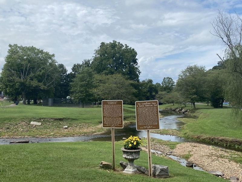
On East Main Street (Tennessee Route 151), on the left when traveling east.
Named by early pioneers traversing thru the region, this designated Indian trail led these settlers into this area during Western migration. This mainly Cherokee trail, (although used some by the Shawnee), originated at Rockwood in Roane County, . . . — — Map (db m180021) HM
On Mackville Hill Road (Kentucky Route 152) at Mackville Elementary School Drive, on the right when traveling east on Mackville Hill Road. Reported unreadable.
John Hunt Morgan and his men arrived in Mackville on Saturday evening, July 12, 1862, following raids on Lebanon and Springfield. Shortly after their arrival a skirmish ensued between Morgan’s men and the Home Guard. The Home Guard took two . . . — — Map (db m152653) HM
On Lawrence Street at 5th Street, on the left when traveling east on Lawrence Street.
John Campbell (1818-1891), founder of Ironton, was an ironmaster and president of the Ohio Iron & Coal Company, a Presbyterian, and an abolitionist. This house and barn, which he built in 1850, became a stop on the Underground Railroad for . . . — — Map (db m59375) HM
On West Main Street (Business U.S. 59), on the right when traveling east.
Home of the Karankawa Indians granted in part to Stephen F. Austin and to Martin de Leon. Settled 1824-1835 by colonists largely from Alabama, Louisiana, Kentucky, Tennessee and, west of the Lavaca, Mexico. Organized as a municipality December 5, . . . — — Map (db m120609) HM
On Main Street north of Earl Garrett Street, on the right when traveling north.
Kentucky native James Kerr, the son of a Baptist minister, was reared in Missouri. Kerr fought in the War of 1812 and was later sheriff of St. Charles County, Missouri. He married Angeline Caldwell in 1818 and served in the Missouri Senate and . . . — — Map (db m111223) HM
Background: Company B of the 151st Engineering Combat Battalion, formed in 1947 in Jackson County, was activated on August 14, 1950, to support the Korean War. After training at Fort Campbell, Kentucky, Company B arrived in Korea on . . . — — Map (db m268152) HM
Near South 9th Street at Washington Street, on the right when traveling north.
St. Lawrence O'Toole Catholic Church Corner of 6th and Center Streets, Ironton Built in 1892, this beautiful Catholic church, as well as the Depot (below) and several other historic buildings are part of a self-guided walking tour of historic . . . — — Map (db m310299) HM
Near West Main Street (Illinois Route 13) east of Glenview Drive.
"If I have helped someone along life's way then my living has not been in vain"
Born in Brookport, Illinois Rev. Turley was a man interested in all facets of life. He always liked to build, loved the positive approach to problems, glorified in . . . — — Map (db m167726) HM
On County Road 42 0.2 miles east of County Road 442, on the left when traveling west.
Of German ancestry, Phillip Hamman was a
Colonial-era scout and a Revolutionary War soldier
hailed as the "Savior of Greenbrier" for his 1778
efforts to defend Ft. Donnally in present-day
West Virginia. In 1780. he married Christina . . . — — Map (db m289257) HM
On Main Street north of East 2nd Street, on the right when traveling north.
On June 26, 1804 the Lewis & Clark Expedition known as President Jefferson's Corps of Discovery passed this place on their way west.
In 1825, treaties with the Kaw and Osage Indians opened up for settlement an area between Fort Osage to the . . . — — Map (db m252086) HM
On Broadway (Missouri Route 224) at Highland Avenue, on the right when traveling west on Broadway.
Madonna of the Trail Monument
The "Madonna of the Trail" statue was designed and sculpted by August Leimbach of St. Louis. The statue was unveiled and dedicated on September 17, 1928 by the Missouri State Society Daughters of the . . . — — Map (db m241047) HM
On Main Street (State Highway 56) at Hillcrest Drive, on the right when traveling south on Main Street.
Red Boiling Springs has long been a landmark in Macon County. It was a central crossroads for both Federal and Confederate forces during the Civil War.
The war came home for local residents on September 24, 1861, when Capts. Ridley R. West and . . . — — Map (db m39584) HM
Near West 103rd Street 0.1 miles east of State Line Road, on the right when traveling east.
For more than a century, a mill thrived on the banks of Indian Creek, supporting early Jackson County settlers and contributing to the growth of south Kansas City.
What would become widely known as Watts Mill bears the name of the family who . . . — — Map (db m251736) HM
Thin black lines indicate changes in relevance. Between each pair of lines entries are ordered geographically but all have the same relevance.
* Inflectional forms of words are their plurals, singulars, and possessives as well as gramatical tenses and similar variations.