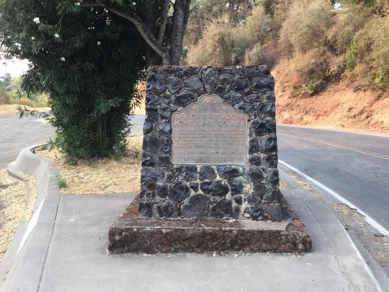
On Bell Hill Road (County Road 510) at Main Street, on the right when traveling north on Bell Hill Road.
Built by Charles Stone and Andy Kelsey on land purchased from Salvador Vallejo. Constructed by forced Indian labor, causing much resentment and culminating in murder by Indians of both Stone and Kelsey in the fall of 1849. Their remains are beneath . . . — — Map (db m121713) HM
Near North Main Street north of 2nd Street, on the left when traveling north.
Lake County’s century-old classic courthouse, designed by A.P. Pettit in 1871, served as the seat of county government from 1871 until 1968 when it was replaced by the new courthouse. Among the court’s landmark cases were the White Cap murders, a . . . — — Map (db m152479) HM
On California Route 108 at milepost 0, 15 miles west of U.S. 395, on the right when traveling east.
The idea of a wagon road through this pass connecting Tuolumne County with mining towns of Mono County was first called to attention by Andrew Fletcher in 1862. The original trail through Sonora Pass was opened for pack animals in September 1862. . . . — — Map (db m12480) HM
Near Main Street south of First Street. Reported permanently removed.
At the time of the first Spanish settlement in California in 1769, the native Pomo had inhabited Lake County for at least 10,000 years. When Mexico became independent of Spain in 1822, secularization af the Mission system provided rich land grants . . . — — Map (db m144283) HM
On Ovid Road (Highway 89) at State Highway 36, in the median on Ovid Road.
The region comprising Bear Lake County has alway been an important juncture for overland travel. From the 1800s onward, migrants on the Oregon and California trails traversed the area, relying on knowledge garnered by Native Americans, early . . . — — Map (db m140213) HM
Standing at the crossroads of Pope Valley, this store was the center of activities for the area's residents for nearly a century, and served as a stopover for people traveling to the mines in Lake County. It was built about 1875 and in 1913 a second . . . — — Map (db m54772) HM
Near Lincoln Highway (U.S. 30) just west of Monroe Avenue, on the right when traveling west.
In 1912, there were approximately one million motor vehicles registered in the United States but few good roads. Most of the roads outside of urban areas were dirt that turned to mud when wet. Long-distance travel by car was still very much a . . . — — Map (db m162418) HM
On Old Highway 30, on the left when traveling north.
The first known Utah law enforcement officer to give his life in the line of duty was Great Salt Lake County Deputy Sheriff Rodney Badger, one of the original 1847 pioneers. He drowned in 1853 in the Weber River while on assignment from Brigham . . . — — Map (db m277805) HM
Considered by some to be the oldest dwelling in Lake County, the Ranch House was built in the 1850’s to 1860’s. It was associated with the earliest settlement of High Valley and beginnings of agriculture in Lake County. It is a one and one half . . . — — Map (db m26738) HM
Near State Highway 91 11 miles south of Interstate 70, on the right when traveling south.
A whole lot of Colorado history has happened right here on top of Fremont Pass. And it all happened because of a metal most people have trouble pronouncing.
Molybdenum (moll-ib-den-um) is used to harden steel.
More molybdenite ore (the . . . — — Map (db m122900) HM
On East Main Street at Halsted Street, on the left when traveling east on East Main Street.
The oldest brick house in Lake County,
home of Melvin Halsted, founder of
Lowell, was built in 1849. His pit and
kilns were located just across Cedar
Creek.
Acquired for the community through the
combined efforts of interested . . . — — Map (db m231125) HM