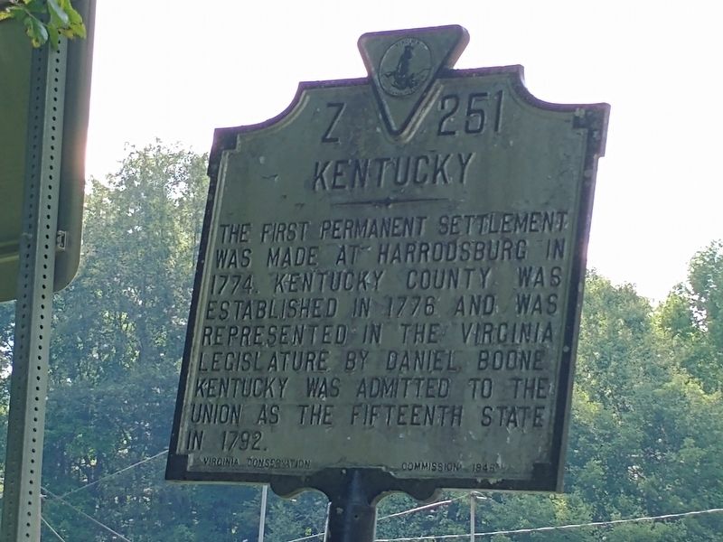
On U.S. 421 0.3 miles west of Blueberry Hill Road, on the right when traveling east.
(obverse)
Lee County Virginia
Area 446 Square Miles
Formed in 1792 from Russell, and named for Henry (Light-Horse Harry) Lee, Revolutionary soldier and Governor of Virginia, 1791-1794. Daniel Boone's son was killed by Indians . . . — — Map (db m181401) HM
On East Clover Street, on the right when traveling east.
Harlan was first called Mount Pleasant. The town is situated in the valley between Big and Little Black Mountain, at the confluence of the three forks of the Upper Cumberland River. It is located at the junctions of two important highways, U.S. . . . — — Map (db m181174) HM
On East Chestnut Street at North Poplar Street, on the right when traveling east on East Chestnut Street.
The site of Marianna was acquired through a deed from Mary Ann Harland and the heirs of her first husband, Daniel Martin. The town was named in her memory. She was born in Kentucky May 6, 1802: died October 25, 1857. The first court house in Lee . . . — — Map (db m116135) HM
On Kentucky Route 11 at Silo Road, on the left when traveling south on Kentucky Route 11.
Company A of the 7th Ky Infantry Regiment was formed in 1861 at Congleton Springs in Owsley County, which is now part of Lee County. Owsley County led all Kentucky counties in the percentage of men enrolled in the Union Army and many from the county . . . — — Map (db m172627) HM
Near Navasota Street north of East 7th Street, on the right when traveling north.
A member of Capt. Wm. W. Hill’s Company at San Jacinto. Born in Kentucky March 5, 1805. Died in Lee County, Texas August 15, 1848. Here also sleeps Amanda Wilkinson, wife of James G. Wilkinson. — — Map (db m25738) HM
Near Ford Road/4 Mile Road (Kentucky Route 1924) 1.2 miles south of Boonesboro Road ( Route 627), on the left when traveling south.
"Civilization exists by geological consent" (Will Durant (1885 - 1981), American historian, philosopher, and educator)
Not many people stop to think about the rock beneath their feet, but it is the type of rock, its structure and . . . — — Map (db m74768) HM
On East Central Street west of South 2nd Street, on the left when traveling west.
Twenty-two Kentucky courthouses were burned during Civil War, nineteen in last fifteen months: twelve by Confederates, eight by guerrillas, two by Union accident. See map on reverse side.
The courthouse at Harlan was burned in reprisal for . . . — — Map (db m181165) HM
On Main Street (Kentucky Route 1651) at Gary Street, on the right when traveling south on Main Street.
First Kentucky Oil Well In 1818, Marcus Huling and Andrew Zimmerman were drilling salt wells along South Fort of Cumberland River. On land leased from Martin Beaty they struck oil. Attempts to market it downriver were not successful, so . . . — — Map (db m73739) HM
Appalachian Spring - Beattyville
In September 2025, music shaped by Appalachian tradition returned to Lee County in a rare public performance. Appalachian Spring, composed by Aaron Copland, was presented outdoors at the Happy Top Amphitheater . . . — — Map (db m313170) HM
Near Commission Circle (Virginia Route 702) 0.6 miles west of Breaks Park Road ( Route 80), on the right when traveling west.
For over 10,000 years, Native Americans used The Breaks for seasonal foraging and hunting, with more permanent settlements near the Ohio River, to the north, and the New and Tennessee Rivers, to the east and south. At the time of settlement by . . . — — Map (db m160897) HM
On Old Wilderness Road (Virginia Route 58) 0.2 miles north of Route 872, on the right when traveling west.
Lee County. Lee County, the western-most county in Virginia, was formed from Russell County in 1792; a part of Scott County was added later. The county is named for Henry "Light Horse Harry" Lee, governor of Virginia from 1791 to 1794 and . . . — — Map (db m80237) HM
On Norray Road (County Route 684) at Wilderness Road (U.S. 58), on the right when traveling east on Norray Road.
This marks the burial place of a party of white settlers who were surprised in camp and slain by Indians at daybreak, October 10, 1773. Those killed were James Boone, son of Daniel Boone; Henry Russell, son of Capt. William Russell; Robert and . . . — — Map (db m233011) HM
On Shelton Mill Road (County Route 97) 0.8 miles north of East University Drive, on the left when traveling north.
Marker Front:
The Greek Revival rock and mortar house was built by Addison Frazer (1809-1873) between 1852 and 1854 and served as the center for a 2,000 acre cotton plantation. Frazer owned 100 slaves and was on the Board of Trustees of . . . — — Map (db m25988) HM
Near Sugar Run Overlook Road (Kentucky Route 988).
The trail ahead follows the 1907 roadbed of an Object Lesson Road. Early in the 20th century, most rural roads, especially here in the Appalachians, were little better than in the days of Daniel Boone. The U.S. Department of Agriculture sponsored . . . — — Map (db m207717) HM
On U.S. 23 0.8 miles south of Jasper Road, on the right when traveling south.
Lee County. Lee County, the western-most county in Virginia, was formed from Russell County in 1792; a part of Scott County was added later. The county is named for Henry “Light-Horse Harry” Lee, governor of Virginia from 1791 to 1794 and . . . — — Map (db m228717) HM
Early settlers of Lee County believe that the explorers Marquette and Joliet landed at this spot in 1673. From here they made their only overland exploration on the west bank of the Mississippi, finding villages of the Illini tribe. Other French . . . — — Map (db m179445) HM
Near Palmyra Street (Illinois Route 2) east of Palmyra Road, on the right when traveling west.
Lee County Veterans
Died in service during WWI
Alsman, Lonnie Pvt • Altenberg, Harry Pvt • Bartholomew, Lloyd S.A.T.C. • Bott, Eddie Sgt • Dillow, Frederick Pvt • Doan, Elijah Pvt • Dornblaser, Paul M Cpl • Elliott, Clayton Sgt • Emery, Earl . . . — — Map (db m239053) WM
On Orby Cantrell Highway (U.S. 23) 0.4 miles south of Baxley Lane, on the right when traveling south.
Lee County, the western-most county in
Virginia, was formed from Russell County in
1792; a part of Scott County was added
later. The county is named for Henry “Light-
Horse Harry” Lee, governor of Virginia
from 1791 to 1794 and former . . . — — Map (db m228710) HM
Near Mechanic Street (State Road T 864) north of Natural Tunnel Parkway (State Road 871), on the left when traveling north.
The Crooked Road
Virginia's Heritage Music Trail
From the Blue Ridge Mountains to the Coalfields region, southwest Virginia is blessed with historic and contemporary music venues, musicians, and fretted instrument makers. Historically . . . — — Map (db m283216) HM
Thin black lines indicate changes in relevance. Between each pair of lines entries are ordered geographically but all have the same relevance.
* Inflectional forms of words are their plurals, singulars, and possessives as well as gramatical tenses and similar variations.