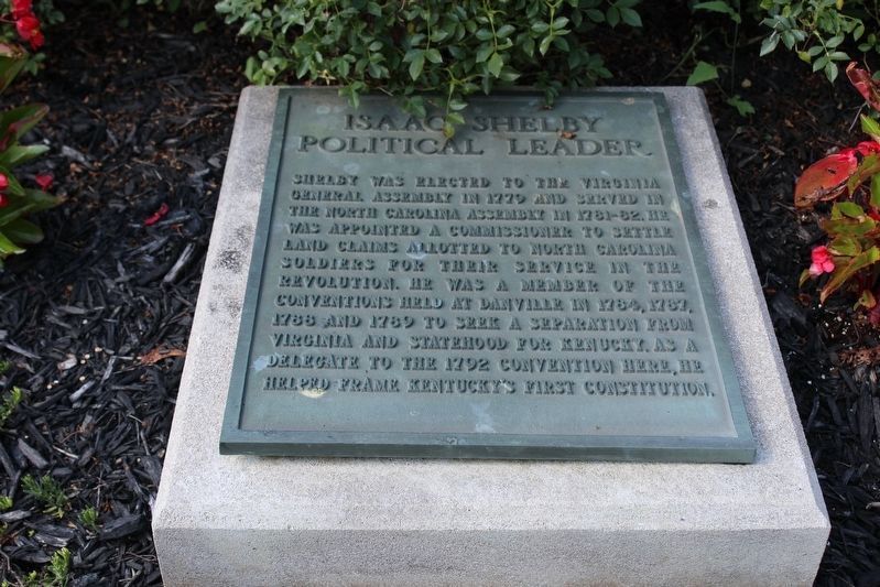
First governor of Kentucky
1792-1796
Fifth governor of Kentucky
1812-1816
One of Shelby’s first acts as Governor was to call for and help design the Great Seal of the Commonwealth of Kentucky. The figures of a pioneer and statesman in this . . . — — Map (db m121734) HM
Near Rosemark Road north of East Kerrville Rosemark Road, on the right when traveling north.
In the 1800s this area, known for its rich and fertile farm land, attracted settlers from the Carolinas, East and Middle Tennessee who were pioneering the "Great West". Associate Reformed Presbyterians (ARP) arrived and established Salem Church in . . . — — Map (db m179144) HM
On Thornton Taylor Parkway (Bypass U.S. 64) west of Eufala Street, on the right when traveling west.
In 1862, Lincoln County and Fayetteville residents celebrated the completion of a local engineering marvel, a huge stone bridge over the Elk River, that they hoped would ensure the continual prosperity of this agricultural community. The 450-foot . . . — — Map (db m152122) HM
On Elk Avenue South south of College Street East (Business U.S. 64), on the right when traveling south.
Lincoln County was a Confederate stronghold during the Civil War. Local men formed companies for the Confederate army before Tennessee seceded. In April 1861, Col. Peter B. Turney organized the 1st Confederate Infantry Regiment (first in the state) . . . — — Map (db m82217) HM
On Hines Street at Main Street, on the left when traveling south on Hines Street.
Moore County was created by an Act of the Tennessee legislature December 1871, and was named in honor of Gen. William Moore. Born in Kentucky in 1786, he settled on Mulberry Creek circa 1806. Captain in the War of 1812 and the Creek Indian Wars, and . . . — — Map (db m24630) HM
Native Tennessean
David Crockett was born in 1786 in Greene County,
Tennessee. In 1811, he moved his wife, Polly, and two sons
to Lincoln County, and in 1813 to Franklin County. When
the Creek War started Crockett mustered into the . . . — — Map (db m207976) HM
On J D Suggs Road near Curtis Road, on the right when traveling west. Reported missing.
The Hobbs Bridge once served as the river crossing here. Completed in 1891 at a cost of $7,329, the bridge was named for Pleasant Hobbs, a member of the Lincoln County Court.
Only one of the original three steel trusses of the Hobbs Bridge . . . — — Map (db m195812) HM
Raising Awareness
The significance of Camp Blount has been recognized for
over a century. In 1913, the local chapter of the Daughters
of the American Revolution marked the site with a boulder
bearing a bronze plaque. In 1927, A.P. . . . — — Map (db m207967) HM
On Washington Street 0.1 miles west of 10th Street SW, on the left when traveling west.
Cattle baron whose herds, moving from east to west Texas and into New Mexico, expanded into one of the greatest cattle spreads in the west. Coming from Tennessee to Paris, 1837, Chisum joined S. K. Fowler in a cattle venture in Denton County, . . . — — Map (db m201835) HM
Sacred to the Memory of
Major William Chronicle, Captain John Mattocks
William Rabb and John Boyd
Who Were killed at this place on the 7th.
of October 1780. Fighting in Defense of America.
Colonel Ferguson an officer of his Britannic . . . — — Map (db m231571) HM
On Huntsville Highway (U.S. 231/431) at Hunter Road, on the left when traveling north on Huntsville Highway.
Tennessee. Lincoln County. Established 1809; named in honor of MAJOR GEN. BENJAMIN LINCOLN of the Revolutionary Army. After service at Saratoga, he was put in Chief Command in the Southern Colonies. Later, he was Secretary of War under the . . . — — Map (db m30570) HM
This church, the first Associate Reformed Presbyterian congregation in what is now Anderson County, was organized about 1790 about 1 1/2 mi. SW of this site. Rev. Robert Irwin, its first regular minister, served from 1803 until his death in . . . — — Map (db m11747) HM
The General and Statesman
Isaac Shelby’s military decisions at the Battle of King’s Mountain in 1779 secured a critical victory for America during the Revolutionary War. Before war’s end, Shelby had also served in the North Carolina . . . — — Map (db m120217) HM
On Spring Street, on the right when traveling west.
John (1776-1823) and Elizabeth Plemmons (1778-1829) Tumlinson were born in Lincoln County, North Carolina and lived in Tennessee, Illinois, and Arkansas before coming to Texas with their seven children as members of Austin's Old Three Hundred . . . — — Map (db m29965) HM
On U.S. 83 0.3 miles south of Texas Highway 1929, on the left when traveling north.
On this site during the Civil War and later, grazed by tens of thousands the Longhorns of cattle baron John S. Chisum. Ranch headquarters were 10 miles east. Here in 1863-1865, Chisum not only ranched but also was buyer of cattle to feed Confederate . . . — — Map (db m82187) HM
On River Highway (North Carolina Route 150) at Mariner Pointe Lane, on the right when traveling west on River Highway.
Among the original pioneers from Pennsylvania, New Jersey, and Maryland who settled on the east side of the Catawba River were George Davidson (1-home destroyed), Reverend John Thomson, Moses White, Hugh Lawson, John Oliphant, John Brevard, . . . — — Map (db m283194) HM
On Musket Lane, on the right when traveling south.
In his nearly half century of life, David Crockett literally migrated from east to west Tennessee. From his birthplace near Limestone, to his last home in Rutherford (Gibson County), the Crockett story weaves its way across the Volunteer state for . . . — — Map (db m58461) HM
On Market Street East, on the right when traveling west.
This Tulip Poplar
The State Tree of Tennessee
Planted
In Memory of
James Taylor Crawford
1903-1977
Who served the people of Lincoln County as
State Representative
State Senator
County Judge
He was a lifelong . . . — — Map (db m207986) HM
On Main Avenue South, on the left when traveling east.
In recognition of the Patriots who Settled in Lincoln County, Tennessee
Abbot, Drury•
Armstrong, Thomas•
Aslin, Thomas•
Beard, William•
Benson, Levin•
Blackmore, George•
Blackmore, George D.•
Brandon, Josiah•
Brown, . . . — — Map (db m207979) WM
Thin black lines indicate changes in relevance. Between each pair of lines entries are ordered geographically but all have the same relevance.
* Inflectional forms of words are their plurals, singulars, and possessives as well as gramatical tenses and similar variations.