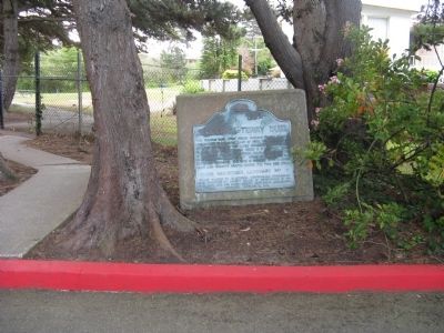
The famous duel that ended dueling in California was fought in a ravine east of here, near the shore of Lake Merced, in the early morning of September 13, 1859. The participants were U.S. Senator David C. Broderick and Chief Justice David S. . . . — — Map (db m220018) HM
On Cabrillo Highway (State Highway 1). Reported missing.
Captain Gaspar de Portola and his party of Spanish explorers, journeying overland from San Diego in a fruitless search for Monterey Bay, camped here by San Gregorio Creek for a three day rest and treatment of their sick, October 24-27, 1769. . . . — — Map (db m11032) HM
On Arroyo Court west of Dartmouth Road, on the right when traveling west.
Here on the banks of San Mateo Creek Captain J. B. de Anza camped. March 29,1776, after exploring the peninsula and selecting the sites for the Mission and Presidio of San Francisco. Here also the party of families, soldiers, and priests, on the way . . . — — Map (db m18418) HM
Built in 1854 among sawmills and redwood groves by Dr. R.O. Tripp and M.A. Parkhurst. Operated by Dr. Tripp in person (who also served as dentist, librarian, postmaster and community leader) until his death in 1909. Purchased by the County of San . . . — — Map (db m202542) HM
On Old Devil's Slide Highway west of Cabrillo Highway (California Route 1), on the right when traveling west.
As coastside population growth began displacing agriculture in the 1960s and 70s, an environmental movement inspired voters to pass a protection act in 1972 that resulted in the California Coastal Commission. With increased environmental awareness, . . . — — Map (db m229568) HM
On California Drive at Burlingame Ave. on California Drive.
This first permanent building in the Mission Revival style of architecture was designed by George H. Howard and J. B. Mathison and financed by local residents and the Southern Pacific Railroad. It opened for service on October 10, 1894. The roof . . . — — Map (db m86792) HM
On Hamilton Street at Marshall Street on Hamilton Street. Reported unreadable.
California Square was a parcel of land located north of Marshall Street, between Hamilton and Winslow, diagonally located across the street from the Courthouse. The site was originally designated as a public park plaza in the Town of Mezesville . . . — — Map (db m202534) HM
San Francisco State is proud to honor Vic Rowen and Joe Verducci who exemplify
the highest ideals of academic performance and competitive athletics. We also
honor them for their professional accomplishments as men of honor and character,
who are . . . — — Map (db m195716) HM
On North Lake Street at Nevada Avenue, on the right when traveling west on North Lake Street.
The beginning
In 1969, James V. Fitzgerald and the San Mateo County Board of Supervisors passed a bill officially designating Fitzgerald Marine Reserve. That same year, Bob Breen was hired as its first Ranger. Within one year of parks . . . — — Map (db m229654) HM
On Skyline Boulevard (California Route 35), on the right when traveling south.
In the early morning darkness on August 5, 1959, near the intersection of Skyline Blvd. and Bunker Hill Drive Hillsborough Officer Doran Stopped a 19 year old convicted felon who was on probation for burglary and interstate auto theft. The felon was . . . — — Map (db m202462) HM
On Higgins Purisima Road near Cabrillo Highway ( Highway 1).
James Johnston, a forty-niner from Ohio, established a homestead on this wild, romantic vista of sloping fields and ocean shore in 1853. For his Californiano bride, Petra Maria de Jara, he built this typical eastern saltbox, whose origins from the . . . — — Map (db m25518) HM
On Coast Highway (California Route 1) at Crespi Drive, on the right when traveling north on Coast Highway.
Captain Gaspar de Portola camped, October 31, 1769, by the creek at the south side of this valley, and to that camp scouting parties brought news of a body of water to the east. On November 4 the expedition advanced. Turning inland here, they . . . — — Map (db m1095) HM
South Panel - 1 of 4
Welcome to historic Downtown Redwood City!
Step back in time, over 150 years, when much of Downtown Redwood City was made up of creeks and wharves. Discover that the town got its name, not from indigenous redwood . . . — — Map (db m202536) HM
The Australian company British Commonwealth Pacific Airlines DC-6B, VH-BPE, on a scheduled flight from Sydney to San Francisco with a final destination of Vancouver, Canada, crashed on Kings Mountain in San Mateo County during the morning hours of . . . — — Map (db m70332) HM
On Old Devil's Slide Highway west of Cabrillo Highway ( Route 1), on the right when traveling west.
Making Tracks, the First Tunnel
The first Devil’s Slide tunnel was built as a corridor for the Ocean Shore Railroad. Construction began in 1905, with plans to lay 73 miles of track from Mission Street in San Francisco to Santa Cruz. The 1906 . . . — — Map (db m229572) HM
This Property Has Been
Placed On The
NATIONAL REGISTER
OF HISTORIC PLACES
By The United States
Department Of The Interior
National Register of Historic Places Statement of Significance:
Building/structure dates: 1890 initial . . . — — Map (db m12539) HM
Near Woodside Road (California Route 84) north of Hess Road, on the right when traveling south.
The GRAND ARMY of the REPUBLIC was a fraternal organization composed of honorably discharged veterans of the Union Army, Navy, Marine Corps and Revenue Cutter Service who served in the American Civil War. Founded in 1866, it grew to include about . . . — — Map (db m202545) HM
After Stanford University opened in 1891, business increased in nearby Mayfield and Menlo Park, towns dating from the 1850s. Mayfield was a farming center, and Menlo Park a summer home to San Franciscans. Residents of both places rejected Senator . . . — — Map (db m41337) HM
Thin black lines indicate changes in relevance. Between each pair of lines entries are ordered geographically but all have the same relevance.
* Inflectional forms of words are their plurals, singulars, and possessives as well as gramatical tenses and similar variations.