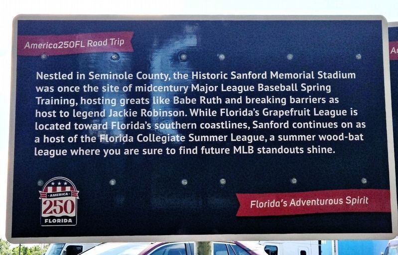
Near Interstate 4 at milepost 95, 1 mile east of Florida Route 434, on the right when traveling west.
Nestled in Seminole County, the Historic Sanford Memorial Stadium was once the site of midcentury Major League Baseball Spring Training, hosting greats like Babe Ruth and breaking barriers as host to legend Jackie Robinson. While Florida’s . . . — — Map (db m311945) HM
On Kings Road at Sipes Avenue, on the left when traveling west on Kings Road.
(side 1)
The migrant settlement of Midway/Canaan City was established for blacks during the celery boom of the 1920’s. However, a few blacks were residing in the area as early as 1865 - 1890. Much of Midway’s population were delivered by . . . — — Map (db m181850) HM
Near Interstate 4 at milepost 95, 1 mile east of Florida Route 434, on the right when traveling west.
The Senator Tree in Seminole County, once the oldest and tallest bald cypress in the U.S., stood for over 3,500 years. A natural landmark for Native tribes and early travelers, it was named in honor of Florida Sen. M.O. Overstreet. In 1929, . . . — — Map (db m311992) HM
On Cranes Roost Boulevard at Festival Drive, on the right when traveling west on Cranes Roost Boulevard.
In 1880 the South Florida Railroad completed a line from Sanford to Orlando. A flag stop was established at Snowville or Snows Station where the railroad crosses SR436. By 1886 the line connected New York City to Tampa via Altamonte. The community . . . — — Map (db m138312) HM
On South French Avenue (U.S. 17/92) north of West 18th Street, on the right when traveling south.
Born in Potsdam, New York on May 2, 1824, French served as a Surgeon with the 21st and 35th New York Regiments, New York Volunteers during the early years of the Civil War. In 1863 he moved to Eau Clair, Wisconsin but susceptibility to rheumatism . . . — — Map (db m52228) HM
On Martin Luther King Jr Boulevard at West Fifth Street, on the left when traveling south on Martin Luther King Jr Boulevard.
In the twentieth century, Dr. Martin Luther King Jr. became the symbol of hope and equality. He became the moral conscience of a nation that refused to give the same rights and liberties to its black citizens. He believed that the Declaration of . . . — — Map (db m175339) HM
Near Southeast 80th Street (County Road 328) at South Pine Avenue (U.S. 441), on the right when traveling east.
Oklahoma Seminoles. The Seminole Nation in the State of Oklahoma is the largest of the three recognized Seminole governments in the United States. They are descendants of the 3,000 Seminoles who were forcibly removed from Florida in the middle . . . — — Map (db m167204) HM
On South French Avenue (U.S. 17/92) south of West 13th Street, on the right when traveling south.
On December 19, 1934, the first state owned Farmers' Market in the nation was dedicated on this site at the corner of 13th and French Avenue, Sanford, Florida. Located on 20 acres acquired by the City of Sanford and Seminole County from Alec V. and . . . — — Map (db m52232) HM
On North Central Avenue (State Road 419/434) at Railroad Street, on the left when traveling north on North Central Avenue.
In the late 1860's Confederate veterans and freed slaves from the war-devastated South began to move into the settlement called "the Lake Jesup Community," to be joined later by others from Northern states and from Sweden. One of the Swedish . . . — — Map (db m93011) HM
On West Seminole Boulevard (U.S. 17/92) north of Interstate 4.
The Lake Monroe Bridge was the first electrically operated swing bridge in Florida. In 1932-33 the State used federal assistance to build this bridge, which replaced a wooden toll bridge that was manually operated. The construction of the bridge . . . — — Map (db m45490) HM
On East Seminole Boulevard west of San Juan Avenue, on the left when traveling east.
Over 1,000 years ago, the Timucua (tee-MOO-quo) people established villages in this area. They fished, hunted, and grew crops such as maize, squash, and beans. By the 1700s, the Timucuans began to disappear as they succumbed to war and disease . . . — — Map (db m55389) HM
On Seminole Boulevard north of North Park Avenue, on the right when traveling west.
The Second Seminole War was the most costly war, in lives and money, ever fought by the United States government against Native Americans. This second of three wars resulted from the Treaty of Payne's Landing in 1832 which required the Seminoles to . . . — — Map (db m57542) HM
On West Seminole Boulevard, on the right when traveling west.
Veterans Memorial Park was built in 1924 as part of the bulkhead project along Sanford's waterfront. The original park was built as the city pier and yacht basin. The park had a large concrete bandshell and a flagpole with a tiered fountain at its . . . — — Map (db m173864) HM
Near Interstate 4 at milepost 95 east of State Road 434, on the right when traveling west.
The importance of Seminole County in the history of the area lies in its location at the navigable headwaters of the St. Johns River and the elevated forest land south of the three large lakes within its boundaries: Monroe, Harney, and Jesup. . . . — — Map (db m54051) HM
Near Interstate 4 at milepost 96, 2.5 miles east of State Road 434, on the right when traveling east.
The importance of Seminole County in the history of the area lies in its location at the navigable headwaters of the St. Johns River and the elevated forest land south of the three large lakes within its boundaries: Monroe, Harney, and Jesup. . . . — — Map (db m52360) HM
On Wekiva River Road 0.1 miles south of Chipola Trail, on the left when traveling south.
The first settlers in Florida were Paleo-Indians who arrived about 14,000 years ago. These hunters and gatherers built their settlements near springs. At least a dozen campsites have been documented along the Wekiva River and Rock Springs Run.
. . . — — Map (db m265284) HM
On Park Avenue at First Street, on the right when traveling south on Park Avenue.
Was on 28 April 1885 Incorporated, organized and named in the Lyman Bank Bldg., southwest corner of Park and First Streets here in Sanford by Rev. E. P. Hooker D. D. Rev. J. A. Tomlinson Hon. F. W. Lyman Rev. S. D. Smith To commemorate the . . . — — Map (db m55354) HM
Near Bush Boulevard west of South Orlando Drive (U.S. 17/92), on the left when traveling west.
Mosquito County was established in 1824 by the U.S. Legislative Council. Mosquito County's name was changed to Orange in 1845. Seminole County was established in 1913 by the Florida Legislature when it was partitioned from Orange County, with . . . — — Map (db m52365) HM
This structure built in 1926 is believed to be the only county "Old Folks Home" still standing in Florida. The unique exterior finish called "pebble dash" qualified the building to be listed on the National Register of Historic Places in 1999. In . . . — — Map (db m52413) HM
On State Park Drive 0.1 miles south of Georgia Route 253, on the right when traveling east.
Located in Seminole County, near the forks of the Chattahoochee and Flint Rivers, was a town of Hitchiti-speaking, Lower Creek Indians. A Spanish mission, Santa Cruz de Sabacola el Menor, was established there in 1675. By 1685, English traders from . . . — — Map (db m17834) HM
On Fleming Street at Nassau Lane, on the right when traveling east on Fleming Street.
The Johnson/Archer House at 1016 Fleming Street, is a grand, Classic Revival historic dwelling, defined by its unique wooden columns, encircling porch and enlarged front dormer.
Thomas B. Johnson, one of Key West's most talented . . . — — Map (db m243691) HM
On Osceola Fish Camp Road 0.1 miles east of East Osceola Road, on the right when traveling east.
Here, where the St. Johns River emerges from near-by Lake Harney, stands a shell mound complex significant to the history and pre-history of Seminole County. The mound has been examined by anthropologists Daniel Britton in the 1850s, Jeffries . . . — — Map (db m93040) HM
On Academy Avenue at Boston Street, on the right when traveling east on Academy Avenue.
(side 1)
Henry Jackson was one of the first Black homesteaders to settle in the Oviedo area. Jackson was born in 1883 in Mitchell County, Georgia, one of fourteen children. He moved to Florida in 1910. Using the Homestead Act of 1862, . . . — — Map (db m242640) HM
On Sanford Avenue just south of East 4th Street, on the left when traveling south.
The Georgetown community has been shaped by active and engaged citizens for more than a century. Through their contributions they have made a profound and lasting impact on the city. Some notable figures included doctors, educators, authors, . . . — — Map (db m179111) HM
On West 7th Street west of Myrtle Avenue, on the right when traveling east.
Sanford High School was built in 1902. This Romanesque Revival Style brick building with its massive three story bell tower was designed by Architect W.G. Talley of Jacksonville. The building is one of the few surviving examples in . . . — — Map (db m93044) HM
On South Bronough Street 0.1 miles south of West Pensacola Avenue, on the right when traveling south.
Seminole County
June 1942 - May 1946
Naval Air Station - Sanford, Florida
fighter and dive bomber training base
Seminole County honors all World War II veterans
including
Medal of Honor posthumous recipient . . . — — Map (db m211042) WM
On Station Street 0.1 miles south of Merritt Street, on the right when traveling north.
Side 1
The unincorporated community of Winwood is a historic African-American community located near the cities of Altamonte Springs and Casselberry. Generations of farm workers who toiled in south Seminole County's citrus groves and . . . — — Map (db m146394) HM
On Aloma Avenue (State Road 426) at Bear Gully Road, on the right when traveling west on Aloma Avenue.
The small community of Gabriella was located on SR 426 about a mile north of Goldenrod, between Goldenrod and Jamestown. The post office was established on July 31, 1886. Sherman Adams was the first post master. The post office was located west . . . — — Map (db m92962) HM
Near General Hutchinson Parkway 0.3 miles east of North Ronald Reagan Boulevard (County Route 427), on the right when traveling east.
(Side 1)
The Senator is one of the oldest and largest cypress trees in America. The Seminole Indians, and other Native American Indians who lived throughout Central Florida used this tree as a land mark. A hurricane in 1925 destroyed the . . . — — Map (db m156627) HM
On East 1st Street east of San Carlos Avenue, on the right when traveling east.
(side 1)
Plant System Hospital
The first hospital in Seminole County was operated by the Plant System Railroad, providing medical care for railroad employees and the community in the 1890's. It was located at West 9th Street in . . . — — Map (db m93060) HM
Near West 7th Street just west of Myrtle Avenue, on the right when traveling west.
1 • Mount Vernon Red Maple Planted in honor of the Founders of the City of Sanford, Florida on February 10, 1992. This red maple has been grown from seeds collected at Mount Vernon, President George Washington's beloved home on the . . . — — Map (db m214875) HM
On West Indiana Avenue west of North Woodland Boulevard (U.S. 17/92), on the left when traveling west.
In 1905 the Landis & Fish Law Firm erected a brick one-story Romanesque-style building on this site. As the firm grew, it was enlarged in 1925 to the two-story Federal structure you see today. Begun by Cary D. Landis and Bert Fish, the firm was . . . — — Map (db m46032) HM
Thin black lines indicate changes in relevance. Between each pair of lines entries are ordered geographically but all have the same relevance.
* Inflectional forms of words are their plurals, singulars, and possessives as well as gramatical tenses and similar variations.