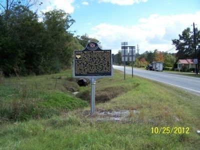
The Treaty of Fort Jackson of August 9, 1814, by Major General Andrew Jackson on behalf of the President of the United States of America and the Chiefs, Deputies and Warriors of the Creek Nation, established a boundary line between the Mississippi . . . — — Map (db m61026) HM
On U.S. 82 near Greenwood Avenue, on the right when traveling west. Reported damaged.
The Treaty of Fort Jackson of August 9, 1814, by Major General Andrew Jackson on behalf of the President of the United States of America and the Chiefs, Deputies and Warriors of the Creek Nation, established a boundary line between the Mississippi . . . — — Map (db m277801) HM
On Blackmon Street (U.S. 82) at Prairie Street, on the right when traveling west on Blackmon Street.
Trinity Episcopal Church was established in Union Springs by Rev. DeBerniere Waddell in 1872 as a parish of the Episcopal Diocese of Alabama with seventeen communicants and an annual budget of $412.50. Until 1879 services were held monthly in the . . . — — Map (db m60973) HM
On Peachburg Road (County Road 40) east of County Road 30, on the right when traveling east.
The entrance gate to the Chunnenuggee Public Garden was located within this 90 x 120 foot strip. The Chunneneggee Ridge Horticultural Society, organized on March 6, 1847, established the Garden in the same year. Now known as the Chunnenuggee . . . — — Map (db m252505) HM
On U.S. 29 at County Road 19, on the right when traveling south on U.S. 29.
Built by U.S. Army engineers over the summer of 1824, Three Notch Road has served as Bullock County’s major transportation route throughout its history. It was constructed to facilitate military communication between Pensacola in Florida and Ft. . . . — — Map (db m89638) HM
On U.S. 82 at County Road 35, on the right when traveling west on U.S. 82.
Side 1
Built by U.S. Army engineers over the summer of 1824, Three Notch Road has served as Bullock County’s major transportation route throughout its history. It was constructed to facilitate military communication between Pensacola . . . — — Map (db m89637) HM
On U.S. 29 just north of Twin Trail, on the right when traveling south.
The town of Aberfoil was incorporated January 26, 1839, in then Macon County, with the first election for councilors conducted and managed by Lewis Stoudenmire, Charles G. Lynch, Thomas Scott, David Hudson, and A. J. and E. A. Jackson. Aberfoil was . . . — — Map (db m61027) HM
On Old Troy Road, on the left when traveling west.
The Macedonia Baptist Church, located between the communities of Midway and Mt. Coney, was constructed by freedmen after the American Civil War, replacing the brush arbors used by the area’s antebellum slaves as sites for religious worship. Four . . . — — Map (db m60947) HM
On Old Troy Road, on the left when traveling west.
Margaret Elizabeth Merritt of Midway sold two acres for $5 to the state of Alabama in 1921 as a site for an elementary school for African-American children. Built in 1922 with matching Rosenwald funds, the Midway Colored Public School featured oak . . . — — Map (db m60910) HM
On Railroad Street, on the right when traveling west.
St. James Christian Methodist Episcopal Church founded by Reverend Jack McMillan, a former slave of Midway’s Daniel McMillan. Initially meeting outdoors under a brush arbor, ex-slaves and their children constructed a wood-frame church building soon . . . — — Map (db m60909) HM
On U.S. 15/29 at County Road 8, on the right when traveling north on U.S. 15/29.
This community, settled during the mid-1830s, was first called Fulford’s Cross Roads, then Missouri Cross Roads when a post office was established here in 1846. The name Perote, adopted in 1850 was suggested by veterans returning from the Mexican . . . — — Map (db m276347) HM
On U.S. 82 west of Prairie Street, on the right when traveling east.
Log Cabin Museum
Early settlers of this area cleared land and built their first homes of logs in the early 1830s. This cabin was built by Reuben Rice Kirkland (1829-1915) about 1850. He and his first wife had ten children while living in the . . . — — Map (db m60969) HM
On State Highway 223 at County Road 22, on the left when traveling south on State Highway 223.
(side 1)
Settlers from the Edgefield District, South Carolina, organized the Sardis Baptist Church on June 10, 1837. The first building, a log cabin, was constructed in 1841 after John M. and his wife Amy Youngblood Dozier deeded four and . . . — — Map (db m67552) HM
On County Route 19, on the right when traveling south.
Samuel Sellers (1788-1857) of North Carolina arrived with his large family at Three Notch Road on January 29, 1835. Here, in what was then the Missouri Beat, Pike County, the first post office in the area was established, 2.5 miles west of . . . — — Map (db m61061) HM
On North Main Street (Alabama Route 51) 0.6 miles south of West Street, on the right when traveling south.
The Second Creek War began in May of 1836 when a portion of area Creeks, angry at their treatment in the wake of the Treaty of Cusseta and in desperate circumstances, struck out against American settlements. A series of small battles occurred . . . — — Map (db m111618) HM
On Alabama Route 239 0.4 miles south of U.S. 29, on the right when traveling south.
Side 1
In 1890, Reverend C. H. Thornton donated 10 acres of land where he
organized a church and the first public school for African Americans
in the Aberfoil community. The first school structure was a one
room log cabin. Rev. . . . — — Map (db m153582) HM
On North Prairie Street, on the right when traveling north.
In the early 1800s, settlers coming from the Carolinas and Georgia received land grants and some purchased land from the Indians. They settled and cleared the forest for new farms and plantations in what would become a newly formed State of Alabama . . . — — Map (db m83258) HM
On U.S. 29 north of County Road 2, on the right when traveling north.
Fort Davis Railroad Depot
Macon County
The first Fort Davis Railroad Depot was constructed in 1892,
which was approximately the time that the Savannah-Americus-Montgomery Railroad came through the community.
The current building was . . . — — Map (db m161039) HM
On West Jeff Davis Avenue at Bragg Street, on the right when traveling east on West Jeff Davis Avenue.
Loveless School
Montgomery's first junior and senior high schools for African American students began in Loveless School. Built in 1923 and enlarged in 1930, this building first housed seven grades; the opening of Carver Elementary School and . . . — — Map (db m71082) HM
Thin black lines indicate changes in relevance. Between each pair of lines entries are ordered geographically but all have the same relevance.
* Inflectional forms of words are their plurals, singulars, and possessives as well as gramatical tenses and similar variations.