112 entries match your criteria. The first 100 are listed. The final 12 ⊳
William G. Pomeroy Foundation Legends & Lore Series Historical Markers
This series is intended for markers in the Pomeroy Foundation's Legends & Lore marker series that describe traditional customs, tales, sayings, dances or art forms of a community shared by word of mouth or observation.
On Franklin Street 0.1 miles Washington Street, on the left when traveling north.
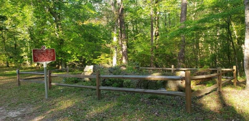
Courts met under "Jury Oak" early 1800s. Judge presided while sitting on tree limb. Public executions held at nearby "hanging tree". — — Map (db m221963) HM
On East Louisiana Avenue east of North Pensacola Avenue, on the right when traveling east.
Immortalized in folksongs, outlaw Morris Slater robbed L&N trains, gave to poor, long evading capture. Killed near here in 1896. — — Map (db m191630) HM
On River Road 0.2 miles south of U.S. 411, on the left when traveling south.
1896-1972. One of the writers of "Popeye" comic, inspired by life & people on Coosa River including father, captain of Gadsden steamboat "Leota." — — Map (db m301103) HM
On Alabama Route 101 south of County Road 147, on the right when traveling south.
A saloon and its whiskey
-“Tricky Trickum Stuff"-
purportedly inspired area's
name in 1850s. After 1882
adopted more dignified Hatton. — — Map (db m180451) HM
On County Road 448 0.1 miles west of County Road 23, on the right when traveling south.
Ca. 1875-1947. Faith healer. Fortune teller and finder of lost things. His yard filled every Sunday with seekers from near and far. Buried here. — — Map (db m239806) HM
On Rue LeJeune at Bienvenue Street, on the right when traveling north on Rue LeJeune.
English Side Eminent Cajun artist
who helped return accordion
to prominence in the music
of Louisiana. Born near
Church Point in 1928. French Side Musicien Cadien célèbre, né
près de Pointe-de-L'église
en 1928. Il a contribué à
l'importance . . . — — Map (db m244454) HM
On Cottonport Avenue near North Main Street, on the right when traveling north.
A regional Easter tradition,
competitors knock decorated
hard-boiled eggs together &
cracked egg loses. Name from
"Pâques", French for Easter.
Jeu traditionnel de Pâques.
Les joueurs "Pâquent” ou
cognent ensemble des
œfs durs décorés. . . . — — Map (db m283066) HM
Nun, renowned for her beauty, tragically died in former Sacred Heart Convent on Normal Hill. Since 1904, her spirit has roamed campus buildings. — — Map (db m290527) HM
On South Second Street south of Ronald Reagan Highway (U.S. 190), on the left when traveling south.
Among first to record Cajun music, bridging old and new tunes, styles and dances influencing generations. French side Un des premiers à enregistrer la musique Cadienne. Son melange de styles influence encore les artisted des nos jours. — — Map (db m175143) HM
On East Maple Avenue near Nimitz Street, on the right when traveling west.
English Original site of Arnestor Johnson's Dry Goods Store. Said to be the first to sell Cajun boudin in the 1940s. A south Louisiana delicacy. French Le premier site du Magasin de Grosserie D'Arnestor Johnson, soi-disant le premier . . . — — Map (db m180945) HM
On South Holden Street at East Clark Street, on the right when traveling south on South Holden Street.
Some claim Laura J. Yeater or another spirit haunts this dormitory opened in 1941. Ghostly activity is reported often on the third floor. — — Map (db m284000) HM
On North 5th Street north of Merchant Street, on the left when traveling north.
A cherry tree keeping vigil over Senator Lewis Linn's grave wept when his body was moved in 1905. His body was returned here in 1938. — — Map (db m278133) HM
Town of Sodom was renamed in 1823 by man who climbed the ridgepole of the gristmill, christened it with whiskey, said village had new hope. — — Map (db m246510) HM
On New York State Route 26 at Pitcher Hill Road, on the left when traveling south on New York State Route 26.
Zella Droff was murdered in
1870s by husband for attending
dances here at former Pitcher
Hotel. Her ghost returns to
travelers on Pink Hill Road. — — Map (db m146667) HM
On Cumberland Head Road, on the right when traveling south. Reported missing.
Legendary lake monster lives
here. Over 300 sightings
reported since 1819. Up
to 200 feet long. NYS Law
protects this regional icon. — — Map (db m136671) HM
Beautiful Indian maiden and her lover from opposing nation rests beneath this rock. When church bell rings, rock turns over, lovers appear. — — Map (db m129044) HM
On Route 11 near Hooker Avenue, on the right when traveling south.
Lived solo in a lean-to six wintry weeks 1791-1792 subsisting on roots & bark until men returned with provisions from Windsor, NY — — Map (db m227319) HM
On Fiddlers Bridge Road at Schultz Hill Road on Fiddlers Bridge Road.
On September 7, 1808, a local fiddler was murdered on a bridge here. The bridge is gone but his ghost still plays a fiddle on moonlit nights. — — Map (db m252697) HM
On Delaware Avenue (New York State Route 384) at North Street, on the right when traveling north on Delaware Avenue.
Theodore Roosevelt
Inaugural Site
has been placed on the
National Register of
Historic Places in 1996
by the United States
Department of the Interior — — Map (db m272559) HM
On Porter Avenue west of Plymouth Avenue, on the right when traveling east.
Near here, Job Hoisington gave his life when he held the enemy & allowed Hull's militia to escape Buffalo's burning, Dec. 30, 1813. — — Map (db m224565) HM
On Leydecker Road just south of Seneca Street, on the right when traveling north.
Hermit of Leydecker Road William Sheppard CA. 1840-1933. Was thought to be an outlaw of Jesse James' Gang. Roamed town as a scissors grinder. — — Map (db m111417) HM
On Bethany Center Road (County Route 15) at Raymond Road (County Route 49), on the left when traveling south on Bethany Center Road.
This asylum is a nationally known center of supernatural activity. Spirits believed to still roam grounds crossing between this world and next — — Map (db m140629) HM
On South Peterboro Street (New York State Route 13) at Railroad Street, on the right when traveling south on South Peterboro Street.
For decades, Phoebe Bradley
walked the roads of Madison
County. At her death in 1905,
she was thought to be the
oldest person in the county. — — Map (db m262121) HM
On U.S. 20 at Route 92, on the right when traveling west on U.S. 20. Reported missing.
Lucy Dutton, Lived ca. 1795
near Cazenovia Lake. Jilted
by man who wed her sister.
Went mad and wandered
Madison County for 30 years — — Map (db m223704) HM
On Main Street (U.S. 20) at Chenango Street, on the right when traveling west on Main Street.
The Loomis Gang burned courthouse in 1864 to prevent their trial, but first cut fire hoses here. No culprit found. One of many tales involving gang. — — Map (db m145681) HM
As Tom Dorsey cleared land his wagon load of huge rocks couldn't be moved by horses. A giant turtle surfaced and dragged wagon into the lake. — — Map (db m129043) HM
On Main Street at Althouse Avenue, on the right when traveling east on Main Street.
Spirit of local boatman haunts former mill after his body was found floating nearby in 1910. Mill relocated to Memorial Park in 1963.
New York Folklore
William G. Pomeroy Foundation — — Map (db m285969) HM
On East Main Street 0.1 miles east of Franklin Street, on the left when traveling east.
James Winchell, 1800-1896, itinerant carpenter who carved wooden broad axes. Extraordinary storyteller and friend to many.
New York Folklore — — Map (db m304687) HM
On Ontario Street (New York State Route 18) 0.1 miles east of Lake Street ( Route 425), on the right when traveling east.
Luther Wilson stuffed leaves into bells of
his cows so British troops
wouldn't hear and confiscate
them as they marched past
on December 23, 1813. — — Map (db m275445) HM
1800s prank believed true. Engraved "Leo de L'N VI 1520" as memorial for 1500s explorer. Found 1820 near this site. 1894 hoax revealed. — — Map (db m129020) HM
On West Seneca Turnpike at Cedarvale Road, on the right when traveling east on West Seneca Turnpike.
Along this route a woman in white searches for her groom. Both died on their wedding night in the early 1900s while driving the 13 curves. — — Map (db m129018) HM
On Tompkins Street at Milton Avenue, on the right when traveling west on Tompkins Street.
Stone throwers demanded Irish green on top of street light over British red. Threw stones until city officials gave in and did so in 1924. New York Folklore — — Map (db m295974) HM
On Kings Highway at Demarest Road, on the right when traveling north on Kings Highway.
Lore says Elizabeth Dobbin lived alone at the foot of Sugar Loaf Mountain in late 1700s, accused by villagers of practicing witchcraft. — — Map (db m313490) HM
During the American Revolution Washington stopped to chat with the children here at this old stone schoolhouse on his way to Newburgh. — — Map (db m129019) HM
Black Rock School attacked by Brant's raiders, 1779. Girls spared as aprons marked with emblem signaling raiders not to harm them. — — Map (db m129078) HM
Hamlet named for Chief Cahoonzie or Cahoonshee buried nearby ca. 1750. Last of his tribe to live here. Wise leader, stood 7 ft tall. — — Map (db m129022) HM
For generations, local legend tells of an enormous snake that grasped its tail in its mouth and rolled down this hill toward its victims. — — Map (db m298405) HM
On New York State Route 80 west of Goose Street, on the left when traveling west.
The famed aviatrix boarded here in August 1924 while giving flying lessons in Frankfort. She read to Arrie Hecox under an apple tree. — — Map (db m206146) HM
On County Road 26 south of Day Road, on the left when traveling south.
David Shipman, Ca. 1729-1813
Burial site of local hunter known by & inspiration for James Fenimore Cooper's literary character. — — Map (db m164041) HM
On Palmer Avenue 0.1 miles west of 2nd Street, on the right when traveling west.
Lumberjack & folk hero whose
tall tales described exploits.
Among feats, used cedar trees
as stilts in 1850s to help
catch fish on Palmer Falls. — — Map (db m144969) HM
On Western Turnpike (U.S. 20) at Old Highway 30 (County Road 157), on the right when traveling west on Western Turnpike.
Lived Near Here In 1800s.
French Settler Accused Of
Witchcraft By New England
Settlers. Killed By Silver
Bullet Shot Through Her Window
— — Map (db m109404) HM
Near Duanesburg Road (New York State Route 7), on the right when traveling east.
Michael Righter
1718-1804 Buried Here
First Permanent Settler of
Duanesburg Who Lived In
Small Cave Near Here ca 1765
Before Building a Log Cabin
— — Map (db m109359) HM
On Parmenter Road, on the right when traveling east.
Named after local legend of early 19th century hog butchering on this hill. One slaughtered hog left frozen in barrel until spring thaw. — — Map (db m266250) HM
On New York State Route 68 west of Dollar Road, on the left when traveling west.
Foote-Legge-Stocking Tavern
named for 3 men involved.
Built by Stillman Foote on
Billius Stocking's land.
Legge served as Tavernkeeper — — Map (db m304555) HM
On Brentwood Road at 1st Avenue, on the right when traveling north on Brentwood Road.
In 1877, Charles A. Codman met Indian spirit in form of an owl. His kind act toward the spirit is why the home became the Hermitage of the Red Owl. — — Map (db m143385) HM
According to local legend, Postmaster General Benjamin Franklin set milestones in 1755 that mark the Post Road from here to Riverhead — — Map (db m129079) HM
On Jericho Turnpike (New York State Route 25) at Route 25A, on the left when traveling west on Jericho Turnpike.
Town Limits Determined By
Distance of One Day Ride.
Land was Gift of Montauk
Chief For Assistance In
Return of Kidnapped Daughter. — — Map (db m147620) HM
On Colonial Springs Road north of Homestead Dive, on the left when traveling south.
Legend says after sailing
with pirate Captain Kidd
in 1690's, Conklin built
home here in 1710. House
destroyed by fire in 1918. — — Map (db m133222) HM
On County Road 64 south of County Road 61, on the left when traveling south.
A streamer fishing fly
created in 1953 by Lew Oatman
as a tribute to Al Prindle,
Shushan's postmaster &
a muse of Norman Rockwell. — — Map (db m159529) HM
As told by early trappers, a cannon was sunk here in the Clyde River by Butler’s Rangers, September 1779. Reported but never found — — Map (db m269852) WM
On Great Lakes Seaway Trail (County Road 101) at Halcus Road on Great Lakes Seaway Trail. Reported missing.
Believed to have been underground railroad safe house ca 1846. Original owners Elizabeth and John Preston were known abolitionists. — — Map (db m270846) HM
On Lakeview Road, on the right when traveling south.
In 1855, inspired by tales of Silver Lake Beast, local hotelier built and launched a mechanical sea serpent to startle and entice visitors. — — Map (db m259381) HM
On Hiddenite Church Road 0.1 miles north of Miller Road, on the right when traveling north.
In 1914 James Paul Lucas, diamond trader, eccentric, and world traveler, settled at this mansion and kept his collection of curiosities. — — Map (db m210424) HM
On West Stewart Parkway just south of West Main Street, on the right when traveling south.
In 1830 talented shipwright and freed slave Hull Anderson built a prosperous shipyard three blocks west of here, before moving to Liberia. — — Map (db m224083) HM
On East Main Street 0.1 miles east of North Charlotte Street, on the left when traveling east.
Though officially names Windmill Creek, waterway is better known by a name of African American man who lived by early Windmill. — — Map (db m226307) HM
On Main Street (State Highway 131) at Seaboard Street (State Highway 211), on the right on Main Street.
In 1953, the small town of Bladenboro was terrorized by mysterious cat-like creature that attacked local animals draining their blood. — — Map (db m291722) HM
On West Broad Street at North 3rd Street, on the right when traveling east on West Broad Street.
Marquis de Lafayette stayed overnight in Murfreesboro said to have missed ball here in his honor when carriage got stuck in the mud nearby — — Map (db m276470) HM
On Main Street (County Road 1603) at North 4th Street (U.S. 64), in the median on Main Street.
Moonshiners from Georgia laid siege to Highlands near here in 1885 to free arrested men. War ended peacefully with a threat and a prayer. — — Map (db m156232) HM
On Andrew Hunter Road 0.1 miles west of Buie Lane, on the right when traveling west.
In 1782, captured by Col.
Fanning & loyalists, Andrew
Hunter escaped by riding his
mare down this steep bluff
and jumping into Deep River. — — Map (db m233999) HM
On South 4th Street at Miami Street, on the right when traveling south on South 4th Street.
In early 19th century, young
Mary disappeared after parents
fell ill. Her laughing spirit
seen on this porch, awaiting
her mother's return. — — Map (db m249340) HM
On West High Street (Pennsylvania Route 641), on the right when traveling west.
Chili-Cheese hot dogs beloved by locals and first served by Greek immigrant Charles Kollas at the Hamilton Restaurant ca. 1938. — — Map (db m312095) HM
On Dean Road west of Vermont Route 346, on the left when traveling west.
Widow Krieger said to escape
drowning in this river when
tried as a witch ca. 1785.
Accusers believed witches
floated. She sank & was saved. — — Map (db m248538) HM
112 entries matched your criteria. The first 100 are listed above. The final 12 ⊳