22 entries match your criteria.
Entries Containing All of the Phrases «berkeley county» AND «west virginia»
This list will also include matches for inflectional* forms of the words.
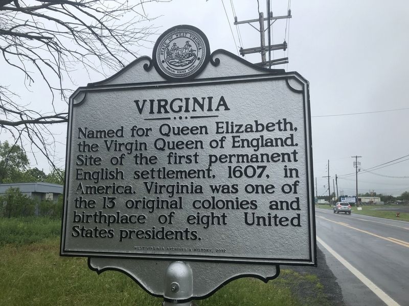
By Devry Becker Jones (CC0), May 28, 2020
Virginia side of the marker
RANKED BY RELEVANCE
| On Winchester Avenue (U.S. 11) 0.2 miles south of Specks Run Road, on the right when traveling north. |
| On Williamsport Pike (U.S. 11) east of Temple Drive, on the right when traveling west. |
| On Gibbs Shoals Road (County Road 164) 0.1 miles north of East Suber Road (County Road 540), on the right when traveling south. |
| On Williamsport Pike (U.S. 11) east of Ripple Way, on the right when traveling west. |
| On South Queen Street (West Virginia Route 45) north of Buxton Street, on the left when traveling north. |
| Near Kearneysville Pike (West Virginia Route 480) at Starkey's Landing, on the left when traveling south. |
| On Congress Street west of North Washington Street (U.S. 522). |
| On Fairfax Street, on the right when traveling west. |
| On Route 9 Bike Path south of Short Road (County Route 9/19), on the right when traveling north. |
| On Charles Town Road (West Virginia Route 9) east of Variform Drive (County Route 9/14). Reported unreadable. |
| On Runnymeade Road (County Route 26) at Soldier Drive, on the right when traveling west on Runnymeade Road. |
| Near North Tennessee Ave (County Route 13) north of Memorial Park Avenue, on the left when traveling north. |
| Near Saint Andrews Drive 0.2 miles south of Hammonds Mill Road ( Route 901), on the left when traveling south. |
| On West Liberty Street at North Lawrence Street, on the right when traveling east on West Liberty Street. |
| On North Queen Street (U.S. 11) north of Cloud Street, on the right when traveling north. |
| On East Burke Street just west of Swartz Street, on the left when traveling west. |
| On Shepherdstown Road (West Virginia Route 45) at Files Cross Road (Local Route 45/2), on the left when traveling east on Shepherdstown Road. |
| On State Highway 199 at County Highway 29, on the left when traveling north on State Highway 199. |
| On Summit Point Road (County Road 13) 0.2 miles west of McCormack Lane, on the right when traveling east. |
| On National Road (U.S. 40) at Wheeling and Elm Glove Boulevard ( Route 88), on the right when traveling west on National Road. |
Thin black lines indicate changes in relevance. Between each pair of lines entries are ordered geographically but all have the same relevance.* Inflectional forms of words are their plurals, singulars, and possessives as well as gramatical tenses and similar variations.
This website earns income from purchases you make after using our links to Amazon.com. We appreciate your support.
Nov. 13, 2026
