16 entries match your criteria.
Entries Containing All of the Phrases «russell county» AND «virginia»
This list will also include matches for inflectional* forms of the words.
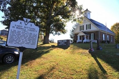
By J. J. Prats, October 18, 2015
Grassy Creek Church and Marker
RANKED BY RELEVANCE
| On Virginia Route 71 at Lower Copper Creek Road (County Route 678), on the left when traveling west on Virginia Route 71. |
| On Dickenson Highway (Route 83) at Greenbrier Road, on the right when traveling east on Dickenson Highway. |
| On Porterfield Highway (U.S. 19) 0.5 miles south of Clinch Mountain Road, on the right when traveling south. |
| On Plumb Alley east of Brewers Alley, on the left when traveling east. |
| On Old Wilderness Road (Virginia Route 58) 0.2 miles north of Route 872, on the right when traveling west. |
| Near Jerry West Highway (West Virginia Route 44) 0.5 miles south of Philips Street, on the right when traveling south. |
| On U.S. 460 south of Shortt Gap Road, on the right when traveling north. |
| On U.S. 23 0.8 miles south of Jasper Road, on the right when traveling south. |
| On Green Spring Road at Gibson Street SE, on the right when traveling north on Green Spring Road. |
| On Orby Cantrell Highway (U.S. 23) 0.4 miles south of Baxley Lane, on the right when traveling south. |
| On Orby Cantrell Highway (U.S. 23), on the right when traveling south on Orby Cantrell Highway. |
| On Virginia Route 80 just west of County Route 620, on the left when traveling west. |
| On Clintwood Highway (Virginia Route 83) at the county line, on the right when traveling east on Clintwood Highway. |
| On East Main Street (Business U.S. 19) east of Memorial Drive (County Road 1045), on the left when traveling east. |
| On Trail of the Lonesome Pine (Alternate U.S. 58) east of Upper Copper Creek Road (County Route 671), on the left when traveling east. |
| On Virginia Route 71 at Lakeview Circle (County Route 785), on the right when traveling south on Virginia Route 71. |
Thin black lines indicate changes in relevance. Between each pair of lines entries are ordered geographically but all have the same relevance.* Inflectional forms of words are their plurals, singulars, and possessives as well as gramatical tenses and similar variations.
This website earns income from purchases you make after using our links to Amazon.com. We appreciate your support.
Nov. 12, 2026
