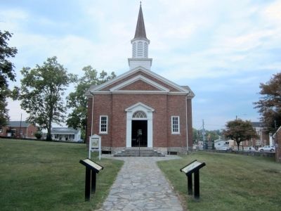
By Bernard Fisher, August 18, 2011
The Lincoln Marriage Cabin Marker
RANKED BY RELEVANCE
Near South College Street (U.S. 127) at West Lexington Street, on the right when traveling south.
On Lincoln Park Road (Kentucky Route 528) north of Mudd & Kelly Lane, on the right when traveling north.
Near Old Kentucky Route 53 0.1 miles north of Gregory Lane, on the left when traveling north.
On Beechland Road (Kentucky Route 438) 0.2 miles north of Lincoln Park Road ( Route 528), on the right when traveling north.
On Beechland Road (Kentucky Route 438) 0.2 miles north of Berry Mill Road, on the right when traveling north.
Near Beechland Road (Kentucky Route 438) at Lincoln Park Road ( Route 528), on the left when traveling east.
Near East Lincoln Highway Road west of County Road 1300E.
On Beechland Road (Kentucky Route 438) at Lincoln Park Road ( Route 528), on the left when traveling east on Beechland Road.
On Mackville Hill Road (Kentucky Route 152) at Mackville Elementary School Drive, on the right when traveling east on Mackville Hill Road. Reported unreadable.
Near Beechland Road (Kentucky Route 438) at Lincoln Park Road ( Route 528), on the left when traveling east.
Near Beechland Road (Kentucky Route 438) at Lincoln Park Road ( Route 528), on the left when traveling east.
On West Main Street (Business U.S. 150) at Cross Main Street, on the right when traveling east on West Main Street.
On W Dixie Avenue at N. Mulberry Street (U.S. 62), on the left when traveling east on W Dixie Avenue.
Paid Advertisement
On South College Street (U.S. 127) at West Lexington Street (U.S. 68) when traveling south on South College Street.
Near Beechland Road (Kentucky Route 438) near Lincoln Park Road ( Route 528), on the left when traveling east.
On Fort Chiswell Road (U.S. 520) just south of Austinville Road (County Route 619), on the left when traveling south.
Near Beechland Road (Kentucky Route 438) at Lincoln Park Road ( Route 528), on the left when traveling east.
On Farm to Market Road 1603 at Rice Road on Route 1603.
On Martin Luther King Avenue at Kobert Avenue, on the left when traveling east on Martin Luther King Avenue.
On East Main Street west of East Ballard Street, on the right when traveling east.
Near MP Daniel Esplanade at South 5th Street, on the right when traveling north.
On Lincoln Park Road, on the left when traveling north.
Near 2nd Street at Farm to Market Road 1458.
Near 2nd Street at Farm to Market Road 1458.
Near North Street (Business U.S. 59) north of Griffith Boulevard, on the right when traveling north.
Near South College Street (U.S. 127) at West Lexington Street, on the right when traveling south.
Near Beechland Road (Kentucky Route 438) at Lincoln Park Road ( Route 528), on the left when traveling east.
Near Old Stage Coach Road 0.1 miles east of Long Run Road, on the right when traveling east.
On East Main Street (Kentucky Route 152) east of Walnut Street ( Route 1584), on the left when traveling east.
Paid Advertisement
On Federal Lane 0.2 miles east of Tennessee Route 22, on the right when traveling east.
On Old Saint Stephens Road 1.2 miles east of Cement Plant Road, on the right when traveling west.
On Tebbs Bend Road 0.3 miles west of New Columbia Road ( Route 55), on the left when traveling west.
On Pine Street West at Third Street South (County Highway 23), on the left when traveling west on Pine Street West.
︽
Thin black lines indicate changes in relevance. Between each pair of lines entries are ordered geographically but all have the same relevance. * Inflectional forms of words are their plurals, singulars, and possessives as well as gramatical tenses and similar variations.
Nov. 13, 2026