16 entries match your criteria.
Mojave Road (Old Government Road) Historical Markers The historic trail stretching 138 miles across the Mojave Desert. It was used by Native Americans, the Juan Baustista de Anza Expedition of 1776, pioneers, US Army and gold seekers.
By Barry Swackhamer
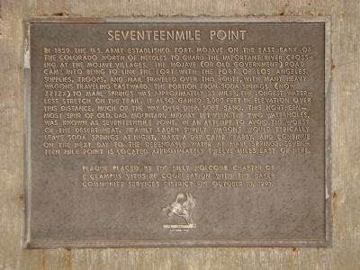
Seventeenmile Point Marker
GEOGRAPHIC SORT Title Sort Marker Number Sort Marker Number Sort for Trails Publication Order Sort Publication Order Sort A Erected Year Sort Most Viewed Sort Most Recent-Interest Sort Most Recently Changed Sort SEE FAQ #33 FOR DESCRIPTIONS
On Baker Boulevard (Business Interstate 15) east of Caltrans Boulevard, on the right when traveling west.
Near Zzyzx Road 5 miles south of Interstate 15.
On Zzyzx Road 5 miles south of Interstate 15, on the left when traveling south.
On Kelso Cima Road at Cedar Canyon Road, on the right when traveling south on Kelso Cima Road.
On National Trails Highway west of Minneola Road, on the right when traveling west.
On Devore Road south of Glen Helen Road, on the right when traveling north.
On Lanfair Road 0.1 miles north of Goffs Road, on the left when traveling north.
On Lanfair Road at Goffs Road, on the right when traveling south on Lanfair Road.
Near California Route 173 2 miles east of Route 138.
On Cedar Canyon Road at New York Mountain Road, on the right when traveling east on Cedar Canyon Road.
Near Old Government Road.
On Old Government Road at Lanfair Road, on the right when traveling east on Old Government Road. Reported missing.
On Interstate 15 34 miles north of Barstow, on the right when traveling north.
On North K Street, on the left when traveling north.
Paid Advertisement
Near Old Government Road. Reported missing.
︽
Nov. 13, 2026