THE HISTORICAL
MARKER DATABASE
“Bite-Size Bits of Local, National, and Global History”


13 entries match your criteria.  


Door County Coastal Byway (Wisconsin) Historical Markers

The Door County Coastal Byway is a 66-mile loop on Wisconsin highways 42 and 57 through the bucolic northern part of Door County. Stretching from just north of Sturgeon Bay (where 42 and 57 diverge) to northern tip of the peninsula at Northport, the byway includes scenery of the Niagara Escarpment as well as the Lake Michigan and Green Bay shores. The Door County Coastal Byway was designated a Wisconsin Scenic Byway in 2009, and a National Scenic Byway in 2021. In 2013, the Byway began erecting kiosks, each with multiple historical markers describing local attractions. As of 2024, there are 11 kiosks, the southernmost being south of Sturgeon Bay (not technically part of the Byway) and the northernmost at the "Devil's Door" where the peninsula ends.
 
Photo Credit: Wisconsin Historical Society, July 20, 2018
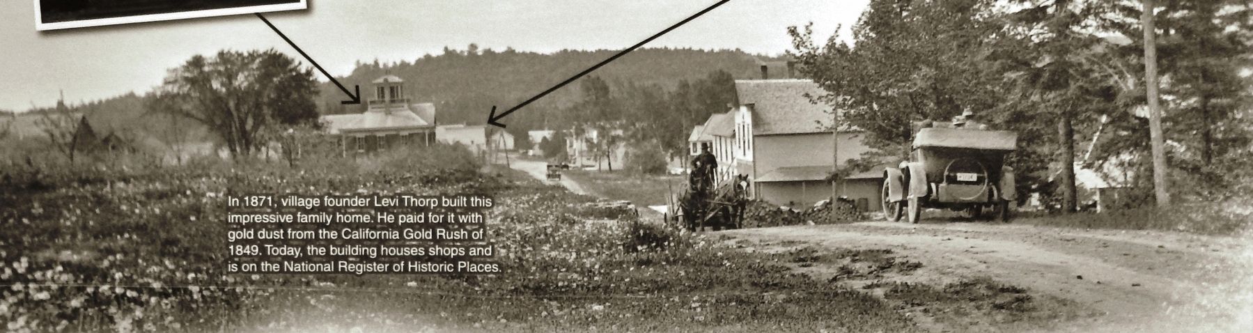
Marker detail: View looking south toward downtown Egg Harbor, 1925
1 ► Wisconsin, Door County, Egg Harbor — Egg Harbor — A Prosperous Village on the Bay —
On Horseshoe Bay Road at Egg Harbor Road (State Highway 42), on the right when traveling south on Horseshoe Bay Road.
2 ► Wisconsin, Door County, Ellison Bay — Ellison Bay — Town of Liberty Grove —
On Sunnyside Lane (State Highway 42) 0.1 miles north of Porcupine Bay Road, on the left when traveling north.
3 ► Wisconsin, Door County, Ellison Bay, Liberty Grove — A Grand View — Scenic Overlook and Park —
On State Highway 42 near Humbug Road, on the left when traveling north.
4 ► Wisconsin, Door County, Ellison Bay, Liberty Grove — Niagara Escarpment —
On Sunnyside Lane (State Highway 42) 0.1 miles north of Porcupine Bay Road, on the left when traveling north.
5 ► Wisconsin, Door County, Ellison Bay, Liberty Grove — This Is Karst Country — Caves by Land and Sea —
On State Highway 42 0.1 miles south of Humbug Road, on the left when traveling north.
6 ► Wisconsin, Door County, Fish Creek — Niagara Escarpment —
On Main Street (Route 42), on the right when traveling north.
7 ► Wisconsin, Door County, Fish Creek — Town of Gibraltar — A Summer Tourist Haven —
On Main Street (Wisconsin Route 42), on the right.
8 ► Wisconsin, Door County, Liberty Grove — Door County Coastal Byway / Northern Door Interior —
On State Highway 57 south of Pioneer Road, on the right when traveling south.
9 ► Wisconsin, Door County, Liberty Grove — Town of Liberty Grove — Legends of Death's Door —
Near North Port des Morts Drive north of State Highway 42, on the right when traveling west.
10 ► Wisconsin, Door County, Sevastopol — A Fortunate Mix — Fruitful Soils and Climate —
On State Highway 42 at Forest Road, on the right when traveling north on State Highway 42.
11 ► Wisconsin, Door County, Sevastopol — Town of Sevastopol — Orchard Country —
On State Highway 42 at Forest Road, on the right when traveling north on State Highway 42.
12 ► Wisconsin, Door County, Sister Bay — Nature of Sister Bay — A Face to the Sunset —
On Mill Road (State Highway 42) at Bay Shore Drive, on the right when traveling west on Mill Road.
13 ► Wisconsin, Door County, Sister Bay — Village of Sister Bay — A Prosperous Port on Green Bay —
On Mill Road (State Highway 42) at Mill Road, on the right when traveling west on Mill Road.
 
 
CeraNet Cloud Computing sponsors the Historical Marker Database.
This website earns income from purchases you make after using our links to Amazon.com. We appreciate your support.
Paid Advertisement
Nov. 13, 2026
