THE HISTORICAL
MARKER DATABASE
“Bite-Size Bits of Local, National, and Global History”


28 entries match your criteria.  


Related Historical Markers

To better understand the relationship, study each marker in the order shown.
 
By Mike Wintermantel, February 12, 2011
Logstown/Legionville Historic Park & Center
SHOWN IN SOURCE-SPECIFIED ORDER
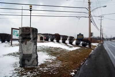
1 ► Pennsylvania, Beaver County, Baden — Legionville Monument —
On Duss Avenue at Anthony Wayne Drive, on the left when traveling north on Duss Avenue.
2 ► Pennsylvania, Beaver County, Baden — Legion of the United States Encampment —
On Duss Avenue at Anthony Wayne Drive, on the left when traveling north on Duss Avenue.
3 ► Pennsylvania, Beaver County, Ambridge — Anthony Wayne's Camp —
On Duss Avenue, on the right when traveling south.
4 ► Pennsylvania, Beaver County, Baden — Hill Cemetery —
On Ohio River Boulevard (Pennsylvania Route 65) at Logan Lane, on the right when traveling east on Ohio River Boulevard.
5 ► Ohio, Hamilton County, Cincinnati, Central Business District — Fort Washington — 1789 - 1808 —
On Ludlow Street at 4th Street, on the left when traveling north on Ludlow Street.
6 ► Ohio, Hamilton County, Cincinnati, Central Business District — Fort Washington Powder Magazine —
On Broadway at Arch Street, on the left when traveling south on Broadway.
7 ► Ohio, Hamilton County, Cincinnati, Central Business District — Fort Washington — Lytle Park Series —
Near East 3rd Street.
8 ► Ohio, Preble County, Eaton — 2-68 — Site of Fort St. Clair —
Near Camden Road (Ohio Route 355).
9 ► Ohio, Preble County, Eaton — Ortt Fort Saint Clair Memorial —
Near Camden Road.
10 ► Ohio, Preble County, Eaton — The Whispering Oak —
Near Camden Rd..
11 ► Ohio, Darke County, Fort Jefferson — 5-19 — Fort Jefferson / St. Clair’s Defeat —
On Weavers-Fort Jefferson Road 0.1 miles west of Route 121, on the left when traveling west.
12 ► Ohio, Darke County, Fort Jefferson — Fort Jefferson —
Near Weavers-Fort Jefferson Road 0.1 miles west of Route 121, on the left when traveling west.
13 ► Ohio, Darke County, Fort Jefferson — Fort Jefferson: A Link in a Chain
On Weavers-Fort Jefferson Road 0.1 miles west of Route 121, on the left when traveling west. Reported permanently removed.
14 ► Ohio, Darke County, Greenville — C15 — Fort Greene-Ville — Ohio Revolutionary Memorial Trail —
On South Broadway Street (Ohio Route 49) at West Main Street, on the right when traveling south on South Broadway Street.
15 ► Ohio, Darke County, Lightsville — Camp Stillwater —
On Ohio Route 49 2.2 miles north of Route 47, on the left when traveling north.
Paid Advertisement
16 ► Ohio, Mercer County, Fort Recovery — C150 — St. Clair's Defeat / Fort Recovery — Ohio Revolutionary Memorial Trail —
On North Elm Street (Ohio Route 49) north of Butler Street ( Route 119), on the right when traveling south.
17 ► Ohio, Paulding County, Melrose — The Indians —
On County Route 171 0.2 miles south of County Route 177, on the left when traveling north.
18 ► Ohio, Defiance County, Defiance — Route and Camp's —
On South Clinton Street (Ohio Route 111) 0.1 miles south of Sunday Street, on the right when traveling south.
19 ► Ohio, Defiance County, Defiance — Fort Defiance / The Indian Wars 1790 - 1795 — Anthony Wayne Parkway —
On Fort Street at Washington Avenue, on the right when traveling west on Fort Street.
20 ► Ohio, Defiance County, Defiance — Fort Defiance —
On Fort Street at Washington Avenue, on the right when traveling west on Fort Street.
21 ► Ohio, Defiance County, Defiance — Fort Defiance Flagstaff —
On Fort Street at Washington Avenue, on the right when traveling north on Fort Street.
22 ► Ohio, Lucas County, Waterville — Fort Deposit / Roche de Bout — Anthony Wayne Parkway —
On South River Road (U.S. 24) at Waterville Monclova Road, on the left when traveling west on South River Road.
23 ► Ohio, Lucas County, Maumee — Fallen Timbers
On Fallen Timbers Lane 0.5 miles north of U.S. 24, on the left when traveling west. Reported permanently removed.
24 ► Ohio, Lucas County, Maumee — Fallen Timbers Battle Monument —
Near State Park Road 0.1 miles south of Fallen Timbers Lane.
25 ► Ohio, Lucas County, Maumee — Fallen Timbers Battle Memorial — In Memoriam —
Near Fallen Timbers Lane 0.5 miles north of U.S. 24, on the left when traveling west.
26 ► Ohio, Lucas County, Maumee — Turkey Foot Rock —
Near Fallen Timbers Lane 0.5 miles north of U.S. 24, on the left when traveling west.
27 ► Ohio, Lucas County, Maumee — C — Hull's Crossing/Turkey Foot Rock — Ohio Revolutionary Memorial Trail
Near North River Road 0 miles south of Jerome Road, on the right when traveling south. Reported missing.
28 ► Ohio, Lucas County, Maumee — Fort Miamis — Anthony Wayne Parkway
On River Road at Michigan Avenue, on the left when traveling south on River Road. Reported permanently removed.
 
 
CeraNet Cloud Computing sponsors the Historical Marker Database.
This website earns income from purchases you make after using our links to Amazon.com. We appreciate your support.
Paid Advertisement
Nov. 13, 2026
